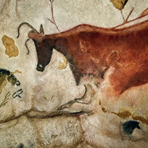
Home > Animals > Insects > Hemiptera > Black Scale
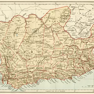
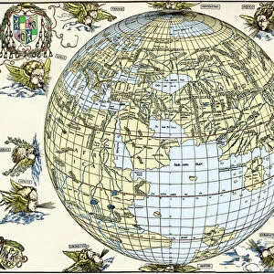
Map of south-Central Africa showing British and German possessions in the 1890 s. After a map published in the June 25th, 1890 edition of The Graphic. The inset map, lower left, shows England on the same scale as the African map

![]()
Wall Art and Photo Gifts from Design Pics
Map of south-Central Africa showing British and German possessions in the 1890 s. After a map published in the June 25th, 1890 edition of The Graphic. The inset map, lower left, shows England on the same scale as the African map
Design Pics offers Distinctively Different Imagery representing over 1,500 contributors
Media ID 24906371
© Ken Welsh
Africa Black Cartography Colonialism Colonies Colony Geographical Geography German Germany Occupied Overseas Possession Territories Territory The Graphic Dependency Dominion Protectorate
FEATURES IN THESE COLLECTIONS
> Africa
> South Africa
> Maps
> Africa
> South Africa
> Related Images
> Animals
> Insects
> Hemiptera
> Black Scale
> Europe
> United Kingdom
> England
> Maps
> Maps and Charts
> Early Maps
EDITORS COMMENTS
This print showcases a historical map of South-Central Africa, highlighting the British and German possessions during the 1890s. Published in The Graphic on June 25th, 1890, this map provides valuable insights into the colonial landscape of that era. The inset map positioned at the lower left corner offers an intriguing comparison between England and Africa, both depicted on the same scale. The intricate details within this image shed light on the complex dynamics of European colonialism during the late 19th century. It serves as a visual representation of power struggles and territorial acquisitions between Britain and Germany in Africa. This snapshot from history reveals how these nations sought to expand their influence by establishing colonies across African lands. As we delve into this archival piece, it becomes evident that this map symbolizes more than just geographical boundaries; it represents a pivotal period in world history characterized by imperialism and domination. The contrast between white-controlled territories denoting European possession and black-dominated regions underscores the racial disparities prevalent during that time. Ken Welsh's expertly captured photograph allows us to explore not only cartography but also delves deeper into our shared human story. It invites us to reflect upon past events while considering their impact on present-day realities.
MADE IN AUSTRALIA
Safe Shipping with 30 Day Money Back Guarantee
FREE PERSONALISATION*
We are proud to offer a range of customisation features including Personalised Captions, Color Filters and Picture Zoom Tools
SECURE PAYMENTS
We happily accept a wide range of payment options so you can pay for the things you need in the way that is most convenient for you
* Options may vary by product and licensing agreement. Zoomed Pictures can be adjusted in the Cart.