Fraud Blocker Skip to main content

Framed Print > Design Pics > Vintage Maps

Vintage Maps Framed Print Collection (#11)

507 Framed Prints

We are proud to offer this selection in partnership with Design Pics

Background imageVintage Maps Framed Print Collection: Map showing the main centres of fighting between the Japanese

Map showing the main centres of fighting between the Japanese and Allied forces in Papua New Guinea, 27 - 30 August
1942, 20th Century, 27 - 30 August, Allied Forces, Archival, Archive, Between, Conflict, Country, Engraving, Fighting, Geographical, Geography, Historical, History, Illustration, Japanese

Background imageVintage Maps Framed Print Collection: Map showing the territory (shaded dark) recaptured during the Russian winter offensive

Map showing the territory (shaded dark) recaptured during the Russian winter offensive
20th Century, Archival, Archive, Conflict, Countries, Country, December 1941, Engraving, Geographical, Geography, Historical, History, Illustration, May 1942, Offensive, Old, Period, Picture, Print

Background imageVintage Maps Framed Print Collection: EDITORIAL Map showing details of the fall of Singapore, 15 February, 1942

EDITORIAL Map showing details of the fall of Singapore, 15 February, 1942. From The War in Pictures Third Year
15 February, 1942, 20th Century, Archival, Archive, Asia, Conflict, Details, Engraving, fall of Singapore, Historical, History, Illustration, Island, Old, Period, Picture, Print, Second World War

Background imageVintage Maps Framed Print Collection: EDITORIAL Retreat to Singapore. Map showing the stages of the Japanese advance

EDITORIAL Retreat to Singapore. Map showing the stages of the Japanese advance
1942, 20th Century, 30-31 January, Advance, Archival, Archive, Asia, Conflict, Country, Engraving, Geographical, Geography, Historical, History, Illustration, in relation to, Insets, Japanese

Background imageVintage Maps Framed Print Collection: EDITORIAL Map showing stages of the German advances on the Eastern Front from 17 August to 6

EDITORIAL Map showing stages of the German advances on the Eastern Front from 17 August to 6 December 1941
17 August, 1941, 20th Century, 6 December, Advances, Archival, Archive, Conflict, Country, Eastern Front, Engraving, Geographical, Geography, German, Historical, History, Illustration, Old, Period

Background imageVintage Maps Framed Print Collection: EDITORIAL ONLY Map showing the advance of the Eighth Army over the Mareth Line, 28 March, 1943

EDITORIAL ONLY Map showing the advance of the Eighth Army over the Mareth Line, 28 March, 1943. From The War in Pictures, Fourth Year

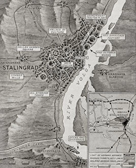
Background imageVintage Maps Framed Print Collection: EDITORIAL ONLY Map of Stalingrad showing the farthest enemy advance into the city before the Red

EDITORIAL ONLY Map of Stalingrad showing the farthest enemy advance into the city before the Red Army's smashing
EDITORIAL ONLY Map of Stalingrad showing the farthest enemy advance into the city before the Red Army's smashing counter attack, 19 November, 1942. From The War in Pictures, Fourth Year

Background imageVintage Maps Framed Print Collection: EDITORIAL ONLY Eighth Army hits back. Map showing the main phases of the Second Battle of El Alamein

EDITORIAL ONLY Eighth Army hits back. Map showing the main phases of the Second Battle of El Alamein, 23 October - 3 November 1942. From The War in Pictures, Fourth Year

Background imageVintage Maps Framed Print Collection: 19th century map showing the Dominions of David and Solomon and places remote

19th century map showing the Dominions of David and Solomon and places remote. Published for the Society for Promoting Christian Knowledge by Messrs

Background imageVintage Maps Framed Print Collection: Map showing the ancient site of Carthage, Utica, and the Gulf of Carthage

Map showing the ancient site of Carthage, Utica, and the Gulf of Carthage, plus the horizontal section of the lesser set of cisterns in the ruins of the ancient city of Carthage

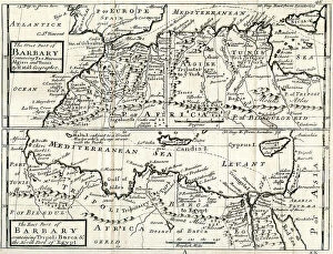
Background imageVintage Maps Framed Print Collection: 18th century map by Herman Moll showing, The West Part of Barbary Containing Fez

18th century map by Herman Moll showing, The West Part of Barbary Containing Fez, Marocco Algiers and Tunis - The East Part of Barbary containing Tripoli, Barca and the North Part of Egypt

Background imageVintage Maps Framed Print Collection: 19th century map showing The World as peopled by The Descendants of Noah

19th century map showing The World as peopled by The Descendants of Noah

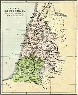
Background imageVintage Maps Framed Print Collection: 19th century map showing the Kngdoms of Judah and israel, illustrative of the Books of Kings

19th century map showing the Kngdoms of Judah and israel, illustrative of the Books of Kings and Chronicles

Background imageVintage Maps Framed Print Collection: 19th century map showing the Journeyings of The Children of Israel from Egypt to the Land of Canaan

19th century map showing the Journeyings of The Children of Israel from Egypt to the Land of Canaan

Background imageVintage Maps Framed Print Collection: Map showing the Allied advance eastwards across France, Belgium

Map showing the Allied advance eastwards across France, Belgium and Holland to the Rhine from 3 September 1945 during WWII. From The War in Pictures, Sixth Year

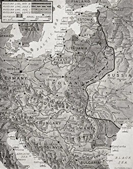
Background imageVintage Maps Framed Print Collection: Map showing the advance of the Russian Army in their effort to wipe out the enemy, August 1944

Map showing the advance of the Russian Army in their effort to wipe out the enemy, August 1944. From The War in Pictures, Fifth Year

Background imageVintage Maps Framed Print Collection: Map showing the speed of the Russian army's drive into the heart of Reich territory, January 1945

Map showing the speed of the Russian army's drive into the heart of Reich territory, January 1945, during WWII
Map showing the speed of the Russian army's drive into the heart of Reich territory, January 1945, during WWII. From The War in Pictures, Sixth Year

Background imageVintage Maps Framed Print Collection: Map showing the Russian advance in October 1943, the Red Army launched an offensive of a 1

Map showing the Russian advance in October 1943, the Red Army launched an offensive of a 1, 000 mile front from Vitebsk to the Taman Peninsula, Russia, wiping out German bridgeheads on the way

Background imageVintage Maps Framed Print Collection: Map showing the occupation, and demilitarization of France by Germany during WWII

Map showing the occupation, and demilitarization of France by Germany during WWII. From The War in Pictures, First Year

Background imageVintage Maps Framed Print Collection: Map illustrating the Far East bombing offensive by American 'Super-Fortresses', November 1944

Map illustrating the Far East bombing offensive by American "Super-Fortresses", November 1944. It shows the area occupied by the Allies, and the Japanese, air raids and naval bases

Background imageVintage Maps Framed Print Collection: Map showing the movement of the Anglo-American troops towards the centre of the Reich

Map showing the movement of the Anglo-American troops towards the centre of the Reich and the Czechoslovak border and the British advance to cut off Holland, April 1945 during WWII

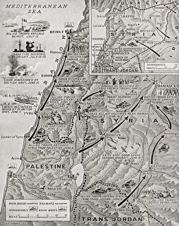
Background imageVintage Maps Framed Print Collection: Syria under allied control, WWII. Hostilities in Syria ended at midnight on 12-13 July

Syria under allied control, WWII. Hostilities in Syria ended at midnight on 12-13 July, 1941 after a five weeks campaign, the course of which is shown on this map. From The War in Pictures, Sixth Year

Background imageVintage Maps Framed Print Collection: Map illustrating the stages of the three thousand mile chase which resulted in the destruction of

Map illustrating the stages of the three thousand mile chase which resulted in the destruction of the Bismarck in revenge for the loss of H.M.S. Hood, 24-27 May, 1941

Background imageVintage Maps Framed Print Collection: Map showing the East African Campaign, May, 1941. From The War in Pictures, Sixth Year

Map showing the East African Campaign, May, 1941. From The War in Pictures, Sixth Year

Background imageVintage Maps Framed Print Collection: Map showing the German advance in Greece, 6-30 April, 1941. From The War in Pictures, Sixth Year

Map showing the German advance in Greece, 6-30 April, 1941. From The War in Pictures, Sixth Year

Background imageVintage Maps Framed Print Collection: EDITORIALGoering with, left, General Jeschonnek, and right, General Loerzer

EDITORIALGoering with, left, General Jeschonnek, and right, General Loerzer, studying a map while planning an attack on Britain, 1940. Hermann Wilhelm Gring or Goering, 1893-1946

Background imageVintage Maps Framed Print Collection: Map showing the extent of the German's attack against the Americans in the Ardennes

Map showing the extent of the German's attack against the Americans in the Ardennes and their drive into Belgium
Map showing the extent of the German's attack against the Americans in the Ardennes and their drive into Belgium, 1944, during WWII. From The War in Pictures, Sixth Year


All Professionally Made to Order for Quick Shipping


-

Why Choose Us?

We are a leading provider of Art Prints and Photo Gifts since 2003, working in partnership with a range of Sporting Clubs, Charities, Museums and Picture Libraries. A large share of profits from any of their images will go directly towards supporting that charity or club. Our archive of images is carefully curated to bring you a wide range of subjects, including landscapes, wildlife, architecture, and more. We ship from our partner labs in the UK, USA, EU (Netherlands) and Australia.
+

How do I place an order?

Ordering is quick & easy - Just follow 5 Simple Steps:
  1. Find your image: Use our search box or browse our online photo Collections to find the image you want.

  2. Choose your print format: Select your desired product and add it to your cart.

  3. Enter your details: If you're a returning customer, simply enter your email address and password, and we'll fill in your billing and shipping address details. All personal details are held securely and are fully GDPR compliant. As standard, we remove all Personally Identifiable Information after 12 months.

  4. Pay for your purchase: We use state-of-the-art security for online shopping and do not have access to your card details.

  5. Sit back and relax: We'll email you confirmation of your order and when it's dispatched. Registered customers can also track orders in the 'My Account' area.

+

How do I pay for an order?

You can pay for your order with most of the major credit and debit cards, or PayPal. For added security, major financial institutions process payment details separately and securely on our behalf. We do not have access to your online payment card details. Online payments are preferred however we do take phone orders. For UK customers only we accept cheques issued against a UK bank.
+

Is my data safe?

We take data security very seriously. We do not have access to your full card details and all payments are requested over a fully secure connection. Additionally, we fully comply with current European and GDPR legislation, and automatically remove all personal data after at most 12 months (unless you have an account with us and have signed in recently). We also have a strict opt-in policy and would never sell your personal details. Your data is only used to fulfill your order promptly and efficiently.
+

Is wall art ready to hang?

For quick and easy installation all wall art, including framed prints, canvas prints and metal prints are supplied with a ready to hang solution on the back. Generally, saw tooth hangers are applied as they allow wall art to hang flush against the wall. The serrated edge of the hanger prevents the frame from shifting or tilting when hung.
+

Are the photo prints fade resistant?

Yes, we use archival quality photo paper photographic paper for vivid reproduction Prints are an accurate representations of the original artwork, which is preserved for artistic character and authenticity. We guarantee they match previews shown on our web site