Home > Europe > United Kingdom > Northern Ireland > Maps
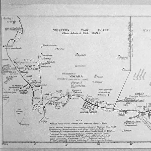
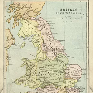
A Map of British - French Settlements in America, 1755

![]()
Wall Art and Photo Gifts from Fine Art Finder
A Map of British - French Settlements in America, 1755
2902786 A Map of British - French Settlements in America, 1755; (add.info.: A Map of British - French Settlements in America, 1755.); Buyenlarge Archive/UIG
Media ID 38452850
© Buyenlarge Archive/UIG / Bridgeman Images
1750s Cartographic Settlements
FEATURES IN THESE COLLECTIONS
> Europe
> Republic of Ireland
> Maps
> Europe
> United Kingdom
> England
> Maps
> Europe
> United Kingdom
> Maps
> Europe
> United Kingdom
> Northern Ireland
> Maps
> Europe
> United Kingdom
> Northern Ireland
> Posters
> Europe
> United Kingdom
> Northern Ireland
> Related Images
> Fine Art Finder
> Artists
> Frank Reynolds
EDITORS COMMENTS
This stunning print of A Map of British - French Settlements in America, 1755 offers a fascinating glimpse into the geopolitical landscape of North America during the 18th century. The intricate cartography and detailed labeling provide valuable insight into the territorial holdings of both British and French powers at that time.
The map showcases the vast extent of French settlements in North America, as well as the expanding reach of British territories. It serves as a visual representation of the fierce competition between these two colonial empires for control over strategic regions and valuable resources on the continent.
As we study this historical document, we can imagine the complex dynamics at play during this period, with rival European powers vying for dominance in the New World. The map also highlights key landmarks and geographical features that were significant to both military strategy and economic interests.
Overall, this print is not just a beautiful piece of cartographic art but also a valuable historical artifact that sheds light on an important chapter in American history. It reminds us of the enduring legacy left by these early settlers and their impact on shaping the modern-day boundaries and cultural landscape of North America.
MADE IN AUSTRALIA
Safe Shipping with 30 Day Money Back Guarantee
FREE PERSONALISATION*
We are proud to offer a range of customisation features including Personalised Captions, Color Filters and Picture Zoom Tools
SECURE PAYMENTS
We happily accept a wide range of payment options so you can pay for the things you need in the way that is most convenient for you
* Options may vary by product and licensing agreement. Zoomed Pictures can be adjusted in the Cart.