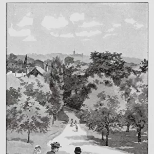
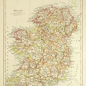
Home > Europe > United Kingdom > Northern Ireland > Maps
World map of a flat earth, printed by Beatus Rhenanus (Bild aus Rheinau), early 1500 s
, early 1500 s")
![]()
Wall Art and Photo Gifts from Fine Art Finder
World map of a flat earth, printed by Beatus Rhenanus (Bild aus Rheinau), early 1500 s
NWI4901273 World map of a flat earth, printed by Beatus Rhenanus (Bild aus Rheinau), early 1500 s.; (add.info.: World map of a flat earth, printed by Beatus Rhenanus (Bild aus Rheinau), early 1500 s.); Photo © Heritage Images
Media ID 38478828
© © Heritage Images / Bridgeman Images
12 12th Xii Xiith Century 12 Century Adam Biblical Episode Breton C12th Google Mediterranean Sea Moldy Nile Paradise Planisphere Red Sea Reptiles Twelfth Century Xii Century Xiith Century 12 12th 12th Xii 12th 13th Century Asian Asian Bible Story Biblical Charcter Biblical Events Biblical Figure Biblical Scene Egyptians Geographer Geographical Map Religious Role Scotland Scotish Serpent Snakes
FEATURES IN THESE COLLECTIONS
> Animals
> Reptiles
> Snakes
> Related Images
> Animals
> Reptiles
> Snakes
> Sea Snake
> Related Images
> Arts
> Landscape paintings
> Waterfall and river artworks
> River artworks
> Europe
> Republic of Ireland
> Maps
> Europe
> United Kingdom
> Maps
> Europe
> United Kingdom
> Northern Ireland
> Maps
> Europe
> United Kingdom
> Northern Ireland
> Posters
> Europe
> United Kingdom
> Northern Ireland
> Related Images
> Europe
> United Kingdom
> Northern Ireland
> Rivers
> Fine Art Finder
> Artists
> Pasquier (workshop of) Grenier
EDITORS COMMENTS
This fascinating print captures a World map of a flat earth, printed by Beatus Rhenanus in the early 1500s. The intricate details and vibrant colors of this historical piece offer a glimpse into the beliefs and perceptions of the world during that time period.
The map showcases Africa, Asia, and other regions with meticulous precision, highlighting the cultural diversity and geographical features of each area. It also includes biblical figures and scenes, reflecting the religious influence on cartography during this era.
As we study this map, we are transported back to the 12th century when priests and clergy played significant roles in shaping people's understanding of the world. The color palette used in this print adds depth and richness to each section, bringing to life the complexities of different regions.
From Scotland to Africa, every corner of this flat earth map is filled with history and symbolism. It serves as a reminder of how perceptions have evolved over time while also honoring the craftsmanship and dedication put into creating such detailed works of art.
Overall, this print is not just a visual representation but a window into our past - offering insights into how people viewed their world centuries ago.
MADE IN AUSTRALIA
Safe Shipping with 30 Day Money Back Guarantee
FREE PERSONALISATION*
We are proud to offer a range of customisation features including Personalised Captions, Color Filters and Picture Zoom Tools
SECURE PAYMENTS
We happily accept a wide range of payment options so you can pay for the things you need in the way that is most convenient for you
* Options may vary by product and licensing agreement. Zoomed Pictures can be adjusted in the Cart.