Home > North America > Haiti > Maps
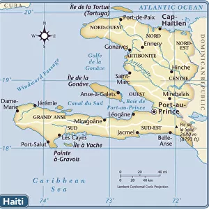
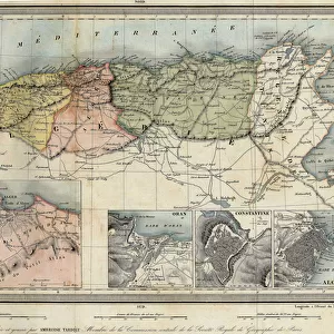
Geography map: double page of an Atlas showing maps and descriptive texts of the islands of Hispagnola (Santo Domingo and Haiti) and the small Antilles in the Caribbean Sea. Engraving of the 17th century. Biblioteca Angelica, Rome
 and the small Antilles in the Caribbean Sea. Engraving of the 17th century. Biblioteca Angelica, Rome")
![]()
Wall Art and Photo Gifts from Fine Art Finder
Geography map: double page of an Atlas showing maps and descriptive texts of the islands of Hispagnola (Santo Domingo and Haiti) and the small Antilles in the Caribbean Sea. Engraving of the 17th century. Biblioteca Angelica, Rome
VEN5030442 Geography map: double page of an Atlas showing maps and descriptive texts of the islands of Hispagnola (Santo Domingo and Haiti) and the small Antilles in the Caribbean Sea. Engraving of the 17th century. Biblioteca Angelica, Rome; (add.info.: Geography map: double page of an Atlas showing maps and descriptive texts of the islands of Hispagnola (Santo Domingo and Haiti) and the small Antilles in the Caribbean Sea. Engraving of the 17th century. Biblioteca Angelica, Rome); © Marage Photos
Media ID 38167670
© © Marage Photos / Bridgeman Images
17eme Siecle Amerique Centrale Amerique Du Nord Caribbean Carte Geographique Central America Dominium Etats Unis Geographie Haiti Livre Livre Ouvert Open Book Saint Domingue Stockravenna 17th Centuries Etats Unis Etats Unis Usa United States Geographical Map
FEATURES IN THESE COLLECTIONS
> Europe
> Italy
> Lazio
> Rome
> Fine Art Finder
> Artists
> Unknown Artist
> Maps and Charts
> Early Maps
> Maps and Charts
> Related Images
> North America
> Haiti
> Maps
> North America
> Haiti
> Related Images
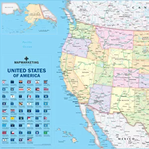
> North America
> United States of America
> Maps
> Popular Themes
> North Island
EDITORS COMMENTS
This stunning 17th-century engraving from the Biblioteca Angelica in Rome showcases a double page of an Atlas depicting the islands of Hispaniola (Santo Domingo and Haiti) and the small Antilles in the Caribbean Sea. The intricate maps and descriptive texts provide a fascinating glimpse into the geography of these regions during this historical period.
The detailed illustrations offer a window into the past, allowing us to explore the layout and features of these islands as they were understood centuries ago. The careful craftsmanship of this engraving highlights both the artistry and scientific precision that went into creating such maps in earlier times.
As we study this image, we are transported back to an era when cartography was still evolving, with explorers charting new territories and expanding our understanding of the world around us. The rich history encapsulated within these pages reminds us of how far we have come in our knowledge of geography, while also serving as a testament to human curiosity and ingenuity.
Whether you are a history buff, a lover of maps, or simply appreciate fine art, this print is sure to captivate your imagination and spark your sense of wonder about the world we inhabit.
MADE IN AUSTRALIA
Safe Shipping with 30 Day Money Back Guarantee
FREE PERSONALISATION*
We are proud to offer a range of customisation features including Personalised Captions, Color Filters and Picture Zoom Tools
SECURE PAYMENTS
We happily accept a wide range of payment options so you can pay for the things you need in the way that is most convenient for you
* Options may vary by product and licensing agreement. Zoomed Pictures can be adjusted in the Cart.