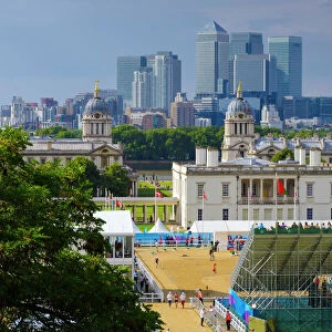
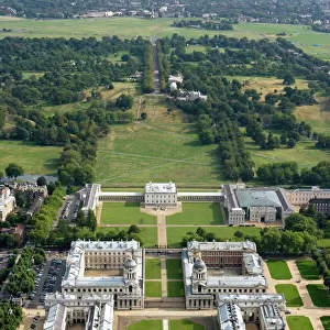
Home > Europe > United Kingdom > England > London > Museums > National Maritime Museum
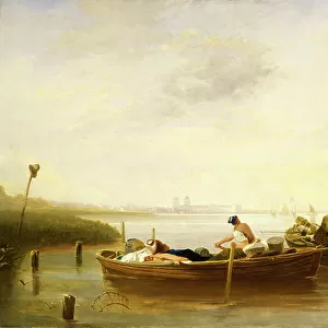
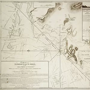
The road and harbour of St. John in the Island of Antigua, 1793 (engraving)
")
![]()
Wall Art and Photo Gifts from Fine Art Finder
The road and harbour of St. John in the Island of Antigua, 1793 (engraving)
7339381 The road and harbour of St. John in the Island of Antigua, 1793 (engraving) by Columbine, E.H. (18th century); 64x80 cm; National Maritime Museum, London, UK; (add.info.: Creator: EH Columbine; Faden
...with the adjacent coast and shoals from Boons Point to Muskitoe cove surveyed in 1789 and 1790 by Lieut E.H. Columbine of His Majesty's Ship Sibyl'. Single sheet. Engraving. Scale [circa 1:22, 000]. North is at 270 degrees. The border is graduated for latitude. Soundings and clearing lines are shown. The chart contains one inset: The south and part of the west Coast of Antigua [circa 1:150, 000] and two views. There is a text box containing remarks.); © National Maritime Museum, Greenwich, London
Media ID 38286202
© © National Maritime Museum, Greenwich, London / Bridgeman Images
Boat Dock Caribbean Harbor Area Harbour Area Harbours Harbourside Isles 18e Siecle 18th Century 18th Centuries
FEATURES IN THESE COLLECTIONS
> Animals
> Insects
> Hemiptera
> Black Scale
> Arts
> Artists
> W
> John White
> Europe
> United Kingdom
> England
> London
> Boroughs
> Greenwich
> Europe
> United Kingdom
> England
> London
> Museums
> Greenwich Heritage Centre
> Europe
> United Kingdom
> England
> London
> Museums
> National Maritime Museum
> Europe
> United Kingdom
> England
> London
> Towns
> Greenwich
> Europe
> United Kingdom
> Heritage Sites
> Maritime Greenwich
> Europe
> United Kingdom
> Maps
> Fine Art Finder
> Artists
> E.H. Columbine
> Fine Art Finder
> Artists
> Unknown Artist
> Maps and Charts
> Early Maps
> Maps and Charts
> Related Images
EDITORS COMMENTS
This stunning engraving captures the road and harbour of St. John in the Island of Antigua, dating back to 1793. Created by E.H. Columbine, this detailed map provides a glimpse into the past with its depiction of the coast and shoals from Boons Point to Muskitoe Cove. The chart is meticulously crafted, showing soundings, clearing lines, and even a text box containing remarks.
The intricate borders are graduated for latitude, while a single inset showcases the south and part of the west coast of Antigua. Two views add depth to the composition, offering viewers a comprehensive look at this Caribbean island's landscape.
As you study this engraving, you can almost imagine yourself standing on the harbourside, watching boats dock in the bustling port. The black-and-white aesthetic adds a timeless quality to this piece, emphasizing its historical significance.
Whether you're an enthusiast of cartography or simply appreciate fine art from centuries past, this print is sure to captivate your imagination. Transport yourself back to 18th-century Antigua as you explore every detail captured in this remarkable work by E.H. Columbine at the National Maritime Museum in London.
MADE IN AUSTRALIA
Safe Shipping with 30 Day Money Back Guarantee
FREE PERSONALISATION*
We are proud to offer a range of customisation features including Personalised Captions, Color Filters and Picture Zoom Tools
SECURE PAYMENTS
We happily accept a wide range of payment options so you can pay for the things you need in the way that is most convenient for you
* Options may vary by product and licensing agreement. Zoomed Pictures can be adjusted in the Cart.