Home > North America > Puerto Rico > Maps
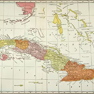
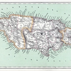
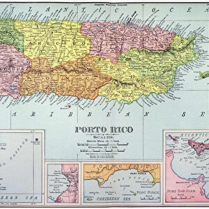
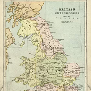
Map of Cuba, Jamaica, and Puerto Rico, chromolithograph, published 1899

![]()
Wall Art and Photo Gifts from Fine Art Storehouse
Map of Cuba, Jamaica, and Puerto Rico, chromolithograph, published 1899
Historical map of the caribbean islands Cuba, Jamaica, and Puerto Rico. Chromolithograph, published in 1899
Unleash your creativity and transform your space into a visual masterpiece!
ZU_09
Media ID 35842704
FEATURES IN THESE COLLECTIONS
> Fine Art Storehouse
> Map
> Historical Maps
> Maps and Charts
> Early Maps
> Maps and Charts
> Related Images
> North America
> Cuba
> Maps
> North America
> Cuba
> Related Images
> North America
> Jamaica
> Maps
> North America
> Jamaica
> Related Images
> North America
> Puerto Rico
> Maps
> North America
> Puerto Rico
> Related Images
EDITORS COMMENTS
This stunning chromolithograph map, published in 1899, offers a captivating glimpse into the Caribbean islands of Cuba, Jamaica, and Puerto Rico during a pivotal moment in their history. The vibrant colors and intricate detail bring the geography of these islands to life, with each landmass delineated by precise borders and topographical features. At the turn of the 20th century, Cuba was on the brink of revolution, having recently gained independence from Spain in 1902. Jamaica, meanwhile, was under British rule, a status it would maintain until 1962. Puerto Rico, a Spanish territory since the late 15th century, was on the cusp of becoming a U.S. territory following the Spanish-American War of 1898. The map's rich detail extends beyond geography, with annotations indicating major cities, ports, and natural features. The inclusion of railroads, roads, and bodies of water adds depth to the representation of each island, offering a glimpse into the transportation networks that connected them to the wider world. The chromolithograph process, a popular method for producing color prints in the late 19th and early 20th centuries, is evident in the rich, saturated hues and smooth gradations of color. The intricate layers of ink applied to the zinc plates used in the process result in a high level of detail and depth, making this map a true work of art as well as a historical document. This map is not only a valuable resource for scholars and historians, but also a beautiful addition to any home or office. Its intricate detail and rich colors transport us back in time, allowing us to explore the Caribbean islands of Cuba, Jamaica, and Puerto Rico as they appeared over a century ago.
MADE IN AUSTRALIA
Safe Shipping with 30 Day Money Back Guarantee
FREE PERSONALISATION*
We are proud to offer a range of customisation features including Personalised Captions, Color Filters and Picture Zoom Tools
SECURE PAYMENTS
We happily accept a wide range of payment options so you can pay for the things you need in the way that is most convenient for you
* Options may vary by product and licensing agreement. Zoomed Pictures can be adjusted in the Cart.