Home > Arts > Artists > P > Portuguese School
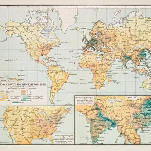
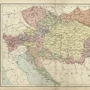
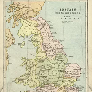
Map of Europe 1877

![]()
Wall Art and Photo Gifts from Fine Art Storehouse
Map of Europe 1877
Warrens Common School Geography 1877
Unleash your creativity and transform your space into a visual masterpiece!
THEPALMER
Media ID 14824569
© This content is subject to copyright
Austria Denmark Norway Portugal Russia Sweden
FEATURES IN THESE COLLECTIONS
> Arts
> Artists
> I
> Italian School Italian School
> Arts
> Artists
> P
> Portuguese School
> Arts
> Artists
> S
> Spanish School
> Europe
> Austria
> Related Images
> Europe
> Denmark
> Related Images
> Fine Art Storehouse
> Map
> Denmark Maps
> Fine Art Storehouse
> Map
> Historical Maps
> Fine Art Storehouse
> Map
> Italian Maps
EDITORS COMMENTS
This print titled "Map of Europe 1877" takes us on a journey back in time, immersing us in the intricate details and historical significance of this beautifully preserved artifact. Originally featured in Warrens Common School Geography from 1877, this map serves as a testament to the enduring power of cartography. As we gaze upon this meticulously crafted piece, our eyes are immediately drawn to the rich colors and delicate lines that outline each country. From Portugal to Russia, Austria to Norway, every nation is represented with utmost precision and accuracy. The borders may have shifted over time, but here they stand frozen in history. The craftsmanship exhibited by THEPALMER's fine art print allows us to appreciate not only the geographical features but also the cultural diversity that defines Europe. This map becomes a gateway into understanding how these nations were interconnected during an era marked by significant political changes and territorial disputes. Intriguingly, it invites us to ponder what life was like for Europeans living at that time - their aspirations, challenges, and dreams within these boundaries. It sparks curiosity about the events that unfolded shortly after its creation: conflicts between empires or alliances formed against common threats. "The Map of Europe 1877" transports us beyond mere geography; it offers an opportunity for reflection on our shared past while reminding us of how far we have come since then. Whether displayed in a classroom or cherished within one's personal collection, this extraordinary artwork undoubtedly holds immense educational value and serves as a timeless reminder
MADE IN AUSTRALIA
Safe Shipping with 30 Day Money Back Guarantee
FREE PERSONALISATION*
We are proud to offer a range of customisation features including Personalised Captions, Color Filters and Picture Zoom Tools
SECURE PAYMENTS
We happily accept a wide range of payment options so you can pay for the things you need in the way that is most convenient for you
* Options may vary by product and licensing agreement. Zoomed Pictures can be adjusted in the Cart.