Fraud Blocker Skip to main content

Fine Art Print > Maps and Charts > British Empire Maps

British Empire Maps Fine Art Print Collection (#8)

Discover the rich history of the British Empire with our exquisite collection of Fine Art Prints featuring intricately detailed maps from Media Storehouse. These beautifully crafted maps offer a captivating glimpse into the expansive territories ruled by the British Empire at its height. Each print showcases the meticulous cartography of the time, transporting you back to an era of exploration and colonial expansion. Adorn your walls with these stunning pieces and add a touch of historical charm to any room.
British Empire Maps were a collection of maps and charts that depicted the vast territories under British rule during the height of its empire

656 Fine Art Prints

Background imageBritish Empire Maps Fine Art Print Collection: Consolidated 'Catalina'(colour litho)

Consolidated "Catalina"(colour litho)
7157700 Consolidated " Catalina" (colour litho) by English School, (20th century); Private Collection; (add.info)

Background imageBritish Empire Maps Fine Art Print Collection: Trial of Warren Hastings, 1788 (litho)

Trial of Warren Hastings, 1788 (litho)
7152653 Trial of Warren Hastings, 1788 (litho) by English School, (20th century); Private Collection; (add.info.: Trial of Warren Hastings, 1788)

Background imageBritish Empire Maps Fine Art Print Collection: Queen Boudicca attacking the Romans, c61 (engraving)

Queen Boudicca attacking the Romans, c61 (engraving)
7150828 Queen Boudicca attacking the Romans, c61 (engraving) by English School, (19th century); Private Collection; (add.info.: Queen Boudicca attacking the Romans, c61)

Background imageBritish Empire Maps Fine Art Print Collection: Caractacus before the Roman Emperor Claudius, 51 (engraving)

Caractacus before the Roman Emperor Claudius, 51 (engraving)
7150826 Caractacus before the Roman Emperor Claudius, 51 (engraving) by English School, (19th century); Private Collection; (add.info.: Caractacus, King of the ancient Britons)

Background imageBritish Empire Maps Fine Art Print Collection: Linoleum sample from Barrys of Kirkcaldy, 1935-36 (colour litho)

Linoleum sample from Barrys of Kirkcaldy, 1935-36 (colour litho)
7193379 Linoleum sample from Barrys of Kirkcaldy, 1935-36 (colour litho) by English School, (20th century); Private Collection; (add.info)

Background imageBritish Empire Maps Fine Art Print Collection: North Cascade and Tower, Empire Exhibition, Scotland 1938 (colour litho)

North Cascade and Tower, Empire Exhibition, Scotland 1938 (colour litho)
7164702 North Cascade and Tower, Empire Exhibition, Scotland 1938 (colour litho) by Sweet, Walter Henry (1889-1943); Private Collection; (add.info.: North Cascade and Tower, Empire Exhibition)

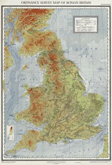
Background imageBritish Empire Maps Fine Art Print Collection: Ordnance survey map of Roman Britain (colour litho)

Ordnance survey map of Roman Britain (colour litho)
3643686 Ordnance survey map of Roman Britain (colour litho) by English School, (20th century); Private Collection; (add.info.: Ordnance survey map of Roman Britain, second edition (c 1931)

Background imageBritish Empire Maps Fine Art Print Collection: North America (colour litho)

North America (colour litho)
5996937 North America (colour litho) by English School, (20th century); Private Collection; (add.info.: North America. Illustration from The Modern World Encyclopedia)

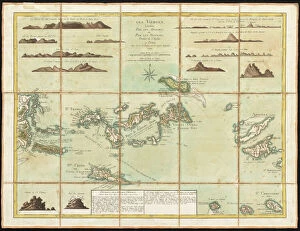
Background imageBritish Empire Maps Fine Art Print Collection: The British Virgin Islands, engraved by Georges-Louis Le Rouge

The British Virgin Islands, engraved by Georges-Louis Le Rouge
5648405 The British Virgin Islands, engraved by Georges-Louis Le Rouge, 1779 (hand-coloured engraving) by Jefferys, Thomas (c.1719-71) (after); 44x58 cm; Boston Public Library, Boston, Massachusetts

Background imageBritish Empire Maps Fine Art Print Collection: Caricature of Sir Alfred Milner, British colonial Governor of the Cape Colony at the outbreak of

Caricature of Sir Alfred Milner, British colonial Governor of the Cape Colony at the outbreak of the Second Boer War
6029706 Caricature of Sir Alfred Milner, British colonial Governor of the Cape Colony at the outbreak of the Second Boer War, 1899 (colour litho) by English School

Background imageBritish Empire Maps Fine Art Print Collection: 'A Lesson in Empire making'(litho)

"A Lesson in Empire making"(litho)
1036812 " A Lesson in Empire making" (litho) by Hall, Sydney Prior (1842-1922) (after); Private Collection; (add.info.: " A Lesson in Empire making")

Background imageBritish Empire Maps Fine Art Print Collection: The Colonies of North America at the Declaration of Independence (colour litho)

The Colonies of North America at the Declaration of Independence (colour litho)
PNP468338 The Colonies of North America at the Declaration of Independence (colour litho) by Stanford, Edward (1827-1904); Private Collection; (add.info)

Background imageBritish Empire Maps Fine Art Print Collection: Map of South Africa (colour litho)

Map of South Africa (colour litho)
2819099 Map of South Africa (colour litho) by French School, (19th century); Private Collection; (add.info.: Map of South Africa. Evenements du Transvaal. Carte de l Afrique Australe)

Background imageBritish Empire Maps Fine Art Print Collection: 1860s Japan - portrait of a group of southern officers Felice or Felix Beato

1860s Japan - portrait of a group of southern officers Felice or Felix Beato (1832 - 29 January 1909), Italian-British photographer working mostly in India, Japan, China

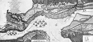
Background imageBritish Empire Maps Fine Art Print Collection: A Correct Plan of the environs of Quebec and of the battle fought on 13th September

A Correct Plan of the environs of Quebec and of the battle fought on 13th September
3058239 A Correct Plan of the environs of Quebec and of the battle fought on 13th September, 1759 (engraving) by Jefferys

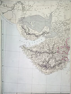
Background imageBritish Empire Maps Fine Art Print Collection: Chart of the Coasts, Sindh and Cutch, Surveyed by Lieutenant A. M

Chart of the Coasts, Sindh and Cutch, Surveyed by Lieutenant A. M
XCF291080 Chart of the Coasts, Sindh and Cutch, Surveyed by Lieutenant A. M. Grieve, 1848-50, 1868 (colour litho) by English School, (19th century); Private Collection; English, out of copyright

Background imageBritish Empire Maps Fine Art Print Collection: Trade of United Kingdom with the Empire, 1922; Impreial produce, 1919 (colour litho)

Trade of United Kingdom with the Empire, 1922; Impreial produce, 1919 (colour litho)
6025446 Trade of United Kingdom with the Empire, 1922; Impreial produce, 1919 (colour litho) by English School, (20th century); Private Collection; (add.info)

Background imageBritish Empire Maps Fine Art Print Collection: Lands of the Gauls during the time of Julius Caesar (engraving)

Lands of the Gauls during the time of Julius Caesar (engraving)
5997504 Lands of the Gauls during the time of Julius Caesar (engraving) by Montaut, Henri de (c.1825-90) (after); Private Collection; (add.info.: Lands of the Gauls during the time of Julius Caesar)

Background imageBritish Empire Maps Fine Art Print Collection: Asia (colour litho)

Asia (colour litho)
5996935 Asia (colour litho) by English School, (20th century); Private Collection; (add.info.: Asia. Illustration from The Modern World Encyclopedia)

Background imageBritish Empire Maps Fine Art Print Collection: The Countie of Westmorland, engraved by Jodocus Hondius (1563-1612) from John Speed

The Countie of Westmorland, engraved by Jodocus Hondius (1563-1612) from John Speed
XCF113471 The Countie of Westmorland, engraved by Jodocus Hondius (1563-1612) from John Speeds Theatre of the Empire of Great Britain, pub

Background imageBritish Empire Maps Fine Art Print Collection: The Great Empires in the Time of Charlemagne, c. 1850 (engraving)

The Great Empires in the Time of Charlemagne, c. 1850 (engraving)
KW206614 The Great Empires in the Time of Charlemagne, c.1850 (engraving) by Hughes, W (fl. c.1850); Private Collection; British, out of copyright

Background imageBritish Empire Maps Fine Art Print Collection: The Roman Empire, c. 1850 (engraving)

The Roman Empire, c. 1850 (engraving)
KW206610 The Roman Empire, c.1850 (engraving) by Hughes, W (fl. c.1850); Private Collection; British, out of copyright

Background imageBritish Empire Maps Fine Art Print Collection: The Charter of Sir Humphrey Gilbert (pen & ink on paper)

The Charter of Sir Humphrey Gilbert (pen & ink on paper)
3472724 The Charter of Sir Humphrey Gilbert (pen & ink on paper) by English School, (16th century); Free Library of Philadelphia; (add.info.: Sir Humphrey Gilbert (c)

Background imageBritish Empire Maps Fine Art Print Collection: Great Britain highlighted on the globe

Great Britain highlighted on the globe
A Greeting from the Dear Home-Land, showing Great Britain highlighted in red on a globe of the planet

Background imageBritish Empire Maps Fine Art Print Collection: British Dominions Book of Beginnings, Story without end

British Dominions Book of Beginnings, Story without end

Background imageBritish Empire Maps Fine Art Print Collection: Checkmate (colour litho)

Checkmate (colour litho)
964661 Checkmate (colour litho) by English School, (19th century); Private Collection; (add.info.: Checkmate. From Truth, 25 December 1896.); © Look and Learn

Background imageBritish Empire Maps Fine Art Print Collection: A Field Officer of Royal Engineers and a Private Sapper

A Field Officer of Royal Engineers and a Private Sapper
NAM254122 A Field Officer of Royal Engineers and a Private Sapper, from Costumes of the Army of the British Empire, according to the last regulations 1812, published by Colnaghi & Co

Background imageBritish Empire Maps Fine Art Print Collection: Town and Harbour of Charles Town (Charleston), South Carolina (lithograph)

Town and Harbour of Charles Town (Charleston), South Carolina (lithograph)
PNP351113 Town and Harbour of Charles Town (Charleston), South Carolina (lithograph) by English School; Private Collection; (add.info)

Background imageBritish Empire Maps Fine Art Print Collection: The North-West Passage (photogravure)

The North-West Passage (photogravure)
6030878 The North-West Passage (photogravure) by Millais, John Everett (1826-96) (after); Private Collection; (add.info.: The North-West Passage)

Background imageBritish Empire Maps Fine Art Print Collection: Map showing the Kings empire, in red, in 1910 and 1935, from The Queen

Map showing the Kings empire, in red, in 1910 and 1935, from The Queen
1772344 Map showing the Kings empire, in red, in 1910 and 1935, from The Queen, The Ladys Newspaper, published 1935 (colour litho) by English School

Background imageBritish Empire Maps Fine Art Print Collection: Town Plan of Savannah, c. 1733 (pen & ink on paper)

Town Plan of Savannah, c. 1733 (pen & ink on paper)
3964034 Town Plan of Savannah, c.1733 (pen & ink on paper) by American School, (18th century); 35.2x39.5 cm; By kind permission of the Earl of Leicester and the Trustees of the Holkham Estate;

Background imageBritish Empire Maps Fine Art Print Collection: York, Shrewsbury, Lancaster and castle of Richmond, England, 1611-1612 (engraving, 1617)

York, Shrewsbury, Lancaster and castle of Richmond, England, 1611-1612 (engraving, 1617)
LRI4715844 York, Shrewsbury, Lancaster and castle of Richmond, England, 1611-1612 (engraving, 1617) by Hondius, Jodocus (1567-1611); Private Collection; (add.info.: York (Earl of Yorkshire)

Background imageBritish Empire Maps Fine Art Print Collection: Map of the civilian government of England (engraving)

Map of the civilian government of England (engraving)
979809 Map of the civilian government of England (engraving) by French School, (18th century); Private Collection; (add.info.: New map of the civilian government of England, and the City of London)

Background imageBritish Empire Maps Fine Art Print Collection: Map of British possessions in 1914 at the outbreak of WWI

Map of British possessions in 1914 at the outbreak of WWI
3614250 Map of British possessions in 1914 at the outbreak of WWI, from The British Empire Universities Modern English Illustrated Dictionary, pub.1914 by English School

Background imageBritish Empire Maps Fine Art Print Collection: Map of Africa after the signing of the Anglo-French Agreement of March 1899 (colour litho)

Map of Africa after the signing of the Anglo-French Agreement of March 1899 (colour litho)
2819021 Map of Africa after the signing of the Anglo-French Agreement of March 1899 (colour litho) by French School, (19th century); Private Collection; (add.info)

Background imageBritish Empire Maps Fine Art Print Collection: Detail of a Map of the India-Tibet border, 1898 (colour litho)

Detail of a Map of the India-Tibet border, 1898 (colour litho)
XCF306011 Detail of a Map of the India-Tibet border, 1898 (colour litho) by English School, (19th century); Private Collection; English, out of copyright

Background imageBritish Empire Maps Fine Art Print Collection: Map of Cutch and Bombay Presidency, India, 1898 (colour litho)

Map of Cutch and Bombay Presidency, India, 1898 (colour litho)
XCF306009 Map of Cutch and Bombay Presidency, India, 1898 (colour litho) by English School, (19th century); Private Collection; English, out of copyright

Background imageBritish Empire Maps Fine Art Print Collection: Map of Western India, 1816 (colour litho)

Map of Western India, 1816 (colour litho)
XCF291079 Map of Western India, 1816 (colour litho) by Arrowsmith, Aaron (fl.1810); Private Collection; (add.info.: Aaron Arrowsmith was Hydrographer to HRH the Prince of Wales; ); British

Background imageBritish Empire Maps Fine Art Print Collection: The North-West Passage (colour litho)

The North-West Passage (colour litho)
978027 The North-West Passage (colour litho) by Millais, John Everett (1826-96) (after); Private Collection; (add.info.: The North-West Passage)

Background imageBritish Empire Maps Fine Art Print Collection: The Turkish Empire, 1626 (hand coloured engraving)

The Turkish Empire, 1626 (hand coloured engraving)
986162 The Turkish Empire, 1626 (hand coloured engraving) by Speed, John (1552-1629); 39.5x51 cm; Private Collection; (add.info.: The Turkish Empire. John Speed. Hand coloured engraving)

Background imageBritish Empire Maps Fine Art Print Collection: Map of Lake Ontario with the English and French fleets, 1757 (engraving)

Map of Lake Ontario with the English and French fleets, 1757 (engraving)
3058240 Map of Lake Ontario with the English and French fleets, 1757 (engraving) by French School, (18th century); Private Collection; (add.info)

Background imageBritish Empire Maps Fine Art Print Collection: Map of the western part of the Roman Empire, 1763 (coloured engraving)

Map of the western part of the Roman Empire, 1763 (coloured engraving)
CHT197866 Map of the western part of the Roman Empire, 1763 (coloured engraving) by d Anville, Jean-Baptiste (1697-1782); Archives du Ministere des Affaires Etrangeres, Paris

Background imageBritish Empire Maps Fine Art Print Collection: New Zealand, Australia and the Pacific (colour litho)

New Zealand, Australia and the Pacific (colour litho)
5996923 New Zealand, Australia and the Pacific (colour litho) by English School, (20th century); Private Collection; (add.info.: New Zealand, Australia and the Pacific)

Background imageBritish Empire Maps Fine Art Print Collection: South America (colour litho)

South America (colour litho)
5996925 South America (colour litho) by English School, (20th century); Private Collection; (add.info.: South America. Illustration from The Modern World Encyclopedia)

Background imageBritish Empire Maps Fine Art Print Collection: Map of the World in the time of the navigators John and Sebastian Cabot (colour litho)

Map of the World in the time of the navigators John and Sebastian Cabot (colour litho)
6029539 Map of the World in the time of the navigators John and Sebastian Cabot (colour litho) by Gill, MacDonald (1884-1947); Private Collection; (add.info)

Background imageBritish Empire Maps Fine Art Print Collection: Still from the film Sixty Years a Queen, c. 1914 (b / w photo)

Still from the film Sixty Years a Queen, c. 1914 (b / w photo)
5671611 Still from the film Sixty Years a Queen, c.1914 (b/w photo) by Byron Company (fl.1890-1942); Museum of the City of New York, USA; eMuseum of the City of New York; American, out of copyright

Background imageBritish Empire Maps Fine Art Print Collection: High Cross, near Leicester, the Centre of Roman Britain (engraving)

High Cross, near Leicester, the Centre of Roman Britain (engraving)
1104521 High Cross, near Leicester, the Centre of Roman Britain (engraving) by English School, (19th century); Private Collection; (add.info.: High Cross, near Leicester, the Centre of Roman Britain)

Background imageBritish Empire Maps Fine Art Print Collection: Map showing the expansion of the British Empire (colour litho)

Map showing the expansion of the British Empire (colour litho)
3630296 Map showing the expansion of the British Empire (colour litho) by German School, (19th century); Private Collection; (add.info.: Map showing the expansion of the British Empire)


All Professionally Made to Order for Quick Shipping


-

British Empire Maps Fine Art Print Collection

British Empire Maps were a collection of maps and charts that depicted the vast territories under British rule during the height of its empire. These maps were created by cartographers, explorers, and military personnel who documented their findings on land, sea, and air. They provided valuable information for navigation, trade routes, colonization efforts, and military strategy. The maps also reflected the political power dynamics of the time as they showed how Britain controlled large parts of Africa, Asia, North America, Australia and New Zealand. Today these maps are important historical artifacts that offer insights into colonialism's impact on indigenous peoples' lives and cultures around the world.
+

Our beautiful Wall Art and Photo Gifts include Framed Prints, Photo Prints, Poster Prints, Canvas Prints, Jigsaw Puzzles, Metal Prints and so much more

The British Empire Maps collection is a fascinating assortment of maps and charts that depict the vastness and complexity of the British Empire during its peak. Our collection , available through our wall art and framed prints, offers a glimpse into the history of one of the most powerful empires in world history. From detailed maps showcasing trade routes to colorful illustrations depicting colonial territories, our collection provides an insight into how Britain once ruled over much of the world. The maps are beautifully crafted with intricate details that capture the essence of each region under British rule. Whether you're interested in exploring historical geography or simply looking for unique decor for your home or office space, our collection has something for everyone. With high-quality printing techniques used on premium paper stock, these prints are sure to make a statement wherever they are displayed. The British Empire Maps collection from Media Storehouse is an excellent resource for anyone seeking to learn about or celebrate Britain's imperial past.
+

What are British Empire Maps (Maps and Charts) art prints?

British Empire Maps art prints are a collection of historical maps and charts that depict the vast territories once controlled by the British Empire. These art prints showcase the intricate details of various regions, including coastlines, rivers, mountains, cities, and other landmarks. They also feature important trade routes and shipping lanes that were crucial to the expansion of the British Empire. These maps and charts were originally created for navigational purposes or as tools for military strategy during colonial times. Today they serve as fascinating pieces of artwork that offer a glimpse into our shared history. Each print is carefully reproduced using high-quality printing techniques to ensure that every detail is captured accurately. Whether you're a history buff or simply appreciate beautiful artwork, these British Empire Maps art prints are sure to impress. They make great additions to any home or office space and are perfect conversation starters for guests who admire them.
+

What British Empire Maps (Maps and Charts) art prints can I buy from Media Storehouse?

We offer a wide range of British Empire Maps art prints that you can purchase. These maps showcase the vastness and diversity of the British Empire during its peak, covering various regions such as Africa, Asia, Australia, Canada, India, New Zealand and more. You can choose from different styles of maps including antique or vintage designs that add a touch of nostalgia to your home decor. The collection includes detailed topographical maps as well as political maps showing the territories under British rule at different points in history. Whether you are interested in exploring historical geography or simply looking for unique wall art to decorate your space with an imperial theme, we have something for everyone. With high-quality printing techniques used on premium paper stock materials, these prints will make a lasting impression on any viewer.
+

How do I buy British Empire Maps (Maps and Charts) art prints?

To buy British Empire Maps art prints from Media Storehouse, you can browse our extensive collection of vintage maps and charts online. Once you have found the print that you want to purchase, simply add it to your cart and proceed to checkout. You will be prompted to enter your shipping information and payment details. We offer a variety of sizes for their art prints, so make sure to select the size that best fits your needs. We also offer framing options if you prefer a ready-to-hang piece of artwork. Our collection includes maps from various time periods in the history of the British Empire, including colonial America, India, Africa, Australia and New Zealand. These maps are not only beautiful pieces of art but also serve as historical documents that provide insight into past political boundaries and cultural landscapes. Buying British Empire Maps art prints from Media Storehouse is an easy process that allows you to bring a piece of history into your home or office space.
+

How much do British Empire Maps (Maps and Charts) art prints cost?

We offer a wide range of British Empire Maps art prints at varying prices. Our collection includes vintage maps from the 18th and 19th centuries as well as more modern reproductions. The cost of each print depends on factors such as size, framing options, and the specific map or chart chosen. We take pride in offering high-quality prints that are perfect for home decor or office spaces. Each print is carefully crafted using premium materials to ensure longevity and durability. Whether you're looking for a unique gift or a stunning addition to your own collection, our selection of British Empire Maps art prints has something for everyone. With so many options available, you're sure to find the perfect piece at an affordable price point that suits your budget.
+

How will my British Empire Maps (Maps and Charts) art prints be delivered to me?

We take pride in delivering your British Empire Maps art prints with utmost care. We use high-quality packaging materials to ensure that your print arrives in perfect condition. Your print will be carefully rolled and placed into a sturdy cardboard tube for protection during transit. We work with trusted delivery partners who offer reliable shipping services worldwide. Once your order has been dispatched, you will receive a tracking number so you can monitor the progress of your delivery. Our team is dedicated to ensuring that all orders are processed efficiently and delivered promptly. If you have any questions or concerns about the delivery of your British Empire Maps art prints, please do not hesitate to contact us. We are always happy to help.