Fraud Blocker Skip to main content

Home > Maps and Charts > Germany

Germany Collection (#2)

Germany is a country located in central Europe with a population of over 83 million people and has a diverse landscape

6,586 Items

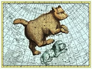
Background imageGermany Collection: Ursa Major constellation, Bode Star Atlas

Ursa Major constellation, Bode Star Atlas
Ursa Major constellation. This star map shows the northern hemisphere constellation of Ursa Major (the Great Bear) as published by the German astronomer Johann Elert Bode (1747-1826) in 1805

Background imageGermany Collection: Illustration shows liverworts. Hepaticae

Illustration shows liverworts. Hepaticae. - Lebermoose, 1 print : color lithograph; sheet 36 x 26 cm. 1904. Ernst Haeckel 1834 a 1919 German biologist, naturalist, philosopher, physician, professor

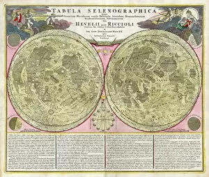
Background imageGermany Collection: Early map of the Moon, 1635

Early map of the Moon, 1635
Map of the Moon, by Johann Doppelmayr (1671- 1750). This early engraving of the Moon by the German mathematician and astronomer Doppelmayer is thought to date from 1730

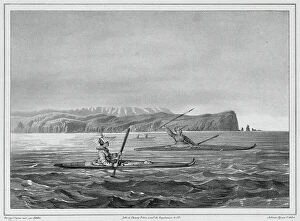
Background imageGermany Collection: Inhabitants of Ounalacheka with their canoes (Aleutian Islands), 19th century

Inhabitants of Ounalacheka with their canoes (Aleutian Islands), 19th century. One of 65 lithographs that were included in the volume of maps published after the round-the-world voyage of
Background imageGermany Collection: Crocodile and naked woman dancing on ice (litho)

Crocodile and naked woman dancing on ice (litho)
7149274 Crocodile and naked woman dancing on ice (litho) by Kley, Heinrich (1863-1945); Private Collection; (add.info.: Crocodile and naked woman dancing on ice)

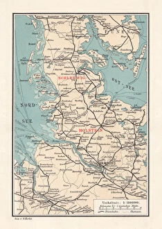
Background imageGermany Collection: Map of Schleswig-Holstein, northernmost state of Germany, lithograph, published 1887

Map of Schleswig-Holstein, northernmost state of Germany, lithograph, published 1887
Map of Schleswig-Holstein, northernmost state of Germany. Lithograph, published in 1887
Background imageGermany Collection: Germany Vector Map

Germany Vector Map
Highly detailed vector map of the Federal Republic of Germany. File was created on July 4, 2011. The colors in the.eps-file are ready for print (CMYK). Included files: EPS (v8) and Hi-Res JPG

Background imageGermany Collection: Woman performing her toilette with the help of her maid (colour litho)

Woman performing her toilette with the help of her maid (colour litho)
7201395 Woman performing her toilette with the help of her maid (colour litho) by Rieth, Paul (1871-1925); Private Collection; (add.info.: Woman performing her toilette with the help of her maid)

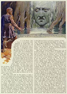
Background imageGermany Collection: Odin questioning Mimir (colour litho)

Odin questioning Mimir (colour litho)
7173279 Odin questioning Mimir (colour litho) by Doepler, Carl Emil (1824-1905); Private Collection; (add.info.: Odin questioning Mimir)

Background imageGermany Collection: WW1 - Trench map from a soldiers war diary showing the Somme Battlefield with

WW1 - Trench map from a soldiers war diary showing the Somme Battlefield with information gleaned from captured German Prisoners

Background imageGermany Collection: Map of Rome in 1570 - in 'Civitatis Orbis Terranum'

Map of Rome in 1570 - in "Civitatis Orbis Terranum"
GIA4814793 Map of Rome in 1570 - in " Civitatis Orbis Terranum" by Braun and Hogenberg. 1588. by Braun, Georg (1541-1622) and Hogenberg

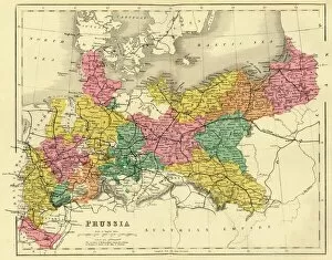
Background imageGermany Collection: Map of Prussia, c1872. Creator: Unknown

Map of Prussia, c1872. Creator: Unknown
Map of Prussia, c1872. Showing the various regions including Holstein, Hanover, Westphalia, Lower Rhine, Lorraine, Nassau, Cassel, Saxony, Brandedburg, Silesia, Pomerania, West Prussia

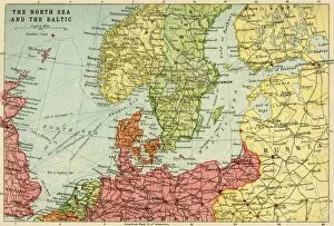
Background imageGermany Collection: Map of the North Sea and the Baltic, c1914, (c1920). Creator: John Bartholomew & Son

Map of the North Sea and the Baltic, c1914, (c1920). Creator: John Bartholomew & Son
Map of the North Sea and the Baltic, c1914, (c1920). Northern Europe at the start of the First World War, including parts of Norway, Sweden, Finland, Russia, Germany, Denmark

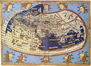
Background imageGermany Collection: Ptolemy World map, 1467

Ptolemy World map, 1467. Found in the collection of Biblioteka Narodowa, Warszawa

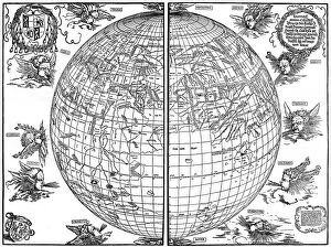
Background imageGermany Collection: Johannes Stabius map of the world, 1515, (1936). Artist: Albrecht Durer

Johannes Stabius map of the world, 1515, (1936). Artist: Albrecht Durer
Johannes Stabius map of the world, 1515, (1936). A print from Durer, Und Seine Zeit, by Wilhelm Waetzoldt, Grosse Phaidon Ausgabe, 1936

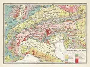
Background imageGermany Collection: Geological map of the European Alps, lithograph, published in 1897

Geological map of the European Alps, lithograph, published in 1897
Geological map of the European Alps. Lithograph, published in 1897

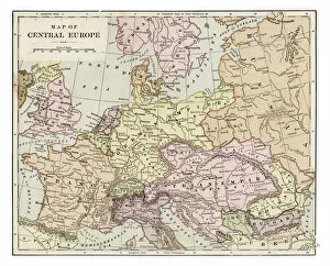
Background imageGermany Collection: Map of central Europe 1889

Map of central Europe 1889
Indiana Educational Series The Complete Geography - Indianapolis 1889

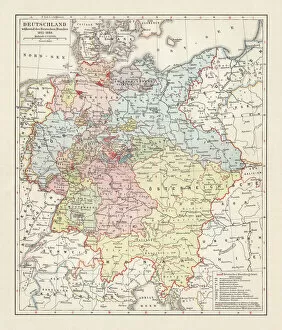
Background imageGermany Collection: Map of the German Confederation (1815-1866), lithograph, published in 1897

Map of the German Confederation (1815-1866), lithograph, published in 1897
Map of the German Confederation between 1815 and 1866. Lithograph, published in 1897

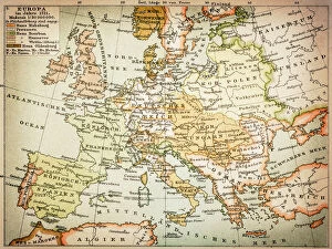
Background imageGermany Collection: Map of Europe 1721

Map of Europe 1721

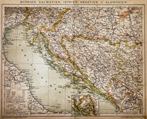
Background imageGermany Collection: Bosnia, dalmatia, istria, croatia, slavonia

Bosnia, dalmatia, istria, croatia, slavonia
Antique illustration of a Bosnia, dalmatia, istria, croatia, slavonia map

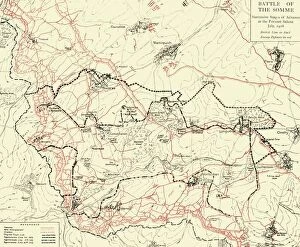
Background imageGermany Collection: Battle of the Somme, First World War, July 1916, (c1920). Creator: Unknown

Battle of the Somme, First World War, July 1916, (c1920). Creator: Unknown
Battle of the Somme, First World War, July 1916, (c1920). Map of northern France showing Successive Stages of Advance at the Fricourt Salient...British line in black, Enemy Defences [Germans] in red

Background imageGermany Collection: Map of Germany 1889

Map of Germany 1889
Comprehensive Geography by James Monteith - American Book Company 1882, 1889

Background imageGermany Collection: Germany - road map

Germany - road map
Highly detailed map of Germany with roads, administrative divisions and cities

Background imageGermany Collection: City map of Aachen, Germany, lithograph, published in 1897

City map of Aachen, Germany, lithograph, published in 1897
City map of Aachen, Germany. Lithograph, published in 1897

Background imageGermany Collection: Map, Britain -- Spearhead of Attack, WW2

Map, Britain -- Spearhead of Attack, WW2. Date: 1940s

Background imageGermany Collection: Ordnance Survey map of north east Sheffield copied by the Germans

Ordnance Survey map of north east Sheffield copied by the Germans, and marked with bombing targets, c. 1940
Original at Sheffield City Archives MD7731/4 and Sheffield Local Studies Librarys 26 M/5

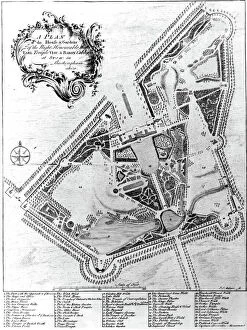
Background imageGermany Collection: A Plan of the House and Gardens at Stowe, Buckinghamshire (engraving)

A Plan of the House and Gardens at Stowe, Buckinghamshire (engraving)
XJF477689 A Plan of the House and Gardens at Stowe, Buckinghamshire (engraving) by Muller, Johann Sebastien (1715-c.1785); Private Collection; (add.info.: House and park of Richard Temple)

Background imageGermany Collection: Star map, 1805

Star map, 1805
Star map, 19th century. This star map shows the stars of the northern hemisphere. It was published by the German astronomer Johann Elert Bode (1747- 1826), in 1805

Background imageGermany Collection: Atlas compass, 16th century

Atlas compass, 16th century
Atlas compass in a 1544 copy of the Agnese Atlas. Several copies of this atlas were produced between 1536 and 1564, in Venice, by the Italian mapmaker Battista Agnese

Background imageGermany Collection: Germany before World War I

Germany before World War I
Map of the German Empire before World War I, circa 1912. Printed color lithograph

Background imageGermany Collection: Map / Europe / Germany 1880S

Map / Europe / Germany 1880S
Map of the German Empire (southern part) after the war with France, including Alsace and Lorraine

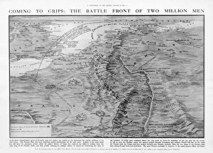
Background imageGermany Collection: The Western Front battleground - map of August 1914

The Western Front battleground - map of August 1914
WW1 - The Western Front battleground - map of August 1914 Date: 1914

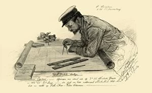
Background imageGermany Collection: A Hansen, first officer on the Knivsberg, 1898. Creator: Christian Wilhelm Allers

A Hansen, first officer on the Knivsberg, 1898. Creator: Christian Wilhelm Allers
A Hansen, first officer on the Knivsberg, 1898. Portrait of a German crew member using compasses and parallel rulers to plot the course of the SS Knivsberg through the South China Sea

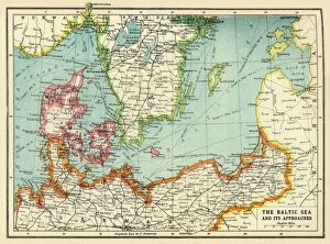
Background imageGermany Collection: The Baltic Sea and Its Approaches, First World War, c1915, (c1920)

The Baltic Sea and Its Approaches, First World War, c1915, (c1920). Map of part of northern Europe, showing sections of the coasts of Norway, Sweden, Russia, Germany and Denmark

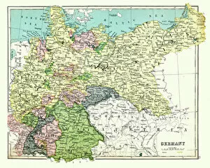
Background imageGermany Collection: Antique map of Germany, 1897, late 19th Century

Antique map of Germany, 1897, late 19th Century
Vintage engraving of a Antique map of Germany, 1897, late 19th Century

Background imageGermany Collection: Map of Africa, 1902. Creator: Unknown

Map of Africa, 1902. Creator: Unknown
Map of Africa, 1902. Showing colonial possessions including French West Africa and German South West Africa, with insets of Table Bay in South Africa, and British and German East Africa

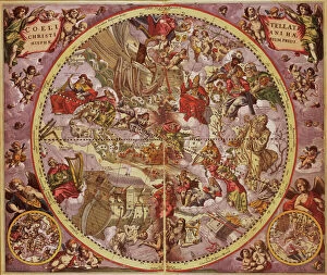
Background imageGermany Collection: Andreas Cellarius (1596-1665). Dutch-German cartographer. Ha

Andreas Cellarius (1596-1665). Dutch-German cartographer. Harmonia Macrocosmica, 1660, a major star atlas, published by Johannes Janssonius in Amsterdam

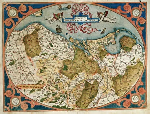
Background imageGermany Collection: Map of Germany and current Netherlands. Theatrum Orbis Terra

Map of Germany and current Netherlands. Theatrum Orbis Terrarum by Abraham Ortelius (1527-1598). First Edition. Antwerp, 1574. Library of Catalonia. Barcelona. Spain

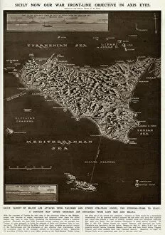
Background imageGermany Collection: Map of Sicily by G. H. Davis

Map of Sicily by G. H. Davis
A contour map of Sicily, giving the shortest air distances from Cape Bon and Malta. At this stage in the Second World War it was a British front-line objective in Axis eyes

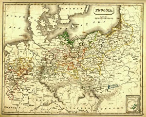
Background imageGermany Collection: Antquie Map of Prussia

Antquie Map of Prussia
Vintage map of Prussia from 1837

Background imageGermany Collection: Wiesbaden, germany

Wiesbaden, germany
Antique illustration of a Wiesbaden, Germany from 1898

Background imageGermany Collection: Bremerhaven

Bremerhaven is a seaport in northwestern Germany, on the North Sea coast, north of Bremen, illustration from 1898

Background imageGermany Collection: MAP OF EUROPE, c1812. A 19th century German map of Europe during the reign of Napoleon I

MAP OF EUROPE, c1812. A 19th century German map of Europe during the reign of Napoleon I, c1812

Background imageGermany Collection: Map of the Roman provinces of Gaul, Britannia and Germania (coloured engraving)

Map of the Roman provinces of Gaul, Britannia and Germania (coloured engraving)
7148263 Map of the Roman provinces of Gaul, Britannia and Germania (coloured engraving) by Kiepert, Heinrich (1818-99); Private Collection; (add.info.: Map of the Roman provinces of Gaul)

Background imageGermany Collection: Ogre cooking people for breakfast (litho)

Ogre cooking people for breakfast (litho)
7149264 Ogre cooking people for breakfast (litho) by Kley, Heinrich (1863-1945); Private Collection; (add.info.: Ogre cooking people for breakfast)

Background imageGermany Collection: Pamir, one of the last commercial sailing ships, off Sydney Heads, Australia (b / w photo)

Pamir, one of the last commercial sailing ships, off Sydney Heads, Australia (b / w photo)
7156948 Pamir, one of the last commercial sailing ships, off Sydney Heads, Australia (b/w photo) by Australian Photographer (20th century); Private Collection; (add.info.: Pamir)

Background imageGermany Collection: Antique map of Mainz Germany 1896

Antique map of Mainz Germany 1896
Map of Mainz Germany 1896 Original edition from my own archives Source : Brockhaus 1896

Background imageGermany Collection: Leeds (colour litho)

Leeds (colour litho)
3648442 Leeds (colour litho) by English School, (20th century); Private Collection; (add.info.: Leeds. Illustration for The Survey Gazetteer of the British Isles, Topographical)


All Professionally Made to Order for Quick Shipping


-

Germany Collection

Germany is a country located in central Europe with a population of over 83 million people and has a diverse landscape, ranging from the Alps in the south to the North Sea and Baltic Sea coasts in the north. The country is known for its strong economy, which is driven by industries such as automotive manufacturing, engineering, and pharmaceuticals. It also has a rich cultural history, with famous composers like Beethoven and Bach hailing from the country. Its capital city Berlin is renowned for its vibrant art scene and historical landmarks such as the Brandenburg Gate.
+

Our beautiful Wall Art and Photo Gifts include Framed Prints, Photo Prints, Poster Prints, Canvas Prints, Jigsaw Puzzles, Metal Prints and so much more

The Germany collection from Media Storehouse offers a wide selection of wall art and framed prints that showcase the beauty, history, and culture of Germany. Our collection features an array of maps and charts that depict the country's geography, landmarks, cities, regions, and historical events. From vintage maps to modern designs, our collection caters to different tastes and preferences. Some of the popular items in our collection include antique city plans of Berlin or Munich; topographic maps of Bavaria or Black Forest; political maps showing Germany's borders over time; charts illustrating Germanic tribes' migration patterns during ancient times. These artworks are available in various sizes and formats such as canvas prints or traditional frames. They make great decorations for homes, offices or public spaces like museums or libraries. The Germany collection is a must-see for anyone interested in exploring the rich heritage of this fascinating country through visual art.
+

What are Germany (Maps and Charts) art prints?

Germany art prints are high-quality reproductions of historical maps and charts depicting various regions, cities, and landmarks in Germany. These prints showcase the intricate details of the original maps and charts, including topography, street names, buildings, rivers, and other geographical features. These art prints are perfect for history enthusiasts who want to explore Germany's rich cultural heritage or for those who simply appreciate beautiful cartographic artwork. They can be used as decorative pieces in homes or offices or as educational tools in schools and libraries. We offer a wide range of Germany art prints that cater to different tastes and preferences. You can choose from vintage-style sepia-toned maps to colorful contemporary designs that highlight specific areas or themes such as wine regions or cycling routes. These art prints provide a unique way to experience Germany's geography and history while adding aesthetic value to any space.
+

What Germany (Maps and Charts) art prints can I buy from Media Storehouse?

We offer a wide range of Germany maps and charts art prints that you can purchase. These include vintage maps, city plans, topographical charts, and historical atlases. You can choose from different styles and sizes to suit your preferences. One popular option is the antique map of Germany created by cartographer Gerard Mercator in 1595. This beautifully detailed map shows the country's regions, cities, rivers, and mountains as they were known during the Renaissance period. Another interesting print is the Berlin Wall Map which depicts the infamous wall that divided East and West Berlin during the Cold War era. The map includes details on checkpoints, watchtowers, escape tunnels and other features related to this historic event. Whether you are looking for a decorative piece for your home or office or an educational resource for teaching purposes, we have a variety of Germany maps and charts art prints available to suit your needs.
+

How do I buy Germany (Maps and Charts) art prints?

To buy Germany art prints from Media Storehouse, you can browse our extensive collection of high-quality prints online. Simply search for the specific artwork or artist you are interested in, or filter by category to find maps and charts related to Germany. Once you have found a print that catches your eye, select the size and format that best suits your needs. We offer a range of options for printing on different materials such as canvas, photographic paper, and fine art paper. You can also choose to have your print framed or unframed depending on your preference. Once you have made your selection, simply add it to your cart and proceed to checkout. Payment is easy with various payment methods available including credit card payments. Buying Germany art prints from Media Storehouse is a straightforward process that allows you to easily access beautiful artworks at affordable prices.
+

How much do Germany (Maps and Charts) art prints cost?

We offer a wide range of Germany art prints at varying prices. Our collection includes vintage maps, historical charts, and modern interpretations of the country's geography. The cost of each print depends on several factors such as size, framing options, and printing material. We understand that every customer has unique preferences when it comes to purchasing art prints. That is why we have made sure to provide a diverse selection that caters to different tastes and budgets. Whether you are looking for an affordable poster or a high-quality canvas print, we have something for everyone. Our Germany art prints make great additions to any home or office space. They are not only aesthetically pleasing but also educational pieces that can spark interesting conversations about history and geography. So if you're interested in adding some German-inspired artwork to your collection, be sure to check out our selection today.
+

How will my Germany (Maps and Charts) art prints be delivered to me?

Your Germany art prints will be delivered to you in a safe and secure manner by our trusted delivery partners. We take great care to ensure that your artwork is packaged with the utmost care, so it arrives at your doorstep in pristine condition. Depending on the size of your order, we may use different shipping methods such as standard post or courier services. We understand how important it is for you to receive your artwork promptly, which is why we work hard to dispatch all orders as quickly as possible. Once dispatched, you will receive an email notification containing tracking information so that you can keep track of your package's progress. We are committed to providing our customers with high-quality products and exceptional service. If for any reason you are not completely satisfied with your purchase, please do not hesitate to contact us so that we can resolve any issues promptly.