Fraud Blocker Skip to main content

Home > Maps and Charts > Related Images

Related Images Collection (#100)

49,992 Items

Background imageRelated Images Collection: ALZATE, Jose Antonio (1737-1799). Scientist and writer. Plan of the Archdiocese of Mexico

ALZATE, Jose Antonio (1737-1799). Scientist and writer. Plan of the Archdiocese of Mexico
CUL4864770 ALZATE, Jose Antonio (1737-1799). Scientist and writer. Plan of the Archdiocese of Mexico. Parish of Otumba (Otumba or Ozumba?) And Parish of Axapulco (Acapulco?). 1767

Background imageRelated Images Collection: Map of Sicily (Italy), during the First Punic War, 264 BC, with the territories of the Roman

Map of Sicily (Italy), during the First Punic War, 264 BC, with the territories of the Roman and Carthaginian empires
NWI4863549 Map of Sicily (Italy), during the First Punic War, 264 BC, with the territories of the Roman and Carthaginian empires, the Mamertines and the Emperor Hieron II (270-215 BC)

Background imageRelated Images Collection: Ancient Mesopotamia: Map of the ancient (Tiger) Tigris in the Euphrates region

Ancient Mesopotamia: Map of the ancient (Tiger) Tigris in the Euphrates region. Colour engraving of the 19th century
NWI4863466 Ancient Mesopotamia: Map of the ancient (Tiger) Tigris in the Euphrates region. Colour engraving of the 19th century.; (add.info.: Ancient Mesopotamia)

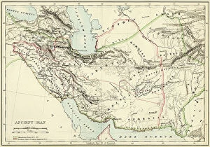
Background imageRelated Images Collection: Map of the Persian Empire during the antiquite showing the Persian Gulf and Iran

Map of the Persian Empire during the antiquite showing the Persian Gulf and Iran. Lithograph of the 19th century
NWI4862318 Map of the Persian Empire during the antiquite showing the Persian Gulf and Iran. Lithograph of the 19th century.; (add.info)

Background imageRelated Images Collection: Geographic map of southern Palestine in Antiquite. The territories of Israel of Palestine

Geographic map of southern Palestine in Antiquite. The territories of Israel of Palestine, Jerusalem, Galilee, Samaria
NWI4860860 Geographic map of southern Palestine in Antiquite. The territories of Israel of Palestine, Jerusalem, Galilee, Samaria, Judee and the Dead Sea

Background imageRelated Images Collection: Plan of the theatre of the city of Troy after the archeological excavations of the 19th century

Plan of the theatre of the city of Troy after the archeological excavations of the 19th century
NWI4859472 Plan of the theatre of the city of Troy after the archeological excavations of the 19th century. Colouring engraving of the 19th century.; (add.info)

Background imageRelated Images Collection: Geographic map of England and France after the Brittany trade in the Hundred Years War in 1360

Geographic map of England and France after the Brittany trade in the Hundred Years War in 1360
NWI4874497 Geographic map of England and France after the Brittany trade in the Hundred Years War in 1360. Lithograph of the 19th century.; (add.info)

Background imageRelated Images Collection: Geographic map of England and Wales, circa 1870. 19th century colour engraving

Geographic map of England and Wales, circa 1870. 19th century colour engraving
NWI4874357 Geographic map of England and Wales, circa 1870. 19th century colour engraving; (add.info.: Geographic map of England and Wales, circa 1870)

Background imageRelated Images Collection: Map of the Iberic peninsula under the Moors (Arab Muslim domination)

Map of the Iberic peninsula under the Moors (Arab Muslim domination), at the beginning of the 13th century
NWI4871927 Map of the Iberic peninsula under the Moors (Arab Muslim domination), at the beginning of the 13th century. 19th century lithography.; (add.info)

Background imageRelated Images Collection: Map of the Netherlands and Belgium, around 1870 - Lithograph 19th century - Map of the Netherlands

Map of the Netherlands and Belgium, around 1870 - Lithograph 19th century - Map of the Netherlands and Belgium
NWI4872346 Map of the Netherlands and Belgium, around 1870 - Lithograph 19th century - Map of the Netherlands and Belgium, 1870s - Color lithograph; (add.info.: Map of the Netherlands and Belgium)

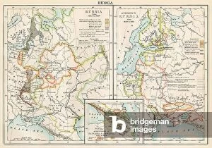
Background imageRelated Images Collection: Maps of Russia from 1462 to 1689 (left) and map of territories added to the Russian Empire (right)

Maps of Russia from 1462 to 1689 (left) and map of territories added to the Russian Empire (right) from 1689 to 1825
NWI4872109 Maps of Russia from 1462 to 1689 (left) and map of territories added to the Russian Empire (right) from 1689 to 1825

Background imageRelated Images Collection: Map of Hispania or Iberic peninsula under the Roman Empire. 19th century lithography

Map of Hispania or Iberic peninsula under the Roman Empire. 19th century lithography
NWI4871877 Map of Hispania or Iberic peninsula under the Roman Empire. 19th century lithography.; (add.info.: Map of Hispania or Iberic peninsula under the Roman Empire)

Background imageRelated Images Collection: Map of Greece (Thessaly, Peloponnese and Cycladic Islands), circa 1870. 19th century lithography

Map of Greece (Thessaly, Peloponnese and Cycladic Islands), circa 1870. 19th century lithography
NWI4871595 Map of Greece (Thessaly, Peloponnese and Cycladic Islands), circa 1870. 19th century lithography.; (add.info.: Map of Greece (Thessaly, Peloponnese and Cycladic Islands), circa 1870

Background imageRelated Images Collection: Map of Malacca peninsula (Burma, Thailand and Malaysia), circa 1870. 19th century lithography

Map of Malacca peninsula (Burma, Thailand and Malaysia), circa 1870. 19th century lithography
NWI4865582 Map of Malacca peninsula (Burma, Thailand and Malaysia), circa 1870. 19th century lithography.; (add.info.: Map of Malacca peninsula (Burma, Thailand and Malaysia), circa 1870

Background imageRelated Images Collection: Map of Italy showing political divisions before the unification of 1797 (Risorgimento)

Map of Italy showing political divisions before the unification of 1797 (Risorgimento). Color lithography
NWI4870950 Map of Italy showing political divisions before the unification of 1797 (Risorgimento). Color lithography.; (add.info)

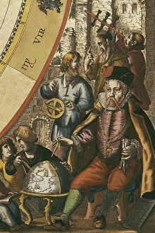
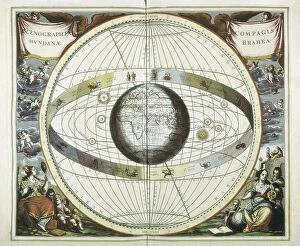
Background imageRelated Images Collection: CELLARIUS, Andreas (1596-1665). Atlas Coelestis seu Harmonia Macrocosmica. 1661

CELLARIUS, Andreas (1596-1665). Atlas Coelestis seu Harmonia Macrocosmica. 1661. BRAHE, Tycho (1546-1601)
CUL4868671 CELLARIUS, Andreas (1596-1665). Atlas Coelestis seu Harmonia Macrocosmica. 1661. BRAHE, Tycho (1546-1601). Danish astronomer. Andreas Cellarius Macrocosmic Harmony (Amsterdam, 1661)

Background imageRelated Images Collection: Middle Ages: Arrangement of a village and countryside around a mansion

Middle Ages: Arrangement of a village and countryside around a mansion. Colour engraving of the 19th century
NWI4892563 Middle Ages: Arrangement of a village and countryside around a mansion. Colour engraving of the 19th century.; (add.info.: Middle Ages)

Background imageRelated Images Collection: Map of New France in Canada by Samuel de Champlain circa 1613. Engraving

Map of New France in Canada by Samuel de Champlain circa 1613. Engraving. Part of Samuel de Champlain's 1613 map of
NWI4902078 Map of New France in Canada by Samuel de Champlain circa 1613. Engraving. Part of Samuel de Champlain's 1613 map of New France in Canada.; (add.info)

Background imageRelated Images Collection: Map of Paris with fortifications and exterior forts (Vincennes, romainville, Nogent, Nogent), walls

Map of Paris with fortifications and exterior forts (Vincennes, romainville, Nogent, Nogent), walls
ELD4902514 Map of Paris with fortifications and exterior forts (Vincennes, romainville, Nogent, Nogent), walls. 19th century (engraving); Private Collection; Photo © The Holbarn Archive

Background imageRelated Images Collection: Metropolitan tubular railway from Vincennes to the Bois de Boulogne (Parisian metro)

Metropolitan tubular railway from Vincennes to the Bois de Boulogne (Parisian metro) - Elabore project by M
PCT4291518 Metropolitan tubular railway from Vincennes to the Bois de Boulogne (Parisian metro) - Elabore project by M. Berlier for the 1900 exhibition in Paris - map of the route

Background imageRelated Images Collection: Map of Epirus and western Greece, 295 BC. From Cassell's Universal History

Map of Epirus and western Greece, 295 BC. From Cassell's Universal History, published 1888 (b/w engraving)
6867255 Map of Epirus and western Greece, 295 BC. From Cassell's Universal History, published 1888 (b/w engraving); (add.info.: Map of Epirus and western Greece, 295 BC)

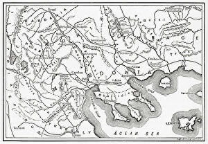
Background imageRelated Images Collection: Map of Macedonia and adjacent districts. From Cassell's Universal History

Map of Macedonia and adjacent districts. From Cassell's Universal History, published 1888 (b/w engraving)
6867237 Map of Macedonia and adjacent districts. From Cassell's Universal History, published 1888 (b/w engraving); (add.info.: Map of Macedonia and adjacent districts)

Background imageRelated Images Collection: Map of Assyria Chaldea and adjacent countries. From Cassell's Universal History

Map of Assyria Chaldea and adjacent countries. From Cassell's Universal History, published 1888 (b/w engraving)
6867225 Map of Assyria Chaldea and adjacent countries. From Cassell's Universal History, published 1888 (b/w engraving); (add.info.: Map of Assyria Chaldea and adjacent countries)

Background imageRelated Images Collection: Map of Europe in 1815. From The Evolution of Modern Europe, 1453 - 1932

Map of Europe in 1815. From The Evolution of Modern Europe, 1453 - 1932, published 1933 (b/w engraving)
6867179 Map of Europe in 1815. From The Evolution of Modern Europe, 1453 - 1932, published 1933 (b/w engraving); (add.info.: Map of Europe in 1815)

Background imageRelated Images Collection: Map of Rome, 1676

Map of Rome, 1676
6116769 Map of Rome, 1676; (add.info.: Map of the centre of Rome, Italy, after a print by Giovanni Battista Falda dated 1676.); Photo © Ken Welsh. All rights reserved 2024

Background imageRelated Images Collection: Australia c. 1760, Mercator projection, from Atlas de Toutes Les Parties Connues du Globe

Australia c. 1760, Mercator projection, from Atlas de Toutes Les Parties Connues du Globe Terrestre by Cartographer
5242662 Australia c. 1760, Mercator projection, from Atlas de Toutes Les Parties Connues du Globe Terrestre by Cartographer Rigobert Bonne pub. Geneva c. 1760

Background imageRelated Images Collection: Geographic atlas: detail of the portulan of Francois Ollive representing the cartridge of Africa

Geographic atlas: detail of the portulan of Francois Ollive representing the cartridge of Africa
JEB4875003 Geographic atlas: detail of the portulan of Francois Ollive representing the cartridge of Africa. 1661 Municipal Library of Marseille.; (add.info.: Geographic atlas)

Background imageRelated Images Collection: CELLARIUS, Andreas (1596-1665). Atlas Coelestis seu Harmonia Macrocosmica. 1661

CELLARIUS, Andreas (1596-1665). Atlas Coelestis seu Harmonia Macrocosmica. 1661. BRAHE, Tycho (1546-1601)
CUL4875768 CELLARIUS, Andreas (1596-1665). Atlas Coelestis seu Harmonia Macrocosmica. 1661. BRAHE, Tycho (1546-1601). Danish astronomer

Background imageRelated Images Collection: Map of the Count of Durham England), circa 1870. 19th century lithography

Map of the Count of Durham England), circa 1870. 19th century lithography
NWI4874845 Map of the Count of Durham England), circa 1870. 19th century lithography.; (add.info.: Map of the Count of Durham England), circa 1870

Background imageRelated Images Collection: Geographic atlas: portulan or nautical map of the Mediterranean Sea and its coasts (Africa)

Geographic atlas: portulan or nautical map of the Mediterranean Sea and its coasts (Africa, Barbaria, Europe)
JEB4874812 Geographic atlas: portulan or nautical map of the Mediterranean Sea and its coasts (Africa, Barbaria, Europe, Middle East). Nautical chart of Francois Ollive, 1661

Background imageRelated Images Collection: Geographic atlas: portulan or nautical map of the Mediterranean Sea and its coasts (Africa)

Geographic atlas: portulan or nautical map of the Mediterranean Sea and its coasts (Africa, Barbaria, Europe)
JEB4874692 Geographic atlas: portulan or nautical map of the Mediterranean Sea and its coasts (Africa, Barbaria, Europe, Middle East). Nautical chart of Joan Oliva on parchment, 1593

Background imageRelated Images Collection: Map of England and Wales, circa 1870. 19th century lithography

Map of England and Wales, circa 1870. 19th century lithography
NWI4874691 Map of England and Wales, circa 1870. 19th century lithography.; (add.info.: Map of England and Wales, circa 1870. 19th century lithography.); Photo © North Wind Pictures

Background imageRelated Images Collection: Map of the Earl of Middlesex (England), circa 1870. 19th century lithography

Map of the Earl of Middlesex (England), circa 1870. 19th century lithography
NWI4875178 Map of the Earl of Middlesex (England), circa 1870. 19th century lithography.; (add.info.: Map of the Earl of Middlesex (England), circa 1870

Background imageRelated Images Collection: Geographic atlas: detail of the portulan of Francois Ollive representing the Irish Sea with a

Geographic atlas: detail of the portulan of Francois Ollive representing the Irish Sea with a fish, 1661
JEB4874965 Geographic atlas: detail of the portulan of Francois Ollive representing the Irish Sea with a fish, 1661. Municipal library of Marseille.; (add.info.: Geographic atlas)

Background imageRelated Images Collection: Geographic atlas: detail of the portulan of Juan Oliva representing the coast near Marseille

Geographic atlas: detail of the portulan of Juan Oliva representing the coast near Marseille
JEB4874904 Geographic atlas: detail of the portulan of Juan Oliva representing the coast near Marseille, 1593 Bibliotheque municipale de Marseille.; (add.info.: Geographic atlas)

Background imageRelated Images Collection: Map of the Earl of Wiltshire (England), circa 1870. 19th century lithography

Map of the Earl of Wiltshire (England), circa 1870. 19th century lithography
NWI4875514 Map of the Earl of Wiltshire (England), circa 1870. 19th century lithography.; (add.info.: Map of the Earl of Wiltshire (England), circa 1870

Background imageRelated Images Collection: Geographic map of Western Australia, 1870. 19th century colour engraving

Geographic map of Western Australia, 1870. 19th century colour engraving
NWI4879176 Geographic map of Western Australia, 1870. 19th century colour engraving.; (add.info.: Geographic map of Western Australia, 1870)

Background imageRelated Images Collection: Map of New Guinee and New Caledonia, years 1870. 19th century lithograph

Map of New Guinee and New Caledonia, years 1870. 19th century lithograph
NWI4879110 Map of New Guinee and New Caledonia, years 1870. 19th century lithograph.; (add.info.: Map of New Guinee and New Caledonia, years 1870)

Background imageRelated Images Collection: Detail depicting a scene of naval battle. Portulan 4 by Augustin Roussin

Detail depicting a scene of naval battle. Portulan 4 by Augustin Roussin. 1630 Watercolour Municipal Library of
JEB4878541 Detail depicting a scene of naval battle. Portulan 4 by Augustin Roussin. 1630 Watercolour Municipal Library of Marseille; (add.info.: Detail depicting a scene of naval battle)

Background imageRelated Images Collection: Detail of portulan 4 by Augustin Roussin representing the city of Venice. Watercolour from 1630

Detail of portulan 4 by Augustin Roussin representing the city of Venice. Watercolour from 1630
JEB4878522 Detail of portulan 4 by Augustin Roussin representing the city of Venice. Watercolour from 1630. Municipal library of Marseille; (add.info)

Background imageRelated Images Collection: View of the city Marseille. Portulan realized by Augustin Roussin (17th century)

View of the city Marseille. Portulan realized by Augustin Roussin (17th century). 1630 Municipal Library of Marseille
JEB4878410 View of the city Marseille. Portulan realized by Augustin Roussin (17th century). 1630 Municipal Library of Marseille; (add.info.: View of the city Marseille)

Background imageRelated Images Collection: Map of the City of Jerusalem (Israel), circa 1870. 19th century lithography

Map of the City of Jerusalem (Israel), circa 1870. 19th century lithography
NWI4878373 Map of the City of Jerusalem (Israel), circa 1870. 19th century lithography.; (add.info.: Map of the City of Jerusalem (Israel), circa 1870

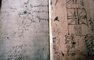
Background imageRelated Images Collection: Mutinerie du Bounty: log of Lieutenant William Bligh (1754-1817)

Mutinerie du Bounty: log of Lieutenant William Bligh (1754-1817) redige in the boat after the mutinerie du Bounty of 29
ELD4881297 Mutinerie du Bounty: log of Lieutenant William Bligh (1754-1817) redige in the boat after the mutinerie du Bounty of 29 April 1789 - Detail avec drapeau et dessin des contours d'une cote

Background imageRelated Images Collection: Patriotic map showing a permissive lunch with his admiring and grateful parents, 1914

Patriotic map showing a permissive lunch with his admiring and grateful parents, 1914
LUX4743862 Patriotic map showing a permissive lunch with his admiring and grateful parents, 1914; (add.info.: Patriotic map showing a permissive lunch with his admiring and grateful parents)

Background imageRelated Images Collection: First World War: Patriotic map showing a soldier sleeping on the ground

First World War: Patriotic map showing a soldier sleeping on the ground, reclaiming that he has an Alsatian in his arms
LUX4744460 First World War: Patriotic map showing a soldier sleeping on the ground, reclaiming that he has an Alsatian in his arms and entitled The dream of our soldiers

Background imageRelated Images Collection: First World War: Patriotic Map showing a couple of a soldier and an Alsatian, 1914

First World War: Patriotic Map showing a couple of a soldier and an Alsatian, 1914
LUX4744459 First World War: Patriotic Map showing a couple of a soldier and an Alsatian, 1914; (add.info.: World War I - War 14-18 (1914-1918) - World War I (WWI or WW1)

Background imageRelated Images Collection: First World War: Patriotic map showing France symbolized by a woman wearing a helmet holds a

First World War: Patriotic map showing France symbolized by a woman wearing a helmet holds a little girl in her arms
LUX4744348 First World War: Patriotic map showing France symbolized by a woman wearing a helmet holds a little girl in her arms with her Alsatian headdress

Background imageRelated Images Collection: First World War: Patriotic map showing an Alsatian greeting a French soldier who brings her back a

First World War: Patriotic map showing an Alsatian greeting a French soldier who brings her back a German helmet
LUX4744337 First World War: Patriotic map showing an Alsatian greeting a French soldier who brings her back a German helmet and a border post in trophee, declaring dear sister here


All Professionally Made to Order for Quick Shipping


-

Why Choose Us?

We are a leading provider of Art Prints and Photo Gifts since 2003, working in partnership with a range of Sporting Clubs, Charities, Museums and Picture Libraries. A large share of profits from any of their images will go directly towards supporting that charity or club. Our archive of images is carefully curated to bring you a wide range of subjects, including landscapes, wildlife, architecture, and more. We ship from our partner labs in the UK, USA, EU (Netherlands) and Australia.
+

How do I place an order?

Ordering is quick & easy - Just follow 5 Simple Steps:
  1. Find your image: Use our search box or browse our online photo Collections to find the image you want.

  2. Choose your print format: Select your desired product and add it to your cart.

  3. Enter your details: If you're a returning customer, simply enter your email address and password, and we'll fill in your billing and shipping address details. All personal details are held securely and are fully GDPR compliant. As standard, we remove all Personally Identifiable Information after 12 months.

  4. Pay for your purchase: We use state-of-the-art security for online shopping and do not have access to your card details.

  5. Sit back and relax: We'll email you confirmation of your order and when it's dispatched. Registered customers can also track orders in the 'My Account' area.

+

How do I pay for an order?

You can pay for your order with most of the major credit and debit cards, or PayPal. For added security, major financial institutions process payment details separately and securely on our behalf. We do not have access to your online payment card details. Online payments are preferred however we do take phone orders. For UK customers only we accept cheques issued against a UK bank.
+

Is my data safe?

We take data security very seriously. We do not have access to your full card details and all payments are requested over a fully secure connection. Additionally, we fully comply with current European and GDPR legislation, and automatically remove all personal data after at most 12 months (unless you have an account with us and have signed in recently). We also have a strict opt-in policy and would never sell your personal details. Your data is only used to fulfill your order promptly and efficiently.
+

Is wall art ready to hang?

For quick and easy installation all wall art, including framed prints, canvas prints and metal prints are supplied with a ready to hang solution on the back. Generally, saw tooth hangers are applied as they allow wall art to hang flush against the wall. The serrated edge of the hanger prevents the frame from shifting or tilting when hung.
+

Are the photo prints fade resistant?

Yes, we use archival quality photo paper photographic paper for vivid reproduction Prints are an accurate representations of the original artwork, which is preserved for artistic character and authenticity. We guarantee they match previews shown on our web site