Fraud Blocker Skip to main content

Home > North America > Cuba > Maps

Maps Collection (#4)

Maps of Cuba North America are a collection that show the geography and political boundaries of Cuba

231 Items

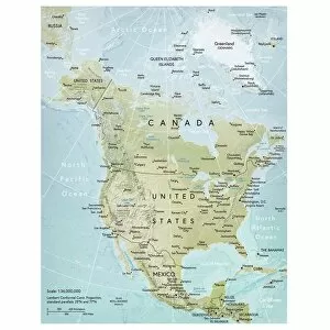
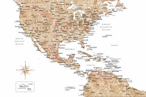
Background imageMaps Collection: North America map

North America map
Vector illustration of a detailed map of North America. Reference map was created by the US Central Intelligence Agency and is available as a public domain map at the University of Texas Libraries

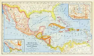
Background imageMaps Collection: 1883 Map Of Central America

1883 Map Of Central America

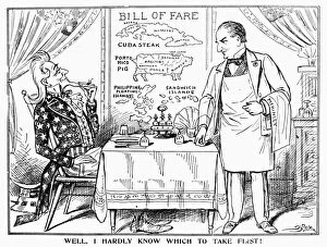
Background imageMaps Collection: Well, I Hardly Know Which To Take First! American cartoon comment, c1900

Well, I Hardly Know Which To Take First! American cartoon comment, c1900, on Uncle Sams seemingly insatiable
IMPERIALISM CARTOON, c1900. Well, I Hardly Know Which To Take First! American cartoon comment, c1900, on Uncle Sams seemingly insatiable imperialist appetite, as President William McKinley, at right

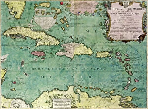
Background imageMaps Collection: Map of the northern Mexican archipelago and the West Indies, 1688 (engraving)

Map of the northern Mexican archipelago and the West Indies, 1688 (engraving)
VNK284160 Map of the northern Mexican archipelago and the West Indies, 1688 (engraving) by Coronelli, Vincenzo Maria (1650-1718); Vorontsov Palace, Crimea

Background imageMaps Collection: Neutral USA and the Caribbean sea map

Neutral USA and the Caribbean sea map
Rosana Laiz Blursbyai

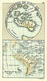
Background imageMaps Collection: Antique Map by Leonardo Da Vinci

Antique Map by Leonardo Da Vinci 1515 and the Hauslab Globe

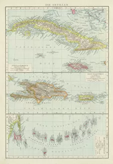
Background imageMaps Collection: Old chromolithograph map of Cuba (northern Caribbean Sea, Gulf of Mexico, and Atlantic Ocean)

Old chromolithograph map of Cuba (northern Caribbean Sea, Gulf of Mexico, and Atlantic Ocean)
Copyright has expired on this artwork. From my own archives, digitally restored

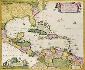
Background imageMaps Collection: Map of the West Indies, Caribbean Sea, Antilles, 1709-1713 (engraving)

Map of the West Indies, Caribbean Sea, Antilles, 1709-1713 (engraving)
VEN5030086 Map of the West Indies, Caribbean Sea, Antilles, 1709-1713 (engraving) by Keulen, Gerard van (1678-1726); Biblioteca Angelica, Rome

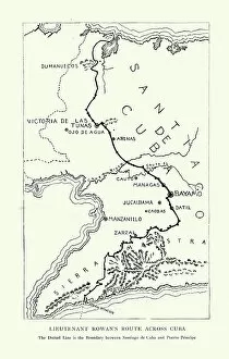
Background imageMaps Collection: Map showing Lieutenant Andrew Summers Rowan's route across Cuba during Spanish American War

Map showing Lieutenant Andrew Summers Rowan's route across Cuba during Spanish American War
Vintage illustration Map showing Lieutenant Andrew Summers Rowan's route across Cuba during Spanish American War, 1890s, 19th Century

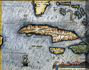
Background imageMaps Collection: Map of the Caribbean Sea by Christophe Plantin, 1588

Map of the Caribbean Sea by Christophe Plantin, 1588
AIS5350385 Map of the Caribbean Sea by Christophe Plantin, 1588 by Plantin, Christophe (1414 or 1420-1589); Biblioteca Universidad, Salamanca

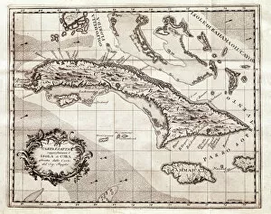
Background imageMaps Collection: The islands of the Greater Antilles (map, 1763)

The islands of the Greater Antilles (map, 1763)
LRI4648656 The islands of the Greater Antilles (map, 1763) by Popple, Henry (d.1743); Museo de America, Madrid, Spain; (add.info.: Geography map)

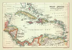
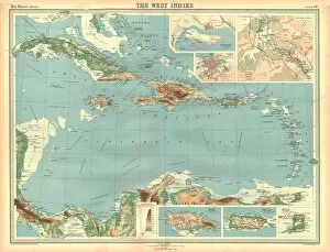
Background imageMaps Collection: West Indies and Central America, Industries and Communications (colour litho)

West Indies and Central America, Industries and Communications (colour litho)
7169506 West Indies and Central America, Industries and Communications (colour litho) by English School, (20th century); Private Collection; (add.info.: West Indies and Central America)

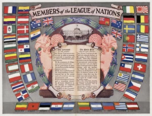
Background imageMaps Collection: Members of the League of Nations (colour litho)

Members of the League of Nations (colour litho)
7163177 Members of the League of Nations (colour litho) by English School, (20th century); Private Collection; (add.info.: Members of the League of Nations)

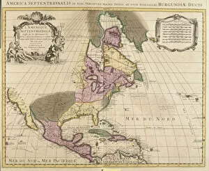
Background imageMaps Collection: Map of North America (Greenland, Canada, USA, Mexico and the Caribbean Islands: Cuba

Map of North America (Greenland, Canada, USA, Mexico and the Caribbean Islands: Cuba
LRI4706891 Map of North America (Greenland, Canada, USA, Mexico and the Caribbean Islands: Cuba, Haiti, Jamaica, West Indies) (etching, 1730) by Delisle

Background imageMaps Collection: The islands of the Greater Antilles and the Lesser Antilles in the Caribbean Sea (map

The islands of the Greater Antilles and the Lesser Antilles in the Caribbean Sea (map
LRI4648655 The islands of the Greater Antilles and the Lesser Antilles in the Caribbean Sea (map, 1500) by Unknown Artist, (16th century); Museo de America, Madrid

Background imageMaps Collection: View of the island of Cuba. Isolario (map of islands) by Benedetto Bordone. Venice 1547

View of the island of Cuba. Isolario (map of islands) by Benedetto Bordone. Venice 1547
GIA4784032 View of the island of Cuba. Isolario (map of islands) by Benedetto Bordone. Venice 1547 by Italian School, (16th century); Private Collection; (add.info.: View of the island of Cuba)

Background imageMaps Collection: Spanish-American War (engraving)

Spanish-American War (engraving)
1063480 Spanish-American War (engraving) by English School, (19th century); Private Collection; (add.info.: Spanish-American War)

Background imageMaps Collection: Portulan: Geographic map with the name of the coastline of Cuba, Florida

Portulan: Geographic map with the name of the coastline of Cuba, Florida
AIS5347578 Portulan: Geographic map with the name of the coastline of Cuba, Florida, Central America and North Latin America, Hydrographic Atlas of Fernao VAZ DOURADO (16th century)

Background imageMaps Collection: Map of Mexico, Cuba, Florida and Jamaica, c. 1567. (mural painting)

Map of Mexico, Cuba, Florida and Jamaica, c. 1567. (mural painting)
LRI4595645 Map of Mexico, Cuba, Florida and Jamaica, c.1567. (mural painting) by Danti, Egnazio (1536-86); Palazzo Vecchio, Florence, Italy; (add.info.: Mexico, Cuba)

Background imageMaps Collection: Map of Mexico and Florida (USA) with the Caribbean Islands (Cuba, Haiti, Jamaica

Map of Mexico and Florida (USA) with the Caribbean Islands (Cuba, Haiti, Jamaica
LRI4707037 Map of Mexico and Florida (USA) with the Caribbean Islands (Cuba, Haiti, Jamaica, Antilles) (etching, 1730) by Delisle

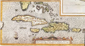
Background imageMaps Collection: Cuba Insula; Hispaniola Insula, engraved by Hendrik Hondius, 1633 (engraving)

Cuba Insula; Hispaniola Insula, engraved by Hendrik Hondius, 1633 (engraving)
5648408 Cuba Insula; Hispaniola Insula, engraved by Hendrik Hondius, 1633 (engraving) by Mercator, Gerard (1512-94) (after); 48x57 cm; Boston Public Library, Boston, Massachusetts, USA; Flemish

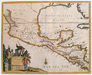
Background imageMaps Collection: Map of New Spain, New Galicia and Guatemala, 1625 (coloured engraving)

Map of New Spain, New Galicia and Guatemala, 1625 (coloured engraving)
REV397910 Map of New Spain, New Galicia and Guatemala, 1625 (coloured engraving) by Spanish School, (17th century); Biblioteca Nacional de Mexico, Mexico; Spanish, out of copyright

Background imageMaps Collection: Map of Mexico and Central America, from the Sala dell Carte Geografiche

Map of Mexico and Central America, from the Sala dell Carte Geografiche
BEN95492 Map of Mexico and Central America, from the Sala dell Carte Geografiche (Hall of Geographical Maps) c.1570 (oil on panel) by Danti

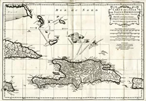
Background imageMaps Collection: Map of Hispaniola (San Domingo, Haiti), West Indies

Map of Hispaniola (San Domingo, Haiti), West Indies. The island is now divided into two separate nations: Haiti to the west (French Creole-speaking)

Background imageMaps Collection: Map of Cuba, c1500 (engraving)

Map of Cuba, c1500 (engraving)
3647379 Map of Cuba, c1500 (engraving) by German School, (19th century); Private Collection; (add.info.: Map of Cuba, c1500)

Background imageMaps Collection: Daiquiri Bay, near Santiago, where the American Forces landed (engraving)

Daiquiri Bay, near Santiago, where the American Forces landed (engraving)
1606233 Daiquiri Bay, near Santiago, where the American Forces landed (engraving) by English School, (19th century); Private Collection; (add.info.: Daiquiri Bay, near Santiago)

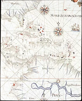
Background imageMaps Collection: The West Indies: Florida, Honduras, Cuba, Peru and the Caribbean

The West Indies: Florida, Honduras, Cuba, Peru and the Caribbean
LRI4648304 The West Indies: Florida, Honduras, Cuba, Peru and the Caribbean (Detail of the Portulan de Castellini, 17th century) by Unknown Artist

Background imageMaps Collection: Map of Central America (coloured engraving)

Map of Central America (coloured engraving)
VNK284159 Map of Central America (coloured engraving) by Netherlandish School, (17th century); Vorontsov Palace, Crimea, Ukraine; (add.info)

Background imageMaps Collection: Capture of the Spanish fleet by the Dutch under Admiral Piet Heyn (1578-1629

Capture of the Spanish fleet by the Dutch under Admiral Piet Heyn (1578-1629
STC221816 Capture of the Spanish fleet by the Dutch under Admiral Piet Heyn (1578-1629) off Matanzas, Cuba, 1628, from Newe Welt und Americanische Historien by Johann Ludwig Gottfried

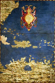
Background imageMaps Collection: Map of the Caribbean and Venezuela, from the Sala delle Carte Geografiche

Map of the Caribbean and Venezuela, from the Sala delle Carte Geografiche
BEN95488 Map of the Caribbean and Venezuela, from the Sala delle Carte Geografiche (Hall of Geographical Maps) c.1570 (oil on panel) by Danti

Background imageMaps Collection: The Spanish-American War, the Defences of Havana, from the Official Chart issued to the United

The Spanish-American War, the Defences of Havana, from the Official Chart issued to the United States Navy (engraving)
1615613 The Spanish-American War, the Defences of Havana, from the Official Chart issued to the United States Navy (engraving) by English School

Background imageMaps Collection: Cubans and Cuban emigres meeting in New York to plan an insurrection in Cuba (engraving

Cubans and Cuban emigres meeting in New York to plan an insurrection in Cuba (engraving
STC214662 Cubans and Cuban emigres meeting in New York to plan an insurrection in Cuba (engraving) (b/w photo) by Davis, Theodore Russell (1840-94) (after); Private Collection; (add.info)

Background imageMaps Collection: The Spanish-American War - map of Spanish colonies (colour litho)

The Spanish-American War - map of Spanish colonies (colour litho)
2818875 The Spanish-American War - map of Spanish colonies (colour litho) by French School, (19th century); Private Collection; (add.info.: The Spanish-American War - map of Spanish colonies)

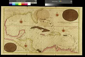
Background imageMaps Collection: Map of the Gulf of Mexico and the Caribbean, 18th century

Map of the Gulf of Mexico and the Caribbean, 18th century
LSE4097795 Map of the Gulf of Mexico and the Caribbean, 18th century by Unknown artist, (18th century); Private Collection; Photo eLeonard de Selva; out of copyright

Background imageMaps Collection: Cuba, Jamaica, Haiti, Puerto Rico (Caribbean) (engraving, 1596)

Cuba, Jamaica, Haiti, Puerto Rico (Caribbean) (engraving, 1596)
LRI4718854 Cuba, Jamaica, Haiti, Puerto Rico (Caribbean) (engraving, 1596) by Mercator, Gerardus (1512-94); Private Collection; (add.info.: Cuba insula, Iamaica, S. Joannis, Is)

Background imageMaps Collection: The Spanish-American War, Map illustrating the Relative Positions of the Two Countries (engraving)

The Spanish-American War, Map illustrating the Relative Positions of the Two Countries (engraving)
1615519 The Spanish-American War, Map illustrating the Relative Positions of the Two Countries (engraving) by English School, (19th century); Private Collection; (add.info.: The Spanish-American War)

Background imageMaps Collection: Map of Florida and Cuba by Jacques Le Moyne, 1591 (engraving)

Map of Florida and Cuba by Jacques Le Moyne, 1591 (engraving)
3036188 Map of Florida and Cuba by Jacques Le Moyne, 1591 (engraving) by Le Moyne, Jacques (de Morgues) (1533-88); (add.info.: Map of Florida and Cuba by Jacques Le Moyne (French, c)

Background imageMaps Collection: Havana, Cuba (chromolitho)

Havana, Cuba (chromolitho)
1093846 Havana, Cuba (chromolitho) by French School, (19th century); Private Collection; (add.info.: Havana, Cuba. French educational card, late 19th or early 20th century.); © Look and Learn

Background imageMaps Collection: Cuba Puerto Rico map 1898

Cuba Puerto Rico map 1898
Map from Physical Geography by R. S. Tarr - The MacMillan Company - London 1898

Background imageMaps Collection: Enfield EN3 5 Map

Enfield EN3 5 Map
Postcode Sector Map of Enfield EN3 5

Background imageMaps Collection: BB Blackburn, BB9 7

BB Blackburn, BB9 7
BB9 7

Background imageMaps Collection: Antique illustration from US navy and army: Cuba map

Antique illustration from US navy and army: Cuba map

Background imageMaps Collection: City map of Havana, capital of Cuba, woodcut, published 1897

City map of Havana, capital of Cuba, woodcut, published 1897
City map of Havana - Capital and largest city of Cuba. Wood engraving, published in 1897

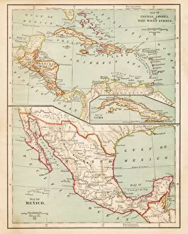
Background imageMaps Collection: Map of the West Indies and Central America, 1902. Creator: Unknown

Map of the West Indies and Central America, 1902. Creator: Unknown
Map of the West Indies and Central America, 1902. Showing the various Caribbean islands, and the north coast of South America. From The Century Atlas of the World. [John Walker & Co, Ltd

Background imageMaps Collection: Geographical map of the West Indies

Geographical map of the West Indies. Map of the Caribbean, showing the Isthmus of Panama, the north coast of South America, the Greater Antilles, and various other islands

Background imageMaps Collection: Map of Mexico and West Indies 1889

Map of Mexico and West Indies 1889
Comprehensive Geography by James Monteith - American Book Company 1882, 1889

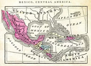
Background imageMaps Collection: Map of Mexico Central America of 1877

Map of Mexico Central America of 1877
The Eclectic Elementary Geography by Wilson & Hinkle / Cincinnati -New York 1881

Background imageMaps Collection: Map of Mexico and Central America 1871

Map of Mexico and Central America 1871
Colton and Fitchs Introductory School Geography - New York: Sheldon and Company 1871


All Professionally Made to Order for Quick Shipping


-

Maps Collection

Maps of Cuba North America are a collection that show the geography and political boundaries of Cuba. The maps depict the island nation's location in relation to other countries in the region, including Mexico, Haiti, Jamaica and the United States. They also provide detailed information on Cuban cities, provinces and regions as well as its coastline. they also feature important landmarks such as Havana Bay and Santiago de Cuba Bay. Additionally, they provide information on transportation networks such as roads, railways and airports. Maps of Cuba North America are essential for anyone looking to travel or do business in this vibrant Caribbean country.
+

Our beautiful Wall Art and Photo Gifts include Framed Prints, Photo Prints, Poster Prints, Canvas Prints, Jigsaw Puzzles, Metal Prints and so much more

The Maps of Cuba North America collection from Media Storehouse offers a unique and fascinating glimpse into the history and geography of Cuba. Our collection features a wide range of maps, including antique maps dating back to the 16th century, as well as more modern maps that showcase the country's current infrastructure and topography. Each map in our collection is beautifully crafted with intricate details that capture the essence of Cuba's rich cultural heritage. Whether you're interested in exploring Havana's historic neighborhoods or tracing the island's coastline, these maps provide an excellent resource for anyone looking to learn more about this beautiful Caribbean nation. With a variety of sizes and framing options available, these prints make great wall art for any home. They also make thoughtful gifts for anyone who loves travel, history, or geography. If you're looking to add some Cuban flair to your decor or expand your knowledge about this fascinating country, then be sure to check out our Maps of Cuba North America collection.
+

What are Maps of Cuba North America art prints?

Maps of Cuba North America art prints are high-quality reproductions of vintage maps depicting the island nation of Cuba and its surrounding regions. These maps showcase the intricate details and topography of the land, including cities, rivers, mountains, and coastlines. They provide a glimpse into the history and geography of this fascinating country. These art prints are perfect for those who love travel or have an interest in Cuban culture. They can be used to decorate homes, offices or classrooms with a unique touch that reflects one's personal style. The Maps of Cuba North America art prints come in various sizes to fit any space and are printed on high-quality paper using archival ink to ensure long-lasting color vibrancy. Whether you're looking for a gift for a friend or family member who loves travel or want to add some character to your own living space, these beautiful maps will make an excellent addition to any collection.
+

What Maps of Cuba North America art prints can I buy from Media Storehouse?

We offer a wide range of Maps of Cuba North America art prints that you can buy. You can choose from various sizes and styles, including vintage maps, satellite images, and contemporary designs. These art prints feature different aspects of Cuba's geography, such as its cities, coastlines, mountains, and rivers. Some also include information about the country's history and culture. One popular option is the antique map of Cuba by John Tallis & Co., which was published in 1851. It shows detailed illustrations of Havana and other major towns along with their surrounding landscapes. Another interesting choice is the NASA satellite image of Cuba at night that highlights the country's urban areas' brightness against its dark rural regions. Whether you're looking for a decorative piece for your home or office or an educational tool for your classroom or library, we have many Maps of Cuba North America art prints to suit your needs and preferences.
+

How do I buy Maps of Cuba North America art prints?

To buy Maps of Cuba North America art prints from Media Storehouse, you can browse our collection online and select the print that catches your eye. Once you have found the perfect map, add it to your cart and proceed to checkout. You will be prompted to enter your shipping information and payment details. After completing the purchase process, you will receive a confirmation email with all relevant order details. We offer a wide range of maps in various sizes and formats, including framed or unframed prints. They use high-quality materials for printing to ensure that each map is vibrant and long-lasting. If you have any questions or concerns about purchasing a map from Media Storehouse, our customer service team is available to assist you via phone or email. Buying Maps of Cuba North America art prints from Media Storehouse is an easy and convenient process that allows you to bring beautiful artwork into your home or office space.
+

How much do Maps of Cuba North America art prints cost?

We offer a wide range of art prints featuring maps of Cuba and North America. The cost of these prints may vary depending on the size, framing options, and other factors. However, We provide affordable prices for their high-quality art prints to ensure that you can find something within their budget. The maps of Cuba and North America are visually stunning pieces that can add character to any room or space. These prints are perfect for those who love geography or have an interest in travel. They make great gifts as well. At Media Storehouse, you can choose from a variety of map designs that suit your style preferences. Whether you prefer vintage or modern styles, there is something for everyone at this online store. The cost of Maps of Cuba North America art prints at Media Storehouse is reasonable and worth investing in if you want to add some unique artwork to your home or office decor collection.
+

How will my Maps of Cuba North America art prints be delivered to me?

Your Maps of Cuba North America art prints will be delivered to you through a reliable and secure shipping service. The company takes great care in ensuring that your order is packaged safely and securely before it is dispatched for delivery. Your art prints will be rolled up carefully into a sturdy tube, which provides excellent protection against any damage during transit. The shipping service used by the company ensures that your package is tracked throughout its journey, so you can keep an eye on its progress until it reaches your doorstep. You can expect to receive your Maps of Cuba North America art prints within a reasonable timeframe after placing your order. Once you receive your package, simply unroll the tube and enjoy displaying your new artwork in whichever way suits you best. Whether it's framed or hung as-is, these beautiful maps are sure to add character and interest to any room they're displayed in.