Home > Europe > France > Canton > Landes
1848 Levasseur Map Of Senegal Gambia And Madagascar

![]()
Wall Art and Photo Gifts from Universal Images Group (UIG)
1848 Levasseur Map Of Senegal Gambia And Madagascar
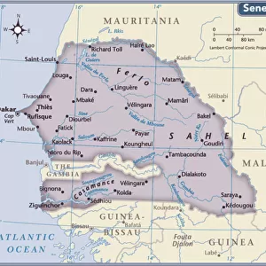
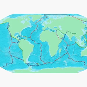
1848, Levasseur Map of Senegal, Gambia and Madagascar
Universal Images Group (UIG) manages distribution for many leading specialist agencies worldwide
Media ID 38548625
© Artokoloro Quint Lox Limited
1848 Antique Map Latitude Longitude Mappa Mundi Old Antique Plan Old Antique View Ols Antique Map Rare Old Maps Topo
FEATURES IN THESE COLLECTIONS
> Africa
> The Gambia
> Maps
> Africa
> Madagascar
> Maps
> Africa
> Madagascar
> Related Images
> Africa
> Senegal
> Related Images
> Europe
> France
> Canton
> Landes
> Historic
> Space exploration
> Maps and Charts
> Early Maps
> Maps and Charts
> Related Images
> Maps and Charts
> World
> Universal Images Group (UIG)
> History
> Historical Maps
EDITORS COMMENTS
Step back in time to the mid-19th century with this stunning print of the 1848 Levasseur Map of Senegal, Gambia and Madagascar. This beautifully detailed illustration showcases the geographical landscape of these West African countries during a pivotal moment in their history.
The map is a testament to the cartographic skills of French geographer Jean-Baptiste Levasseur, who meticulously documented the topography, rivers, and trade routes of this region. The intricate design features a grid system, latitude and longitude lines, and illustrations of various landmarks and settlements.
This vintage map not only provides a fascinating glimpse into the past but also serves as a valuable resource for historians, researchers, and enthusiasts alike. It's an excellent addition to any collection or study on geography, travel, or exploration.
Printed on high-quality paper using traditional techniques, this reproduction maintains its original charm while offering durability for generations to come. Hang it proudly in your home or office as a unique piece of art that transports you back in time.
MADE IN AUSTRALIA
Safe Shipping with 30 Day Money Back Guarantee
FREE PERSONALISATION*
We are proud to offer a range of customisation features including Personalised Captions, Color Filters and Picture Zoom Tools
SECURE PAYMENTS
We happily accept a wide range of payment options so you can pay for the things you need in the way that is most convenient for you
* Options may vary by product and licensing agreement. Zoomed Pictures can be adjusted in the Cart.