Home > Europe > France > Canton > Landes
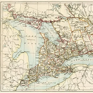
1874 Beers Map Of Florida Georgia North Carolina And South Carolina

![]()
Wall Art and Photo Gifts from Universal Images Group (UIG)
1874 Beers Map Of Florida Georgia North Carolina And South Carolina
1874, Beers Map of Florida, Georgia, North Carolina and South Carolina
Universal Images Group (UIG) manages distribution for many leading specialist agencies worldwide
Media ID 38549868
© Artokoloro Quint Lox Limited
1874 Georgia Antique Map Latitude Longitude Mappa Mundi Old Antique Plan Old Antique View Ols Antique Map Rare Old Maps Topo
FEATURES IN THESE COLLECTIONS
> Asia
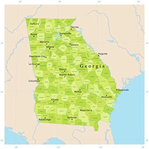
> Georgia
> Related Images
> Europe
> France
> Canton
> Landes
> Historic
> Space exploration
> Maps and Charts
> Early Maps
> Maps and Charts
> Related Images
> Maps and Charts
> World
> Universal Images Group (UIG)
> History
> Historical Maps
EDITORS COMMENTS
Step back in time and explore the southeastern United States like never before with this stunning 1874 Beers Map of Florida, Georgia, North Carolina, and South Carolina. This beautifully preserved print is a treasure trove of geographical information, showcasing the region's topography, cities, towns, rivers, and roads as they existed over a century ago.
The intricate details on this vintage map reveal a world that was vastly different from today. Note the dense forests that once covered much of the region, the winding waterways that crisscrossed through it all, and the small settlements that would eventually grow into bustling cities. The map also highlights important landmarks such as forts, lighthouses, and railroads that played crucial roles in shaping the region's history.
This historic map is not only a fascinating piece of cartography but also an important artifact for anyone interested in geography, travel or local history. It serves as a reminder of how far we've come since then and how our understanding of this beautiful region has evolved over time. Whether you're an armchair traveler or simply someone who appreciates the beauty of old maps, this print is sure to delight.
MADE IN AUSTRALIA
Safe Shipping with 30 Day Money Back Guarantee
FREE PERSONALISATION*
We are proud to offer a range of customisation features including Personalised Captions, Color Filters and Picture Zoom Tools
SECURE PAYMENTS
We happily accept a wide range of payment options so you can pay for the things you need in the way that is most convenient for you
* Options may vary by product and licensing agreement. Zoomed Pictures can be adjusted in the Cart.