Canvas Print > Arts > Pop art > Contemporary art > Fine art gallery
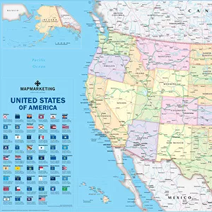
Canvas Print : Map Routes Principal Main Explorers Early Road


![]()
Canvas Prints from Design Pics
Map Routes Principal Main Explorers Early Road
Map published in 1908 of the United States showing routes of the principal explorers from the 1500's onwards, and early roads and highways. The routes are laid over a contemporary early 20th century map. The map was created by Frank Bond, 1856 -1940, American cartographer, illustrator and politician and Ithamar Parsons Berthrong, 1853 - 1936, American surveyor and inventor
Design Pics offers Distinctively Different Imagery representing over 1,500 contributors
Media ID 32815057
© Ken Welsh
Cartography Drawing Explorers Geographical Geography Highways Main Principal Routes Map Making
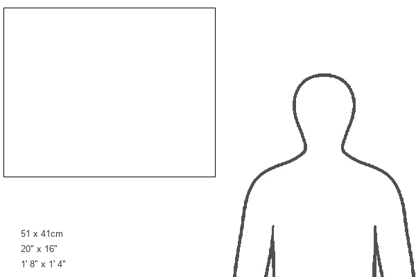
20"x16" (51x41cm) Canvas Print
Discover the rich history of American exploration with our stunning Canvas Print of "Map Routes Principal Main Explorers Early Road" by Ken Welsh from Design Pics. This captivating vintage map, published in 1908, showcases the principal routes and discoveries of early explorers from the 1500s onwards, along with early roads and highways. Bring the intrigue of early American history into your home or office with this beautiful and intricately detailed Canvas Print. Each print is expertly crafted using premium materials and high-definition printing techniques to ensure a vibrant and long-lasting display. Elevate your decor and transport yourself on a journey through time with this impressive piece from the Media Storehouse Canvas Prints collection.
Delivered stretched and ready to hang our premium quality canvas prints are made from a polyester/cotton blend canvas and stretched over a 1.25" (32mm) kiln dried knot free wood stretcher bar. Packaged in a plastic bag and secured to a cardboard insert for safe transit.
Canvas Prints add colour, depth and texture to any space. Professionally Stretched Canvas over a hidden Wooden Box Frame and Ready to Hang
Estimated Product Size is 50.8cm x 40.6cm (20" x 16")
These are individually made so all sizes are approximate
Artwork printed orientated as per the preview above, with landscape (horizontal) orientation to match the source image.
FEATURES IN THESE COLLECTIONS
> Arts
> Contemporary art
> Arts
> Pop art
> Contemporary art
> Contemporary art gallery
> Arts
> Pop art
> Contemporary art
> Fine art gallery
> Maps and Charts
> Early Maps
> Maps and Charts
> Related Images
> North America
> United States of America
> Maps
> People
> Politicians
EDITORS COMMENTS
This print showcases a remarkable piece of cartographic history. The image features a map published in 1908, meticulously illustrating the routes taken by principal explorers from the 1500s onwards, as well as early roads and highways of that era. Created by the talented American cartographer Frank Bond (1856-1940) and surveyor Ithamar Parsons Berthrong (1853-1936), this map provides an invaluable glimpse into the geographical exploration that shaped the United States. The juxtaposition of these historical routes over a contemporary early 20th-century map adds depth to our understanding of America's past. It serves as a visual testament to both the progress made in transportation infrastructure and how it evolved from its humble beginnings. With its rich colors and intricate details, this vintage print transports us back in time, allowing us to appreciate not only the artistry involved but also gain insight into America's vast landscape during those formative years. As we study this archival treasure, we are reminded of the courage and determination exhibited by these intrepid explorers who ventured into uncharted territories. Ken Welsh has masterfully captured this significant moment in history through his expertly curated collection. Whether you have an affinity for geography or simply appreciate historical illustrations, this print is sure to captivate your imagination with its blend of artistry and factual representation.
MADE IN AUSTRALIA
Safe Shipping with 30 Day Money Back Guarantee
FREE PERSONALISATION*
We are proud to offer a range of customisation features including Personalised Captions, Color Filters and Picture Zoom Tools
SECURE PAYMENTS
We happily accept a wide range of payment options so you can pay for the things you need in the way that is most convenient for you
* Options may vary by product and licensing agreement. Zoomed Pictures can be adjusted in the Cart.