Canvas Print > Arts > Artists > B > Willem Blaeu
Canvas Print : World Map 17th Century 1634 1635 Willem Blaeu


![]()
Canvas Prints from Design Pics
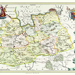
World Map 17th Century 1634 1635 Willem Blaeu
World map dating from 1634/1635 by Willem Blaeu. Nova totius terrarum orbis geographica ac hydrographica tabula. Along the bottom of the map are illustrations of the seven wonders of the ancient world
Design Pics offers Distinctively Different Imagery representing over 1,500 contributors
Media ID 31611835
© Ken Welsh
17th Century Décor Decoration Decorative Drawing Wall Art 1634 1635 Willem Blaeu World Map
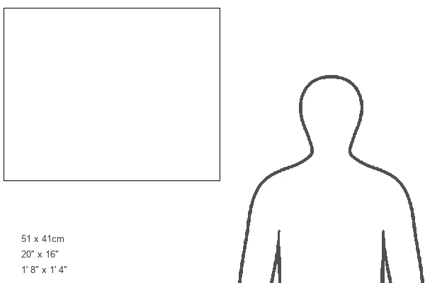
20"x16" (51x41cm) Canvas Print
Step back in time with our Canvas Print of the "World Map 1634-1635" by Ken Welsh from Design Pics. This stunning piece showcases a captivating 17th-century map created by renowned cartographer Willem Blaeu. The intricate details of the map are brought to life on canvas, with accurate depictions of continents, oceans, and the seven wonders of the ancient world. Add an element of history and sophistication to your space with this beautiful and authentic work of art.
Delivered stretched and ready to hang our premium quality canvas prints are made from a polyester/cotton blend canvas and stretched over a 1.25" (32mm) kiln dried knot free wood stretcher bar. Packaged in a plastic bag and secured to a cardboard insert for safe transit.
Canvas Prints add colour, depth and texture to any space. Professionally Stretched Canvas over a hidden Wooden Box Frame and Ready to Hang
Estimated Product Size is 50.8cm x 40.6cm (20" x 16")
These are individually made so all sizes are approximate
Artwork printed orientated as per the preview above, with landscape (horizontal) orientation to match the source image.
FEATURES IN THESE COLLECTIONS
> Arts
> Artists
> B
> Willem Blaeu
> Maps and Charts
> Early Maps
> Maps and Charts
> Related Images
> Maps and Charts
> World
EDITORS COMMENTS
This stunning print captures a piece of history, showcasing the World Map dating back to the 17th century. Created by Willem Blaeu in 1634/1635, this map titled "Nova totius terrarum orbis geographica ac hydrographica tabula" is a true masterpiece. The intricate details and vibrant colors make it an exquisite decorative piece for any wall. What sets this map apart are the illustrations of the seven wonders of the ancient world that adorn its bottom edge. These captivating engravings transport us back in time, allowing us to marvel at these architectural marvels that have long since vanished. As we gaze upon this vintage artwork, we can't help but appreciate its historical significance. It serves as a reminder of how our understanding of geography has evolved over centuries and offers a glimpse into what was known about our vast planet during that era. Ken Welsh's skillful photography perfectly captures every detail and color tone, preserving this archival treasure for generations to come. Whether you're a history enthusiast or simply seeking unique wall art with character, this World Map print will undoubtedly add charm and sophistication to any space
MADE IN AUSTRALIA
Safe Shipping with 30 Day Money Back Guarantee
FREE PERSONALISATION*
We are proud to offer a range of customisation features including Personalised Captions, Color Filters and Picture Zoom Tools
SECURE PAYMENTS
We happily accept a wide range of payment options so you can pay for the things you need in the way that is most convenient for you
* Options may vary by product and licensing agreement. Zoomed Pictures can be adjusted in the Cart.