Home > North America > Antigua and Barbuda > Maps
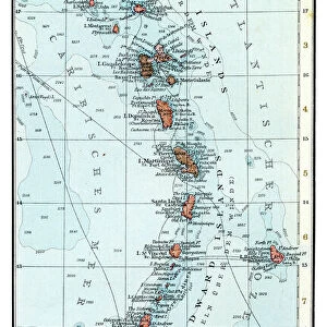
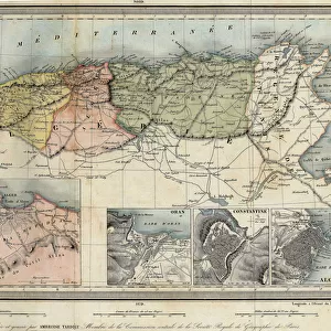
Geography map: representation of the main British islands of the Caribbean Sea (Antigua, Barbados, Jamaica, Tobago, St. Christopher Island or St. Kitts) from an Atlas from the beginning of the 18th century. Biblioteca Angelica, Rome
 from an Atlas from the beginning of the 18th century. Biblioteca Angelica, Rome")
![]()
Wall Art and Photo Gifts from Fine Art Finder
Geography map: representation of the main British islands of the Caribbean Sea (Antigua, Barbados, Jamaica, Tobago, St. Christopher Island or St. Kitts) from an Atlas from the beginning of the 18th century. Biblioteca Angelica, Rome
VEN5030281 Geography map: representation of the main British islands of the Caribbean Sea (Antigua, Barbados, Jamaica, Tobago, St. Christopher Island or St. Kitts) from an Atlas from the beginning of the 18th century. Biblioteca Angelica, Rome; (add.info.: Geography map: representation of the main British islands of the Caribbean Sea (Antigua, Barbados, Jamaica, Tobago, St. Christopher Island or St. Kitts) from an Atlas from the beginning of the 18th century. Biblioteca Angelica, Rome); © Marage Photos
Media ID 38167652
© © Marage Photos / Bridgeman Images
Amerique Centrale Amerique Du Nord Caraïbes Caribbean Caribbean Island Carte Geographique Central America Etats Unis Geographie Jamaica Jamaican Stockravenna 18eme Siecle Geographical Map
FEATURES IN THESE COLLECTIONS
> Europe
> Italy
> Lazio
> Rome
> Fine Art Finder
> Artists
> Unknown Artist
> Maps and Charts
> Early Maps
> Maps and Charts
> Related Images
> North America
> Antigua and Barbuda
> Maps
> North America
> Barbados
> Maps
> North America
> Barbados
> Related Images
> North America
> Jamaica
> Maps
> North America
> Jamaica
> Related Images
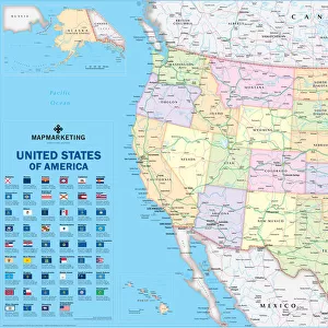
> North America
> United States of America
> Maps
EDITORS COMMENTS
This stunning print from an Atlas at the Biblioteca Angelica in Rome showcases a detailed representation of the main British islands in the Caribbean Sea during the early 18th century. The islands depicted include Antigua, Barbados, Jamaica, Tobago, and St. Christopher Island (St. Kitts), each with their own unique geography and topography.
The intricate engraving captures the essence of these tropical paradises, providing a glimpse into what life may have been like on these lush island destinations centuries ago. From the sandy beaches to the dense forests and rolling hills, this map offers a fascinating look at how these islands were perceived and understood by cartographers of that time.
As we study this historical document, we are transported back to an era when exploration and discovery were paramount. The attention to detail in this map is truly remarkable, showcasing not only the physical features of each island but also highlighting important landmarks and settlements.
Whether you have a personal connection to these Caribbean islands or simply appreciate fine cartography, this print is sure to captivate your imagination and inspire further exploration into the rich history of this region. It serves as a reminder of our interconnected world and how geography has shaped societies throughout time.
MADE IN AUSTRALIA
Safe Shipping with 30 Day Money Back Guarantee
FREE PERSONALISATION*
We are proud to offer a range of customisation features including Personalised Captions, Color Filters and Picture Zoom Tools
SECURE PAYMENTS
We happily accept a wide range of payment options so you can pay for the things you need in the way that is most convenient for you
* Options may vary by product and licensing agreement. Zoomed Pictures can be adjusted in the Cart.