Fraud Blocker Skip to main content

World Map Collection (#4)

"Exploring the Rich Tapestry of Our World

Background imageWorld Map Collection: Section plate from Francesco Camocio's Cosmographia Universalis, 1567

Section plate from Francesco Camocio's Cosmographia Universalis, 1567
7339210 Section plate from Francesco Camocio's Cosmographia Universalis, 1567, taken from the atlas Tavole Moderne di Geografia, 1567 (engraving) by Unknown Artist

Background imageWorld Map Collection: Section plate from Francesco Camocio's Cosmographia Universalis, 1567

Section plate from Francesco Camocio's Cosmographia Universalis, 1567
7339208 Section plate from Francesco Camocio's Cosmographia Universalis, 1567, taken from the atlas Tavole Moderne di Geografia, 1567 (engraving) by Unknown Artist

Background imageWorld Map Collection: Claudii Ptholemaei Alexandrini liber geographiae cum tabulis et universali figura et cum additione

Claudii Ptholemaei Alexandrini liber geographiae cum tabulis et universali figura et cum additione locorum quae a
7342516 Claudii Ptholemaei Alexandrini liber geographiae cum tabulis et universali figura et cum additione locorum quae a recentioribus reperta sunt diligenti cura emendatus et impressus

Background imageWorld Map Collection: Globus terrestris (Chart), 1564 (engraving)

Globus terrestris (Chart), 1564 (engraving)
7295387 Globus terrestris (Chart), 1564 (engraving) by Amman, Jost (1539-91); 30x20 cm; National Maritime Museum, London, UK; (add.info.: Creator: Jost Amman Single sheet)

Background imageWorld Map Collection: A new and correct sea chart of the whole world showing the variations of the compass as they were

A new and correct sea chart of the whole world showing the variations of the compass as they were found in the year
7340787 A new and correct sea chart of the whole world showing the variations of the compass as they were found in the year 1700, 1702 (engraving) by British School

Background imageWorld Map Collection: World map by John Seller, 1675 (coloured engraving)

World map by John Seller, 1675 (coloured engraving)
7340041 World map by John Seller, 1675 (coloured engraving) by Seller, John (1632-97); 44x55 cm; National Maritime Museum, London

Background imageWorld Map Collection: A general chart exhibiting the discoveries made by Captain James Cook in this

A general chart exhibiting the discoveries made by Captain James Cook in this
7295409 A general chart exhibiting the discoveries made by Captain James Cook in this and his two preceeding voyages with the tracks of the ships under his command

Background imageWorld Map Collection: World map on vellum, c.1540 (vellum)

World map on vellum, c.1540 (vellum)
7295751 World map on vellum, c.1540 (vellum) by Italian School, (16th century); 35.4x50.8 cm; National Maritime Museum, London, UK; (add.info.: Creator: Brother of Giovanni Verrazano Single sheet)

Background imageWorld Map Collection: A general chart for the purpose of picking off a ship's track, 1860 (print)

A general chart for the purpose of picking off a ship's track, 1860 (print)
7337585 A general chart for the purpose of picking off a ship's track, 1860 (print) by British School, (19th century); 820 cm; National Maritime Museum, London

Background imageWorld Map Collection: Map of the British world empire, from Castle Line Atlas of South Africa, 1895 (print)

Map of the British world empire, from Castle Line Atlas of South Africa, 1895 (print)
7339270 Map of the British world empire, from Castle Line Atlas of South Africa, 1895 (print) by Philip, George (1800-82); 51x20 cm; National Maritime Museum, London

Background imageWorld Map Collection: Section plate from Francesco Camocio's Cosmographia Universalis, 1567

Section plate from Francesco Camocio's Cosmographia Universalis, 1567
7339209 Section plate from Francesco Camocio's Cosmographia Universalis, 1567, taken from the atlas Tavole Moderne di Geografia, 1567 (engraving) by Unknown Artist

Background imageWorld Map Collection: A new and correct map of the world (section), c.1774 (coloured engraving)

A new and correct map of the world (section), c.1774 (coloured engraving)
7339537 A new and correct map of the world (section), c.1774 (coloured engraving) by Sayer & Bennett (18th century); 46x44 cm; National Maritime Museum, London

Background imageWorld Map Collection: The world map of Cosmas

The world map of Cosmas
1578415 The world map of Cosmas; (add.info.: The world map of Cosmas, 6th century.); Universal History Archive/UIG

Background imageWorld Map Collection: World map after Ptolemy, 1513 (coloured woodcut)

World map after Ptolemy, 1513 (coloured woodcut)
7339798 World map after Ptolemy, 1513 (coloured woodcut) by Unknown Artist, (16th century); 44x58 cm; National Maritime Museum, London, UK; (add.info.: Creator: unknown)

Background imageWorld Map Collection: Oval planisphere of the world showing Magellan's track, 1554 (vellum)

Oval planisphere of the world showing Magellan's track, 1554 (vellum)
7339654 Oval planisphere of the world showing Magellan's track, 1554 (vellum) by Agnese, Battista (c.1500-64); 26x40 cm; National Maritime Museum, London

Background imageWorld Map Collection: A new and correct map of the world (section), c.1774 (coloured engraving)

A new and correct map of the world (section), c.1774 (coloured engraving)
7339477 A new and correct map of the world (section), c.1774 (coloured engraving) by Sayer & Bennett (18th century); 46x44 cm; National Maritime Museum, London

Background imageWorld Map Collection: Early 17th century map of the world, after Mercator, with inset portraits of explorers (Drake)

Early 17th century map of the world, after Mercator, with inset portraits of explorers (Drake, Magellan)
7337521 Early 17th century map of the world, after Mercator, with inset portraits of explorers (Drake, Magellan, Thomas Cavendish and Oliver van der Nort), the elements, and eclipses

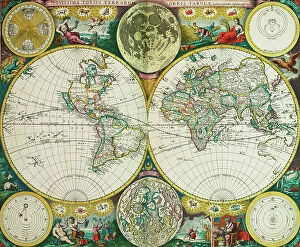
Background imageWorld Map Collection: New board for all the world, 1661 (print)

New board for all the world, 1661 (print)
7340059 New board for all the world, 1661 (print) by Wit, Frederick de (1630-1706); 465x575 cm; National Maritime Museum, London

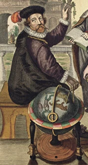
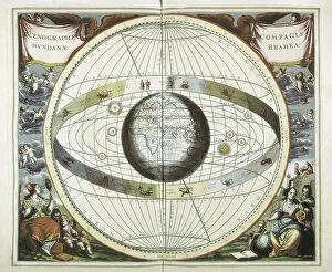
Background imageWorld Map Collection: Atlas Coelestis seu Harmonia Macrocosmica by BRAHE, 1661 (engraving)

Atlas Coelestis seu Harmonia Macrocosmica by BRAHE, 1661 (engraving)
CUL4933043 Atlas Coelestis seu Harmonia Macrocosmica by BRAHE, 1661 (engraving); Biblioteca Nacional, Madrid, Spain; (add.info.: CELLARIUS, Andreas (1596-1665)

Background imageWorld Map Collection: A Map of the World, c.1805 (silk)

A Map of the World, c.1805 (silk)
7342574 A Map of the World, c.1805 (silk) by Unknown Artist, (19th century); 51x85.3 cm; National Maritime Museum, London

Background imageWorld Map Collection: World map displaying the tracks of Captain Cook, 1790 (Chart)

World map displaying the tracks of Captain Cook, 1790 (Chart)
7295494 World map displaying the tracks of Captain Cook, 1790 (Chart) by Bowen, Thomas (c.1790); 49.5x38 cm; National Maritime Museum, London

Background imageWorld Map Collection: Sphere and stand, c.1890 (plaster, printed lithography, varnish, papier mache, brass, wood, paper)

Sphere and stand, c.1890 (plaster, printed lithography, varnish, papier mache, brass, wood, paper, ink)
7339588 Sphere and stand, c.1890 (plaster, printed lithography, varnish, papier mache, brass, wood, paper, ink) by Johnston, Alexander Keith (1804-71); 24.4x23.5 cm; National Maritime Museum, London

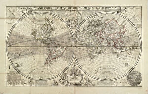
Background imageWorld Map Collection: A new and correct map of the world, laid down according to the newest discoveries

A new and correct map of the world, laid down according to the newest discoveries
7339544 A new and correct map of the world, laid down according to the newest discoveries, and from the most exact observations, by Herman Moll, Geographer, 1709 (engraving, paper) by Moll

Background imageWorld Map Collection: Mercator map of the world, 1606 (engraving, technical drawing)

Mercator map of the world, 1606 (engraving, technical drawing)
7339525 Mercator map of the world, 1606 (engraving, technical drawing) by Blaeu, Willem (1571-1638); 41x57 cm; National Maritime Museum, London

Background imageWorld Map Collection: A new and accurate map of the world, 1626 (coloured engraving)

A new and accurate map of the world, 1626 (coloured engraving)
7339498 A new and accurate map of the world, 1626 (coloured engraving) by Speed, John (1552-1629); 39x52 cm; National Maritime Museum, London

Background imageWorld Map Collection: Chart of the world showing tracks followed by sailing and low powered steam vessels, 1888 (print)

Chart of the world showing tracks followed by sailing and low powered steam vessels, 1888 (print)
7339279 Chart of the world showing tracks followed by sailing and low powered steam vessels, 1888 (print) by British School, (19th century); 71.5x127 cm; National Maritime Museum, London

Background imageWorld Map Collection: World planisphere, 1508 (paper, leather)

World planisphere, 1508 (paper, leather)
7339117 World planisphere, 1508 (paper, leather) by Rosselli, Francesco (1445-c.1513); 42x37 cm; National Maritime Museum, London

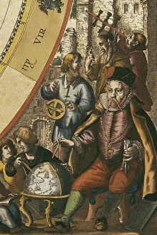
Background imageWorld Map Collection: CELLARIUS, Andreas (1596-1665). Atlas Coelestis seu Harmonia Macrocosmica. 1661

CELLARIUS, Andreas (1596-1665). Atlas Coelestis seu Harmonia Macrocosmica. 1661. BRAHE, Tycho (1546-1601)
CUL4868671 CELLARIUS, Andreas (1596-1665). Atlas Coelestis seu Harmonia Macrocosmica. 1661. BRAHE, Tycho (1546-1601). Danish astronomer. Andreas Cellarius Macrocosmic Harmony (Amsterdam, 1661)

Background imageWorld Map Collection: CELLARIUS, Andreas (1596-1665). Atlas Coelestis seu Harmonia Macrocosmica. 1661

CELLARIUS, Andreas (1596-1665). Atlas Coelestis seu Harmonia Macrocosmica. 1661. BRAHE, Tycho (1546-1601)
CUL4875768 CELLARIUS, Andreas (1596-1665). Atlas Coelestis seu Harmonia Macrocosmica. 1661. BRAHE, Tycho (1546-1601). Danish astronomer

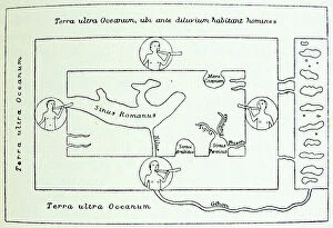
Background imageWorld Map Collection: World Map of Pomponius Mela, 1471

World Map of Pomponius Mela, 1471
1789121 World Map of Pomponius Mela, 1471; (add.info.: Reconstruction of the World map according to spanish geographer Pomponius Mela (c)

Background imageWorld Map Collection: An outline chart, for the purpose of marking off the track of a ship, 1829-46 (Paper, Linen)

An outline chart, for the purpose of marking off the track of a ship, 1829-46 (Paper, Linen, Blue paper)
7339795 An outline chart, for the purpose of marking off the track of a ship, 1829-46 (Paper, Linen, Blue paper) by British School, (19th century); 66.5x124 cm; National Maritime Museum, London

Background imageWorld Map Collection: World planisphere, 1592 (Vellum)

World planisphere, 1592 (Vellum)
7339596 World planisphere, 1592 (Vellum) by Oliva, Joan (fl.16th-17th century); 19.5x25 cm; National Maritime Museum, London, UK; (add.info.: Creator: Joan Oliva Scale: circa 1:100 000 000)

Background imageWorld Map Collection: Inscription in South Pacific Ocean, c.1725 (papier mache, plaster, copper plate engraved, varnish)

Inscription in South Pacific Ocean, c.1725 (papier mache, plaster, copper plate engraved, varnish, brass, wood, paper)
7339587 Inscription in South Pacific Ocean, c.1725 (papier mache, plaster, copper plate engraved, varnish, brass, wood, paper, hand-coloured) by Valk

Background imageWorld Map Collection: A new and correct map of the world (section), c.1774 (coloured engraving)

A new and correct map of the world (section), c.1774 (coloured engraving)
7339541 A new and correct map of the world (section), c.1774 (coloured engraving) by Sayer & Bennett (18th century); 46x44 cm; National Maritime Museum, London

Background imageWorld Map Collection: A general chart exhibiting the discoveries made by Captain James Cook in this

A general chart exhibiting the discoveries made by Captain James Cook in this
7295697 A general chart exhibiting the discoveries made by Captain James Cook in this and his two preceeding voyages with the tracks of the ships under his command, 1794 by Roberts

Background imageWorld Map Collection: A general chart exhibiting the discoveries made by Captain James Cook in this

A general chart exhibiting the discoveries made by Captain James Cook in this
7295348 A general chart exhibiting the discoveries made by Captain James Cook in this and his two preceeding voyages with the tracks of the ships under his command

Background imageWorld Map Collection: World map, 1567 (ink on vellum)

World map, 1567 (ink on vellum)
7339124 World map, 1567 (ink on vellum) by Desliens, Nicolas (1541-66); 59.7x39.4 cm; National Maritime Museum, London, UK; (add.info.: Creator)

Background imageWorld Map Collection: World chart by Pierre Hamon, 1568 (ink on vellum)

World chart by Pierre Hamon, 1568 (ink on vellum)
7339122 World chart by Pierre Hamon, 1568 (ink on vellum) by Hamon, Pierre (1530-69); 439.2x30 cm; National Maritime Museum, London

Background imageWorld Map Collection: World map, 1508 (paper - printed/hand coloured, leather covered boards)

World map, 1508 (paper - printed/hand coloured, leather covered boards)
7339116 World map, 1508 (paper - printed/hand coloured, leather covered boards) by Rosselli, Francesco (1445-c.1513); 42x37 cm; National Maritime Museum, London

Background imageWorld Map Collection: 1881 German version of the World Map 1531, 1881

1881 German version of the World Map 1531, 1881
3507797 1881 German version of the World Map 1531, 1881; (add.info.: 1881 German version of the World Map 1531, by Oronce Fine (Orontius Finnaeus)

Background imageWorld Map Collection: The world as known after the circumnavigation by Sir Francis Drake

The world as known after the circumnavigation by Sir Francis Drake
1578478 The world as known after the circumnavigation by Sir Francis Drake; (add.info.: The world as known after the circumnavigation by Sir Francis Drake in the years 1577-1580)

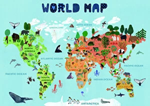
Background imageWorld Map Collection: World map for kids

World map for kids
Jota de jai

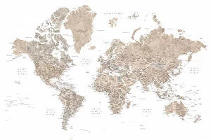
Background imageWorld Map Collection: Detailed world map with cities, Jimmy

Detailed world map with cities, Jimmy
Rosana Laiz Blursbyai

Background imageWorld Map Collection: Detailed world map with cities, Piper

Detailed world map with cities, Piper
Rosana Laiz Blursbyai

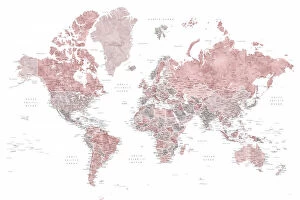
Background imageWorld Map Collection: Detailed world map with cities, Abey

Detailed world map with cities, Abey
Rosana Laiz Blursbyai

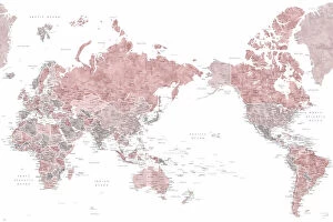
Background imageWorld Map Collection: Pacific centered world map in dusty pink

Pacific centered world map in dusty pink
Rosana Laiz Blursbyai

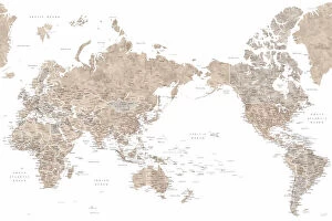
Background imageWorld Map Collection: Pacific centered world map in taupe

Pacific centered world map in taupe
Rosana Laiz Blursbyai

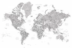
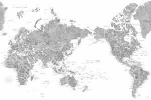
Background imageWorld Map Collection: Pacific centered world map in gray watercolor

Pacific centered world map in gray watercolor
Rosana Laiz Blursbyai


All Professionally Made to Order for Quick Shipping

"Exploring the Rich Tapestry of Our World: From Ancient Vellum to Modern Tectonic Plates" Embark on a captivating journey through time and space with these fascinating glimpses into our world's diverse history. Delve into the depths of knowledge as you unravel the secrets held within each map, revealing stories of conquest, discovery, and cultural exchange. Discover Africa's political landscape in EXPL2A-00352 - an intricate tapestry showcasing the continent's ever-evolving borders and nations. Transport yourself back to 1897 Ireland with a vintage map that captures the essence of a bygone era. Unearth Hereford mappa mundi, a medieval masterpiece from c. 1290 meticulously crafted on vellum. Marvel at its intricate details depicting both known lands and mythical creatures, offering insight into ancient cartographic beliefs. Travel forward in time to witness how perceptions changed with an old map from 1980 or explore the vast reaches of the British Empire through a 19th-century world map. Immerse yourself in Anglo-Saxon culture with their unique interpretation of our planet during the 10th century. Witness historical events unfold before your eyes as you examine an old map from 1914, capturing geopolitical tensions prior to World War I. Dive deeper into local exploration with a Buenos Aires map or broaden your perspective by studying tectonic plates' boundaries etched across a global canvas. Finally, step back two centuries ago and marvel at how our understanding has evolved over time through an enchanting snapshot of the world in 1800. These maps are more than just geographical representations; they hold tales waiting to be discovered. Join us as we unlock their mysteries and celebrate humanity's insatiable curiosity for exploring every corner of this beautiful planet we call home.