Fraud Blocker Skip to main content

World Map Collection (#6)

"Exploring the Rich Tapestry of Our World

Background imageWorld Map Collection: Red Cross Group, between 1910 and 1920. Creator: Harris & Ewing

Red Cross Group, between 1910 and 1920. Creator: Harris & Ewing. Red Cross Group, between 1910 and 1920
Red Cross Group, between 1910 and 1920. Group of men and women, with maps of the world and The Philippine Islands

Background imageWorld Map Collection: Map of the World, 1566, reprinted 1889. Creator: Unknown

Map of the World, 1566, reprinted 1889. Creator: Unknown
Map of the World, 1566, reprinted 1889. Heart-shaped world map with the North Pole in the centre. After John Paul Cimerlin

Background imageWorld Map Collection: Typus Cosmographicus Universalis, Sim. Grynaeus, Novus Orbis, Basileae 1532, reprinted 1889
Typus Cosmographicus Universalis, Sim. Grynaeus, Novus Orbis, Basileae 1532, reprinted 1889. Creator: Unknown
Typus Cosmographicus Universalis, Sim. Grynaeus, Novus Orbis, Basileae 1532, 1532, reprinted 1889

Background imageWorld Map Collection: Vniversale descrittione di tvtta la terra conoscivta fin qvi, 1565

Vniversale descrittione di tvtta la terra conoscivta fin qvi, 1565. Creators: Paolo Forlani, Ferrando Bertelli
Vniversale descrittione di tvtta la terra conoscivta fin qvi, 1565. Relief shown pictorially. Based on an earlier map by Giacomo Gastaldi. From the Rosenwald Collection, Library of Congress, no

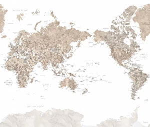
Background imageWorld Map Collection: Pacific-centered world map with cities, Piper

Pacific-centered world map with cities, Piper
Rosana Laiz Blursbyai

Background imageWorld Map Collection: Watercolor world map with countries, Fifi

Watercolor world map with countries, Fifi
Rosana Laiz Blursbyai

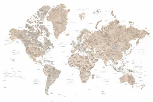
Background imageWorld Map Collection: Classic world map in watercolor, Piper

Classic world map in watercolor, Piper
Rosana Laiz Blursbyai

Background imageWorld Map Collection: Lucille, map of the United States and the Caribbean sea

Lucille, map of the United States and the Caribbean sea
Rosana Laiz Blursbyai

Background imageWorld Map Collection: Adventure map of North America in cobalt blue

Adventure map of North America in cobalt blue
Rosana Laiz Blursbyai

Background imageWorld Map Collection: Map of North America in aquamarine watercolor

Map of North America in aquamarine watercolor
Rosana Laiz Blursbyai

Background imageWorld Map Collection: Pacific-centered world map with cities, Abey

Pacific-centered world map with cities, Abey
Rosana Laiz Blursbyai

Background imageWorld Map Collection: Watercolor world map with countries, Leo

Watercolor world map with countries, Leo
Rosana Laiz Blursbyai

Background imageWorld Map Collection: Watercolor world map with countries, Abey

Watercolor world map with countries, Abey
Rosana Laiz Blursbyai

Background imageWorld Map Collection: Classic world map in watercolor, Therese

Classic world map in watercolor, Therese
Rosana Laiz Blursbyai

Background imageWorld Map Collection: The world map in a circle, muted brown

The world map in a circle, muted brown
Rosana Laiz Blursbyai

Background imageWorld Map Collection: Catalan Atlas (reproduction)

Catalan Atlas (reproduction)
5054662 Catalan Atlas (reproduction) by Cresques, Abraham (1325-87) (after); (add.info.: Reproduction of 1375 World map made in Majorca)

Background imageWorld Map Collection: The punk band the Sex Pistols, who signed up last week with A & M Records have been fired

The punk band the Sex Pistols, who signed up last week with A & M Records have been fired again, but with a £ 75, 000 pay off

Background imageWorld Map Collection: world map 1883

world map 1883
map of the world - 1883

Background imageWorld Map Collection: map of the world 1814

map of the world 1814
antique map showing the world with all the latest discovery of 1814

Background imageWorld Map Collection: Old Map of the World 1957

Old Map of the World 1957
WMY1957

Background imageWorld Map Collection: Old Map of the World 1893

Old Map of the World 1893
WMY1893

Background imageWorld Map Collection: Old Map of the World 1951

Old Map of the World 1951
WMY1951

Background imageWorld Map Collection: Old Map of the World 1931

Old Map of the World 1931
WMY1931

Background imageWorld Map Collection: Antique map of Algeria and Tunisia

Antique map of Algeria and Tunisia

Background imageWorld Map Collection: Kunyu Wanguo Quantu (Map of the Myriad Countries of the World), 1602. Creator: Ricci

Kunyu Wanguo Quantu (Map of the Myriad Countries of the World), 1602. Creator: Ricci
Kunyu Wanguo Quantu (Map of the Myriad Countries of the World), 1602. Found in the Collection of Nanjing Museum

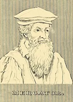
Background imageWorld Map Collection: Mercator, (1512-1594), 1830. Creator: Unknown

Mercator, (1512-1594), 1830. Creator: Unknown
Mercator, (1512-1594), 1830. Gerardus Mercator (1512-1594) Belgian geographer, cosmographer and cartographer known for his 1569 world map of sailing courses with rhumb lines

Background imageWorld Map Collection: Map of the World, According to Ptolemy, 1923. Creator: Agathodaemon of Alexandria

Map of the World, According to Ptolemy, 1923. Creator: Agathodaemon of Alexandria
Map of the World, According to Ptolemy, 1923. From " Australia, New Zealand and Oceania in Pictures", by H. Clive Barnard, M.A. Blitt. [A. & C. Black, Limited, London, 1923]

Background imageWorld Map Collection: Development of the British Empire, lithograph, published 1897

Development of the British Empire, lithograph, published 1897
Map of the territorial development of the British Empire from the 17th century to the end of the 19th century. Lithograph, published in 1897

Background imageWorld Map Collection: Old map showing Rome arround 1st century BC

Old map showing Rome arround 1st century BC
Old map showing Rome circa 1st century bc Original edition from my own archives Source : Illustriertes Konversations Lexikon 1878

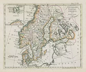
Background imageWorld Map Collection: Antique map of Denmark, Norway, Sweden and Finland

Antique map of Denmark, Norway, Sweden and Finland
Wonderful hand coloured antique map, circa 1780 - 1800

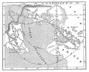
Background imageWorld Map Collection: Antique illustration of 31 december 1861 eclipse map

Antique illustration of 31 december 1861 eclipse map

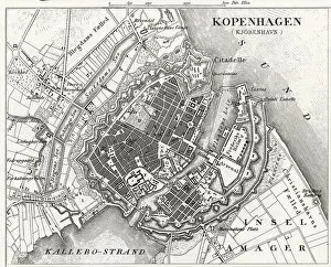
Background imageWorld Map Collection: Engraving: Map of Copenhagen

Engraving: Map of Copenhagen
Engraved illustrations of the Map of Copenhagen from Iconographic Encyclopedia of Science, Literature and Art, Published in 1851. Copyright has expired on this artwork. Digitally restored

Background imageWorld Map Collection: Behaims 1492 globe showing a round Earth but no New World

Behaims 1492 globe showing a round Earth but no New World
Diagram of globe by Martin Behaim, without the New World, created in 1492. Hand-colored woodcut of a 19th-century illustration

Background imageWorld Map Collection: Adventure World

Adventure World
Martina

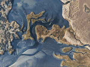
Background imageWorld Map Collection: Búða beach, Iceland

Búða beach, Iceland
Jure Kravanja

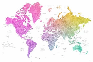
Background imageWorld Map Collection: Pink World Map

Pink World Map
Martina

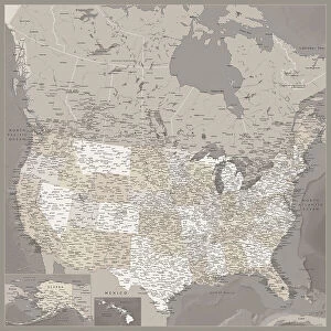
Background imageWorld Map Collection: Highly detailed map of the United States and Canada

Highly detailed map of the United States and Canada
Rosana Laiz Blursbyai

Background imageWorld Map Collection: Highly detailed map of the United States, Davey

Highly detailed map of the United States, Davey
Rosana Laiz Blursbyai

Background imageWorld Map Collection: Geography lesson

Geography lesson
Brig Barkow

Background imageWorld Map Collection: Detailed world map with cities Idrak

Detailed world map with cities Idrak
Rosana Laiz Blursbyai

Background imageWorld Map Collection: Detailed world map with cities Qawi

Detailed world map with cities Qawi
Rosana Laiz Blursbyai

Background imageWorld Map Collection: Detailed world map with cities Vali

Detailed world map with cities Vali
Rosana Laiz Blursbyai

Background imageWorld Map Collection: Detailed world map with cities Mizn

Detailed world map with cities Mizn
Rosana Laiz Blursbyai

Background imageWorld Map Collection: Abey world map no labels

Abey world map no labels
Rosana Laiz Blursbyai

Background imageWorld Map Collection: Detailed world map with cities Taliessa

Detailed world map with cities Taliessa
Rosana Laiz Blursbyai

Background imageWorld Map Collection: Amanda world map silhouette

Amanda world map silhouette
Rosana Laiz Blursbyai

Background imageWorld Map Collection: Coddiwomple world map

Coddiwomple world map
Rosana Laiz Blursbyai

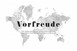
Background imageWorld Map Collection: Vorfreude world map

Vorfreude world map
Rosana Laiz Blursbyai


All Professionally Made to Order for Quick Shipping

"Exploring the Rich Tapestry of Our World: From Ancient Vellum to Modern Tectonic Plates" Embark on a captivating journey through time and space with these fascinating glimpses into our world's diverse history. Delve into the depths of knowledge as you unravel the secrets held within each map, revealing stories of conquest, discovery, and cultural exchange. Discover Africa's political landscape in EXPL2A-00352 - an intricate tapestry showcasing the continent's ever-evolving borders and nations. Transport yourself back to 1897 Ireland with a vintage map that captures the essence of a bygone era. Unearth Hereford mappa mundi, a medieval masterpiece from c. 1290 meticulously crafted on vellum. Marvel at its intricate details depicting both known lands and mythical creatures, offering insight into ancient cartographic beliefs. Travel forward in time to witness how perceptions changed with an old map from 1980 or explore the vast reaches of the British Empire through a 19th-century world map. Immerse yourself in Anglo-Saxon culture with their unique interpretation of our planet during the 10th century. Witness historical events unfold before your eyes as you examine an old map from 1914, capturing geopolitical tensions prior to World War I. Dive deeper into local exploration with a Buenos Aires map or broaden your perspective by studying tectonic plates' boundaries etched across a global canvas. Finally, step back two centuries ago and marvel at how our understanding has evolved over time through an enchanting snapshot of the world in 1800. These maps are more than just geographical representations; they hold tales waiting to be discovered. Join us as we unlock their mysteries and celebrate humanity's insatiable curiosity for exploring every corner of this beautiful planet we call home.