Fraud Blocker Skip to main content

Home > Maps and Charts > Norway

Norway Collection (#7)

Norway is a country located in Northern Europe, bordered by Sweden, Finland

320 Items

Background imageNorway Collection: Track of Journey from Cape Evans to Cape Crozier - June 27th to August 1st 1911, (1913)

Track of Journey from Cape Evans to Cape Crozier - June 27th to August 1st 1911, (1913). The final expedition of British Antarctic explorer Captain Robert Falcon Scott (1868-1912)

Background imageNorway Collection: Main Physiographic Features of the Mackay Glacier and Granite Harbour, 1913

Main Physiographic Features of the Mackay Glacier and Granite Harbour, 1913
Main Physiographic Features of the Mackay Glacier and Granite Harbour showing Nunatakker, Nunakoller, Ice-Flood Floor, Facets, Cwms & Mackay Ice Tongue. (Looking West), 1913

Background imageNorway Collection: Sketch Map to Illustrate Journeys of the Western Geological Parties, 1913

Sketch Map to Illustrate Journeys of the Western Geological Parties, 1913. The final expedition of British Antarctic explorer Captain Robert Falcon Scott (1868-1912)

Background imageNorway Collection: Winter Work (Left to right - Debenham, Cherry-Garrard, Bowers, Evans, Taylor), c1911, (1913)

Winter Work (Left to right - Debenham, Cherry-Garrard, Bowers, Evans, Taylor), c1911, (1913). Geologist Frank Debenham, zoologist Apsley Cherry-Garrard, Lieutenant Henry Bowers

Background imageNorway Collection: Tracks of S. Y. Terra Nova - January to March 1912, 1913

Tracks of S. Y. Terra Nova - January to March 1912, 1913
Tracks of S.Y. Terra Nova - January to March 1912, 1913. Map showing routes of the SY (Sailing Yacht or Steam Yacht) Terra Nova which took supplies to expedition members

Background imageNorway Collection: Main Physiographic Features of the Koettlitz Glacier, 1913

Main Physiographic Features of the Koettlitz Glacier, 1913
Main Physiographic Features of the Koettlitz Glacier showing the Pinnacle Ice in the Western half and the Finger Valleys radiating from the Cwms of the Lister Scarp, 1913

Background imageNorway Collection: Tracks of the Terra Nova, 1910-1913, (1913)

Tracks of the Terra Nova, 1910-1913, (1913). Map showing routes of the SY (Sailing Yacht or Steam Yacht) Terra Nova which took supplies to expedition members

Background imageNorway Collection: Map of North and East sea 1896

Map of North and East sea 1896
Andres Allgemeiner Handatlas - Bielefeld und Leipzig 1896

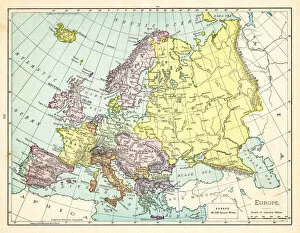
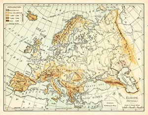
Background imageNorway Collection: Map of Europe 1897

Map of Europe 1897
Natural Elementary Geography by Redway and Hinman - NY/Cincinnati/Chicago 1897

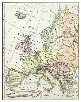
Background imageNorway Collection: Map of Europe 1895

Map of Europe 1895
The Rand-McNally Grammar School Geography 1895 - Chicago & New York

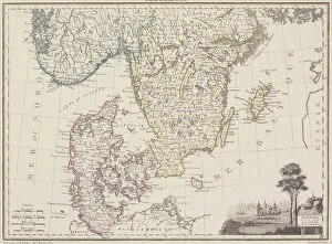
Background imageNorway Collection: Map of Sweden with Denmark and Norway

Map of Sweden with Denmark and Norway

Background imageNorway Collection: Antique Map of Europe 1744

Antique Map of Europe 1744
An engraved map of Europe with ornamental cartouche and relief shown pictorially by Emanuel Bowen 1744, London, Geographer to His Majesty

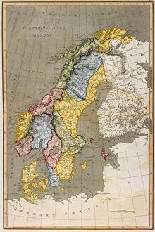
Background imageNorway Collection: Old map of Norway and Sweden (Scandinavia)

Old map of Norway and Sweden (Scandinavia)
Antique Illustration. Copyright has expired on this artwork. From my own archives, digitally restored

Background imageNorway Collection: Old chromolithograph map of Norway and Sweden (Scandinavia)

Old chromolithograph map of Norway and Sweden (Scandinavia)
Antique Illustration. Copyright has expired on this artwork. From my own archives, digitally restored

Background imageNorway Collection: 17th century map of Russia and surrounding countries by Dutch artist, engraver

17th century map of Russia and surrounding countries by Dutch artist, engraver, publisher and cartographer Nicolaes Visscher I, 1618 -1679

Background imageNorway Collection: Merok, Geiranger (b / w photo)

Merok, Geiranger (b / w photo)
7155119 Merok, Geiranger (b/w photo) by Norwegian Photographer, (19th century); Private Collection; (add.info.: Merok, Geiranger. Illustration for Norsk Natur (np, c 1895)

Background imageNorway Collection: United States Air Force - Grumman SA-16A Albatross 51-0070

United States Air Force - Grumman SA-16A Albatross 51-0070 (msn 149) of the Military Air Transport Service (MATS) Later 51-070 was modified to SA-16B, then to SA-16B - ASW (Model G-251)

Background imageNorway Collection: Map coast Norway Sweden MerdAŝy Uddevalla Custe

Map coast Norway Sweden MerdAŝy Uddevalla Custe
Map of the coast of Norway and Sweden between Merdoy and Uddevalla The Custe of Noorweghen, with that lands from north east in its wesenandde form (...) (title on object)

Background imageNorway Collection: Map Great Britain Chart shewing several Places

Map Great Britain Chart shewing several Places
Map of Great Britain A Chart shewing the several Places of Action between the English and Spanish Fleets, with the Places where serval of the Spanish Ships were destroyed in their return to Spain

Background imageNorway Collection: Passport card coast Norway vicinity Trondheim Passport card

Passport card coast Norway vicinity Trondheim Passport card
Passport card from the coast of Norway in the vicinity of Trondheim Passport card from the Coast of Norway Starting from Swarten Os to Heyligerlander Leen Naaukeurigh

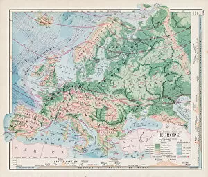
Background imageNorway Collection: Map of Europe 1889

Map of Europe 1889
Indiana Educational Series The Complete Geography - Indianapolis 1889

Background imageNorway Collection: City map of Christiania (now Oslo), Norway, lithograph, published 1897

City map of Christiania (now Oslo), Norway, lithograph, published 1897
City map of Christiania, now Oslo - capital of Norway. Lithograph, published in 1897

Background imageNorway Collection: antique, archival, baltic, border, cartography, denmark, document, europe, european

antique, archival, baltic, border, cartography, denmark, document, europe, european, finland, geography, historic, historical, latitude, longitude, map, nobody, north, norway, region, scale

Background imageNorway Collection: Victorian Map of Europe

Victorian Map of Europe
Engraved illustrations of Europe in the Time of Charlemagne from Iconographic Encyclopedia of Science, Literature and Art, Published in 1851. Copyright has expired on this artwork. Digitally restored

Background imageNorway Collection: Ancient map of the Arctic Region, lithograph, published in 1883

Ancient map of the Arctic Region, lithograph, published in 1883
Ancient map of the Arctic Region. Lithograph, published in 1883

Background imageNorway Collection: MAP OF EUROPE, 1812-1815. An American map of 1905 comparing the political landscape

MAP OF EUROPE, 1812-1815. An American map of 1905 comparing the political landscape of Europe before and after the 1815 Congress of Vienna

Background imageNorway Collection: Orteliuss map of Europe, 1603

Orteliuss map of Europe, 1603
Orteliuss map of Europe. This map of Europe is from the 1603 edition of Theatrum orbis terrarum (Theatre of the World). First published in 1570 by Flemish mapmaker Abraham Ortelius (1527-1598)

Background imageNorway Collection: Has Captain Scott reached the Pole today?

Has Captain Scott reached the Pole today?
Page from The Sphere magazine speculating on whether Captain Robert Falcon Scott and his polar exploration team had reached the South Pole in December 1911, as scheduled

Background imageNorway Collection: Map of Norway and Sweden, c19th century

Map of Norway and Sweden, c19th century

Background imageNorway Collection: Scandinavia, c1906, (1907)

Scandinavia, c1906, (1907). From The Worlds History, Volume VI. Edited by Dr. H. F. Helmolt [William Heinemann, London, 1907]

Background imageNorway Collection: Map of Europe 1895

Map of Europe 1895
The Rand-McNally Grammar School Geography 1895 - Chicago & New York

Background imageNorway Collection: Map of Europe 1877

Map of Europe 1877
Warrens Common School Geography 1877


All Professionally Made to Order for Quick Shipping


-

Norway Collection

Norway is a country located in Northern Europe, bordered by Sweden, Finland, and Russia and has a population of approximately 5.4 million people and covers an area of 385,207 square kilometers. The country is known for its stunning natural beauty, including fjords, mountains, and glaciers. Norway's economy is highly developed and relies heavily on the exportation of oil and gas as well as fishery products. The capital city is Oslo which has a population of around 700 thousand people. Norway ranks high in terms of quality of life with excellent healthcare services and education systems available to all citizens regardless of their socioeconomic status or background.
+

Our beautiful Wall Art and Photo Gifts include Framed Prints, Photo Prints, Poster Prints, Canvas Prints, Jigsaw Puzzles, Metal Prints and so much more

The Norway collection from Media Storehouse is a stunning assortment of wall art and framed prints that showcase the beauty of Norway's landscapes, coastlines, and cities. Our collection features vintage maps, nautical charts, topographic maps, and aerial views of various regions in Norway. These pieces are perfect for anyone who loves geography or has an interest in Norwegian culture. Our collection includes high-quality reproductions of historical maps dating back to the 17th century as well as contemporary designs that capture the country's modernity. Each print is carefully crafted using archival-grade paper and ink to ensure longevity and vibrancy. Whether you're looking to decorate your home or office with beautiful artwork or searching for a unique gift for someone special, the Norway collection from Media Storehouse offers something for everyone. With its diverse range of styles and sizes available at affordable prices, our collection is sure to impress any art lover or history buff.
+

What are Norway (Maps and Charts) art prints?

Norway art prints are a collection of high-quality, visually stunning prints that showcase the beauty and intricacies of Norway's geography. These prints feature detailed maps and charts that highlight the country's diverse landscapes, including its rugged coastlines, majestic fjords, towering mountains, and lush forests. The Norway art print collection is perfect for anyone who loves exploring new places or has an interest in geography. These prints are produced using state-of-the-art printing technology to ensure that every detail is captured with precision. They are available in a range of sizes to suit any space or decor style. Whether you're looking for a statement piece for your living room or office or simply want to add some visual interest to your home decor, these art prints are sure to impress. Norway art prints offer a unique way to appreciate the natural beauty of this incredible country while also adding a touch of sophistication and elegance to any space.
+

What Norway (Maps and Charts) art prints can I buy from Media Storehouse?

We offer a wide range of Norway maps and charts art prints that are perfect for those who love the beauty of this Scandinavian country. You can choose from a variety of styles, including vintage maps, modern designs, and detailed topographical charts. These prints showcase the stunning landscapes and landmarks of Norway, such as its fjords, mountains, cities, and cultural sites. Some popular options include antique-style maps that show the historical regions or cities of Norway in intricate detail. There are also contemporary designs that feature bold colors and abstract shapes inspired by Norwegian nature or culture. For those interested in outdoor activities like hiking or skiing, there are topographic charts that display elevation levels and terrain features. Whether you're looking to decorate your home with beautiful artwork or want to gift someone who loves travel or geography-related themes, we have plenty of high-quality Norway map and chart art prints to choose from.
+

How do I buy Norway (Maps and Charts) art prints?

To purchase Norway art prints from Media Storehouse, you can browse our extensive collection of prints online. Once you have found the print that you would like to purchase, simply add it to your cart and proceed to checkout. You will be prompted to enter your shipping information and payment details. We offer a variety of sizes for their art prints, so be sure to select the size that best fits your needs. We also offer framing options for an additional fee if you would like your print ready-to-hang upon arrival. When purchasing from Media Storehouse, rest assured that all of their products are high-quality and made with premium materials. Their Norway art prints are no exception - they are printed on archival paper using state-of-the-art printing technology. Buying Norway art prints from Media Storehouse is a simple process that allows you to bring beautiful artwork into your home or office space.
+

How much do Norway (Maps and Charts) art prints cost?

We offer a wide range of Norway Maps and Charts art prints that are available at various prices. Our collection includes high-quality prints featuring detailed maps and charts of the beautiful country of Norway. These prints are perfect for anyone who loves geography or wants to add some unique artwork to their home or office. Our pricing varies depending on the size and type of print you choose. We have options ranging from small posters to large canvas prints, so there is something for every budget. Additionally, our Norway Maps and Charts art prints come in a variety of styles, including vintage maps and modern designs. We take pride in offering affordable yet high-quality art prints that will last for years to come. Whether you're looking for a gift or want to decorate your own space with stunning artwork, our selection of Norway Maps and Charts art prints has something for everyone.
+

How will my Norway (Maps and Charts) art prints be delivered to me?

We understand that receiving your Norway art prints in perfect condition is important to you. That's why we take great care in packaging and delivering your order. Your art prints will be carefully rolled into a sturdy tube for safe transportation. We use high-quality materials to ensure that your artwork arrives undamaged and ready for framing or display. We work with trusted delivery partners who have years of experience in handling delicate items like artwork. They will deliver your package directly to the address you provide during checkout. You can track the progress of your delivery online using the tracking number provided. Once you receive your Norway art prints, we recommend unrolling them immediately and laying them flat on a clean surface to allow any creases from shipping to relax naturally before framing or displaying. If you have any questions about our delivery process, please don't hesitate to contact us.