Metal Print > Maps and Charts > World
Metal Print : Map World Herodotus Cartography Chart Countries


![]()
Metal Prints from Design Pics
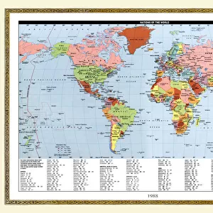
Map World Herodotus Cartography Chart Countries
Map of the world according to Herodotus. From the book Outline of History by H.G. Wells, published 1920
Design Pics offers Distinctively Different Imagery representing over 1,500 contributors
Media ID 32815085
© Ken Welsh
Cartography Chart Countries Geographical Geography World Herodotus
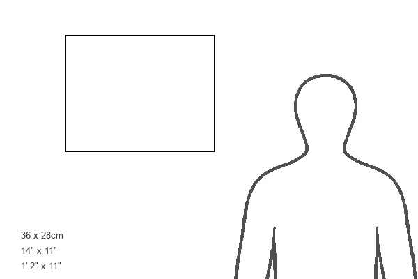
14"x11" (28x35cm) Metal Print
Discover history like never before with our Media Storehouse Metal Prints featuring the captivating Map World Herodotus Cartography Chart Countries by Ken Welsh from Design Pics. This intricately detailed map transports you back to ancient times, showcasing the world as described by the renowned Greek historian Herodotus in the book "Outline of History" by H.G. Wells. Each Metal Print is meticulously crafted, with vibrant colors and sharp lines that bring the map to life. The high-quality metal surface not only enhances the visual appeal but also provides a durable, waterproof, and scratch-resistant finish. Perfect for history enthusiasts, educators, or anyone seeking a unique and captivating piece of art for their home or office.
Our Metal Prints feature rounded corners and rear fixings for easy wall mounting. Images are directly printed onto a lightweight, high quality 5mm thick, durable metallic surface for a vivid and vibrant finish. Available in 2 sizes, 28x35cm (14x11) and 50x40cm (20x16). The unique material is fade, moisture, chemical and scratch resistant to help ensure this art lasts a lifetime.
Made with durable metal and luxurious printing techniques, metal prints bring images to life and add a modern touch to any space
Estimated Product Size is 35.5cm x 27.9cm (14" x 11")
These are individually made so all sizes are approximate
Artwork printed orientated as per the preview above, with landscape (horizontal) or portrait (vertical) orientation to match the source image.
FEATURES IN THESE COLLECTIONS
> Maps and Charts
> Early Maps
> Maps and Charts
> Related Images
> Maps and Charts
> World
EDITORS COMMENTS
This print showcases a remarkable piece of history - the Map of the World according to Herodotus. Taken from H. G. Wells' renowned book, "Outline of History" published in 1920, this engraving offers a fascinating glimpse into ancient cartography and geographical knowledge. The intricate details and meticulous craftsmanship evident in this archival illustration transport us back to an era where exploration was at its peak. Each country is meticulously charted, reflecting the limited understanding of geography during that period. This vintage map serves as a testament to the evolution of our collective knowledge over time. Ken Welsh's expertise in capturing historical images shines through once again with this stunning print. The richness and depth conveyed by his photography allow viewers to immerse themselves in the past, appreciating both the artistry and significance behind such relics. Whether you are an avid historian or simply appreciate beautiful artwork, this print is sure to captivate your imagination. Display it proudly on your wall or use it as a conversation starter among friends and family - either way, it will undoubtedly spark curiosity about our world's rich history.
MADE IN AUSTRALIA
Safe Shipping with 30 Day Money Back Guarantee
FREE PERSONALISATION*
We are proud to offer a range of customisation features including Personalised Captions, Color Filters and Picture Zoom Tools
SECURE PAYMENTS
We happily accept a wide range of payment options so you can pay for the things you need in the way that is most convenient for you
* Options may vary by product and licensing agreement. Zoomed Pictures can be adjusted in the Cart.