Metal Print > Maps and Charts > Americas
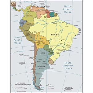
Metal Print : South America Map 18th Century Countries Geography


![]()
Metal Prints from Design Pics
South America Map 18th Century Countries Geography
A map of South America from the early 18th century by an anonymous cartographer
Design Pics offers Distinctively Different Imagery representing over 1,500 contributors
Media ID 31615493
© Ken Welsh
18th Century Cartography Countries Drawing Geographical Geography South America
10"x8" (25x20cm) Table Top Metal Print
Step back in time with our exquisite Metal Prints featuring the South America Map 18th Century Countries Geography by Ken Welsh from Design Pics. This captivating vintage map transports you to an era of exploration and discovery. With intricate detail and beautiful antique cartography, this metal print makes a stunning addition to any room. The high-quality metal print process ensures vibrant colors and a durable finish that will last a lifetime. Bring history into your home or office and start a conversation with this unique and intriguing piece of art.
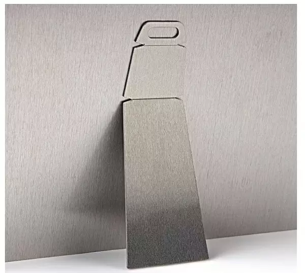
Table Top Metal Prints feature rounded corners and an easel back for easy display. Available in two sizes, 18x13cm (7x5) or 25x20cm (10x8). Lightweight and vibrant, they are perfect for displaying artwork and are guaranteed to add style to any desk or table top. The unique material is fade, moisture, chemical and scratch resistant to help ensure this art lasts a lifetime.
Made with durable metal and luxurious printing techniques, metal prints bring images to life and add a modern touch to any space
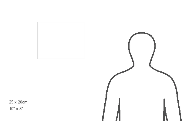
Estimated Product Size is 25.4cm x 20.3cm (10" x 8")
These are individually made so all sizes are approximate
Artwork printed orientated as per the preview above, with landscape (horizontal) or portrait (vertical) orientation to match the source image.
FEATURES IN THESE COLLECTIONS
> Maps and Charts
> Early Maps
> Maps and Charts
> Related Images
EDITORS COMMENTS
This print takes us back in time to the early 18th century, unveiling a beautifully detailed map of South America. Crafted by an anonymous cartographer, this historical gem showcases the intricate geography and countries that shaped the continent during that era. The vibrant colors and meticulous illustrations bring life to this archival piece, allowing us to delve into the rich history of South America. As we gaze upon this vintage engraving, we are transported to a period where exploration and discovery were at their peak. Each line and contour on this map represents countless hours of dedication and expertise from its creator. It serves as a testament to human curiosity and our relentless pursuit of knowledge. The significance of this artwork lies not only in its aesthetic appeal but also in its ability to educate us about the past. It offers a glimpse into how boundaries were defined centuries ago, shedding light on political landscapes that have evolved over time. Ken Welsh's skillful capture ensures that every detail is preserved with utmost precision, making it an invaluable addition for history enthusiasts or those seeking inspiration from times gone by. This picture print allows us to appreciate the artistry behind cartography while immersing ourselves in South America's fascinating story.
MADE IN AUSTRALIA
Safe Shipping with 30 Day Money Back Guarantee
FREE PERSONALISATION*
We are proud to offer a range of customisation features including Personalised Captions, Color Filters and Picture Zoom Tools
SECURE PAYMENTS
We happily accept a wide range of payment options so you can pay for the things you need in the way that is most convenient for you
* Options may vary by product and licensing agreement. Zoomed Pictures can be adjusted in the Cart.