Metal Print > Animals > Fishes > G > Grouper
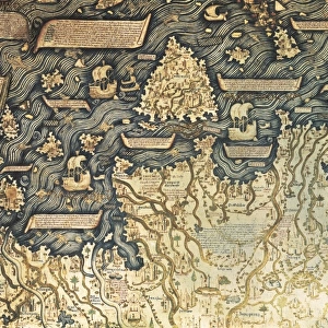
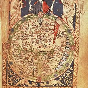
Metal Print : Fra Mauro map (1460). The Fra Mauro Map orientation (South at the top). is considered
. The Fra Mauro Map orientation (South at the top). is considered")
![]()
Metal Prints From Universal Images Group (UIG)
Fra Mauro map (1460). The Fra Mauro Map orientation (South at the top). is considered
Fra Mauro map (1460). The Fra Mauro Map orientation (South at the top).is considered the greatest memorial of medieval cartography. by the Venetian monk Fra Mauro. It is a circular planisphere drawn on parchment and set in a wooden frame, about two meters in diameter
Universal Images Group (UIG) manages distribution for many leading specialist agencies worldwide
Media ID 9761279
© Universal History Archive/Universal Images Group
Circular Considered Diameter Drawn Frame Greatest Medieval Memorial Monk Parchment Planisphere South Venetian Wooden 1460 Mauro Meters Orientation
10"x8" (25x20cm) Table Top Metal Print
Discover the wonders of medieval cartography with our Media Storehouse Metal Prints featuring the iconic Fra Mauro Map (1460). This historic masterpiece, created by the Venetian monk Fra Mauro, is renowned for its intricate detail and accuracy. Our high-quality Metal Prints showcase the map's distinctive South-at-the-top orientation, adding a unique and captivating touch to any space. Bring the rich history of cartography into your home or office with this beautiful and intriguing piece.
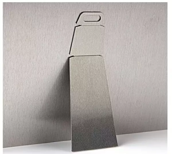
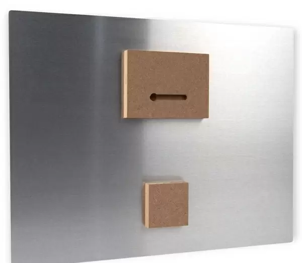
Table Top Metal Prints feature rounded corners and an easel back for easy display. Available in two sizes, 18x13cm (7x5) or 25x20cm (10x8). Lightweight and vibrant, they are perfect for displaying artwork and are guaranteed to add style to any desk or table top. The unique material is fade, moisture, chemical and scratch resistant to help ensure this art lasts a lifetime.
Made with durable metal and luxurious printing techniques, metal prints bring images to life and add a modern touch to any space
Estimated Product Size is 25.4cm x 20.3cm (10" x 8")
These are individually made so all sizes are approximate
Artwork printed orientated as per the preview above, with landscape (horizontal) or portrait (vertical) orientation to match the source image.
FEATURES IN THESE COLLECTIONS
> Animals
> Fishes
> G
> Grouper
> Maps and Charts
> Related Images
> Universal Images Group (UIG)
> History
EDITORS COMMENTS
This print showcases the awe-inspiring Fra Mauro Map, created in 1460 by the talented Venetian monk, Fra Mauro. Regarded as the pinnacle of medieval cartography, this masterpiece is a testament to human ingenuity and artistic skill. The map's unique orientation with South at the top adds an intriguing twist to traditional cartographic representations. Measuring about two meters in diameter, this circular planisphere is meticulously drawn on parchment and encased within an exquisite wooden frame. Its intricate details and precision make it a true marvel of craftsmanship. The Fra Mauro Map stands as a remarkable memorial to an era when exploration and discovery were at their zenith. It offers a glimpse into how people perceived the world during that time, showcasing various continents, oceans, cities, mountains, and rivers with astonishing accuracy given the limited knowledge available then. As we delve into this extraordinary image print from Universal Images Group (UIG), we are transported back in time to witness history unfold before our eyes. Let your imagination wander across its surface as you ponder the countless hours of dedication poured into its creation. Whether you are an avid lover of maps or simply appreciate artistry from centuries past, this photograph invites you to explore one of humanity's greatest achievements – both in terms of geographical understanding and aesthetic brilliance.
MADE IN AUSTRALIA
Safe Shipping with 30 Day Money Back Guarantee
FREE PERSONALISATION*
We are proud to offer a range of customisation features including Personalised Captions, Color Filters and Picture Zoom Tools
SECURE PAYMENTS
We happily accept a wide range of payment options so you can pay for the things you need in the way that is most convenient for you
* Options may vary by product and licensing agreement. Zoomed Pictures can be adjusted in the Basket.