Mouse Mat > Europe > France > Canton > Landes
Mouse Mat : Dutch Trade Map of the Baltic Sea

![]()
Home Decor From Fine Art Storehouse
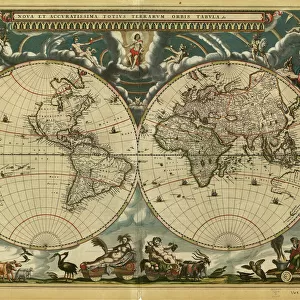
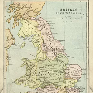
Dutch Trade Map of the Baltic Sea
Dutch Trade map of the Baltic Sea (hand-coloured engraving)
During the last decades of the 16th century and throughout the 17th century Dutch merchants and mariners dominated European trade in the Baltic area. In the Republic of the United Netherlands this trade was mainly concentrated in Amsterdam. The most frequently visited Baltic ports of call were Lübeck, Danzig, Koningsbergen and Riga
(Photo by Art Images via Getty Images)
Unleash your creativity and transform your space into a visual masterpiece!
Bridgeman Art Library/Image Partner
Media ID 32062999
© www.bridgemanart.com
17th Century Baltic Sea Cartouche Compass Rose Estuary Finland Fish Geography Industry Island Land Scandinavia Shipping Ships Whale Trade Route Traditionally Dutch
Mouse Pad
Bring some life into your office, or create a heartfelt gift, with a personalised deluxe Mouse Mat. Made of high-density black foam with a tough, stain-resistant inter-woven cloth cover they will brighten up any home or corporate office.
Archive quality photographic print in a durable wipe clean mouse mat with non slip backing. Works with all computer mice
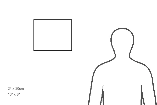
Estimated Product Size is 24.2cm x 19.7cm (9.5" x 7.8")
These are individually made so all sizes are approximate
Artwork printed orientated as per the preview above, with landscape (horizontal) or portrait (vertical) orientation to match the source image.
FEATURES IN THESE COLLECTIONS
> Fine Art Storehouse
> Map
> Historical Maps
> Animals
> Fishes
> Related Images
> Arts
> Artists
> O
> Oceanic Oceanic
> Europe
> Finland
> Related Images
> Europe
> France
> Canton
> Landes
> Europe
> Netherlands
> Amsterdam
> Europe
> Netherlands
> Maps
> Europe
> Netherlands
> Posters
> Europe
> Netherlands
> Related Images
EDITORS COMMENTS
This hand-coloured engraving showcases the Dutch Trade Map of the Baltic Sea, capturing a significant era in European trade during the late 16th and throughout the 17th century. The dominance of Dutch merchants and mariners is evident as they established their stronghold in Amsterdam, serving as the epicenter for this bustling commerce. Lübeck, Danzig, Koningsbergen, and Riga emerged as prominent Baltic ports frequented by these enterprising traders. The intricately detailed map highlights various elements essential to navigation and exploration. A compass rose guides seafarers through uncharted waters while cartouches provide vital information about coastal regions. Islands dotting the sea are meticulously depicted alongside estuaries that served as gateways to inland trade routes. Fishermen ply their trade amidst an ocean teeming with life; a solitary whale gracefully glides through its depths. This illustration not only serves practical purposes but also reflects traditional Dutch cartography techniques prevalent during this period. Preserved over time, this print from Fine Art Storehouse offers us a glimpse into history - a testament to human ingenuity and ambition in expanding global networks of commerce. It reminds us of an era when maritime trade was at its zenith and Amsterdam stood tall as Europe's trading hub within reach of Scandinavia's shores and Finland's distant horizons.
MADE IN AUSTRALIA
Safe Shipping with 30 Day Money Back Guarantee
FREE PERSONALISATION*
We are proud to offer a range of customisation features including Personalised Captions, Color Filters and Picture Zoom Tools
SECURE PAYMENTS
We happily accept a wide range of payment options so you can pay for the things you need in the way that is most convenient for you
* Options may vary by product and licensing agreement. Zoomed Pictures can be adjusted in the Basket.