Poster Print > Europe > Italy > Maps
Poster Print : Map Roman Power After Samnite Wars 3rd Century BC


![]()
Poster Prints from Design Pics
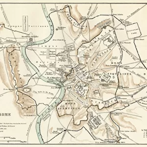
Map Roman Power After Samnite Wars 3rd Century BC
Map showing the Roman power after the Samnite Wars, 3rd century BC. From the book Outline of History by H.G. Wells, published 1920
Design Pics offers Distinctively Different Imagery representing over 1,500 contributors
Media ID 32815163
© Ken Welsh
Cartography Chart Countries Geographical Geography Italian Italy 3rd Century Bc
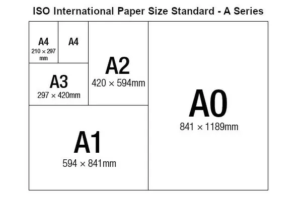
A3 (42 x 29.7cm) Poster Print
Explore the historical expansion of the Roman Empire with our stunning Map Roman Power After Samnite Wars 3rd Century BC print from the Media Storehouse collection. This captivating poster, featuring the detailed and intricately designed map by Ken Welsh from Design Pics, showcases the extent of Roman power following the Samnite Wars in the 3rd century BC. A must-have for history enthusiasts or anyone looking to add a touch of ancient history to their space. This high-quality print comes with easy-to-follow instructions for hassle-free hanging, ensuring a beautiful and informative display. Delve into the past and bring the story of the Roman Empire to life with this fascinating piece.
Premium quality poster prints are printed on luxurious semi-gloss satin 270 gsm paper. Our meticulously crafted poster prints offer an affordable option for decorating any space, making them ideal for living rooms, bedrooms, offices and beyond. To ensure your poster arrives in good condition, we roll and send them in strong mailing tubes.
Poster prints are budget friendly enlarged prints in standard poster paper sizes (A0, A1, A2, A3 etc). Whilst poster paper is sometimes thinner and less durable than our other paper types, they are still ok for framing and should last many years. Our Archival Quality Photo Prints and Fine Art Paper Prints are printed on higher quality paper and the choice of which largely depends on your budget.
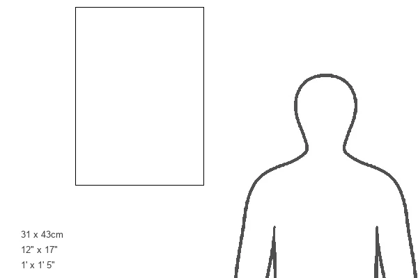
Estimated Product Size is 30.6cm x 42.6cm (12" x 16.8")
These are individually made so all sizes are approximate
Artwork printed orientated as per the preview above, with portrait (vertical) orientation to match the source image.
FEATURES IN THESE COLLECTIONS
> Maps and Charts
> Early Maps
> Maps and Charts
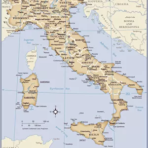
> Italy
> Maps and Charts
> Related Images
EDITORS COMMENTS
This print showcases a historical map that delves into the Roman power after the Samnite Wars in the 3rd century BC. A true gem from H. G. Wells' renowned book, "Outline of History" published back in 1920. The intricate cartography and detailed chart provide a fascinating glimpse into Italy's past, specifically highlighting the Italian regions affected by these ancient conflicts. Engraved with precision and care, this archival piece offers an invaluable resource for those interested in geography and history alike. Its vintage allure adds to its charm, transporting us back to a different era where empires rose and fell. The picture captures not only geographical boundaries but also echoes the triumphs and struggles of nations long gone. It serves as a reminder of how our world has evolved over time, shedding light on pivotal moments that shaped civilizations. Ken Welsh's expertise shines through this remarkable illustration, preserving an important period in human history for generations to come. Whether you are an avid historian or simply appreciate artistry within historical context, this print is sure to captivate your imagination and spark curiosity about our collective past.
MADE IN AUSTRALIA
Safe Shipping with 30 Day Money Back Guarantee
FREE PERSONALISATION*
We are proud to offer a range of customisation features including Personalised Captions, Color Filters and Picture Zoom Tools
SECURE PAYMENTS
We happily accept a wide range of payment options so you can pay for the things you need in the way that is most convenient for you
* Options may vary by product and licensing agreement. Zoomed Pictures can be adjusted in the Cart.