Fraud Blocker Skip to main content

Home > Design Pics > Vintage Maps

Vintage Maps Collection (#4)

507 Items

We are proud to offer this selection in partnership with Design Pics

Background imageVintage Maps Collection: French map from 1720 of Palestine. Titled Carte de la Terre Promise or Map of the Promised Land

French map from 1720 of Palestine. Titled Carte de la Terre Promise or Map of the Promised Land

Background imageVintage Maps Collection: Plan of Madrid, Spain, dated 1934

Plan of Madrid, Spain, dated 1934

Background imageVintage Maps Collection: Map of Limerick, Ireland, dating from 1690 and showing the forces of William III besieging

Map of Limerick, Ireland, dating from 1690 and showing the forces of William III besieging the city during the Williamite War of 1689 - 1691

Background imageVintage Maps Collection: Imagined situation of the Garden of Eden, in this case, in Mesopotamia, just east of Babylon

Imagined situation of the Garden of Eden, in this case, in Mesopotamia, just east of Babylon. After a map by Jan Luyken from a work by Samuel Bochart, 1599 - 1667

Background imageVintage Maps Collection: The true and exact Plan of all the Old and New Fortifications of the City of Barcelona, ?

The true and exact Plan of all the Old and New Fortifications of the City of Barcelona, ??Capital of the Province of Catalonia, Spain. Dated circa 1706, in the midst of the War of Spanish Succession

Background imageVintage Maps Collection: Map showing the extent of the damage caused by the Great Fire of London, 1666

Map showing the extent of the damage caused by the Great Fire of London, 1666. According to the description in the top right corner of the map

Background imageVintage Maps Collection: Physical map of the world, showing the principal trade routes in the 1930 s

Physical map of the world, showing the principal trade routes in the 1930 s. The Antarctic and part of the Arctic Regions are omitted. From a contemporary print c.1935

Background imageVintage Maps Collection: Anonymous map of Madrid dating from late 17th or early 18th century

Anonymous map of Madrid dating from late 17th or early 18th century

Background imageVintage Maps Collection: An Exact Plan of the Town Castle Moles and Bay of Gibraltar during the Twelfth Siege of Gibraltar

An Exact Plan of the Town Castle Moles and Bay of Gibraltar during the Twelfth Siege of Gibraltar, September 1704 to May 1705, during the War of Spanish Succession

Background imageVintage Maps Collection: World Map. A Dutch edition of Guillaume De L Isles double hemisphere map of the World first

World Map. A Dutch edition of Guillaume De L Isles double hemisphere map of the World first published in Paris in 1720. It includes marked routes of major explorers

Background imageVintage Maps Collection: Map of the centre of Rome, Italy, after a print by Giovanni Battista Falda dated 1676

Map of the centre of Rome, Italy, after a print by Giovanni Battista Falda dated 1676

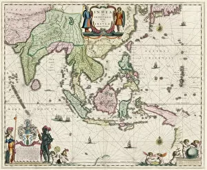
Background imageVintage Maps Collection: Map of South-East Asia, including Indonesia, India, Ceylon etc

Map of South-East Asia, including Indonesia, India, Ceylon etc, published by Willem Janszoon Blaeu in 1635

Background imageVintage Maps Collection: Map of Brazil, by Dutch cartographer Johannes Willemszoon Blaeu

Map of Brazil, by Dutch cartographer Johannes Willemszoon Blaeu, published in Amsterdam 1662 by Pieter Schenk

Background imageVintage Maps Collection: 17th century map of Russia and surrounding countries by Dutch artist, engraver

17th century map of Russia and surrounding countries by Dutch artist, engraver, publisher and cartographer Nicolaes Visscher I, 1618 -1679

Background imageVintage Maps Collection: Map of Africa dating from the late 17th century published by Carel Allard, 1648 - 1709

Map of Africa dating from the late 17th century published by Carel Allard, 1648 - 1709

Background imageVintage Maps Collection: Souvenir Battle of Waterloo map, published in London and dated August 12, 1815

Souvenir Battle of Waterloo map, published in London and dated August 12, 1815, less than two months after the event. The neat

Background imageVintage Maps Collection: Map of the African continent by the geographer A. H. Brue, published in Paris January 1820

Map of the African continent by the geographer A. H. Brue, published in Paris January 1820
Map of the African continent by the geographer A.H. Brue, published in Paris January 1820

Background imageVintage Maps Collection: The sea chart of Juan de la Cosa. Juan de la Cosa, c. 1450 - 1510

The sea chart of Juan de la Cosa. Juan de la Cosa, c. 1450 - 1510. Spanish navigator and cartographer. Owner and captain of the Santa Maria

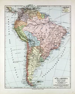
Background imageVintage Maps Collection: Map Of South America, 1899

Map Of South America, 1899

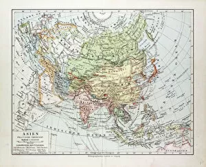
Background imageVintage Maps Collection: Map Of Asia, 1899

Map Of Asia, 1899

Background imageVintage Maps Collection: Map Of New York, United States Of America, 1899

Map Of New York, United States Of America, 1899

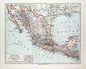
Background imageVintage Maps Collection: Map Of Mexiko, 1899

Map Of Mexiko, 1899

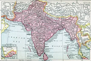
Background imageVintage Maps Collection: The Indian Empire And Ceylon Circa 1930

The Indian Empire And Ceylon Circa 1930

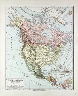
Background imageVintage Maps Collection: Map Of North America, 1899

Map Of North America, 1899

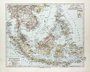
Background imageVintage Maps Collection: Map Of Indonesia, 1899

Map Of Indonesia, 1899

Background imageVintage Maps Collection: Map showing the placings in Australia of The Tolpuddle Martyrs

Map showing the placings in Australia of The Tolpuddle Martyrs, a group of 19th-century Dorset agricultural labourers who were arrested for

Background imageVintage Maps Collection: Map showing the placings in Canada of The Tolpuddle Martyrs, a group of 19th-century Dorset

Map showing the placings in Canada of The Tolpuddle Martyrs, a group of 19th-century Dorset agricultural labourers who were arrested for

Background imageVintage Maps Collection: Map showing the arrest and transportation to Australia and Tasmania of the Tolpuddle Labourers, 1834

Map showing the arrest and transportation to Australia and Tasmania of the Tolpuddle Labourers, 1834. The Tolpuddle Martyrs

Background imageVintage Maps Collection: Plan of London around St. Pauls in 1563. After Ralph Agass map. From London Pictures, published 1890

Plan of London around St. Pauls in 1563. After Ralph Agass map. From London Pictures, published 1890

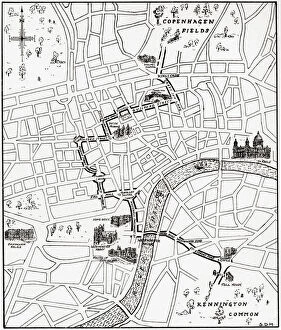
Background imageVintage Maps Collection: Map showing the route of the demonstration at Copenhagen Fields, London

Map showing the route of the demonstration at Copenhagen Fields, London, England 21 April 1834 in protest against the deportation of the Tolpuddle Martyrs

Background imageVintage Maps Collection: Satellite view of Northern Great Barrier Reef, East coast of Cape York Peninsula, North Australia

Satellite view of Northern Great Barrier Reef, East coast of Cape York Peninsula, North Australia
Satellite view of the Northern Great Barrier Reef along the east coast of Cape York Peninsula in north Australia. This image was compiled from data acquired in 2014 by Landsat 8 satellite

Background imageVintage Maps Collection: Satellite view of Adams Bridge. This chain of limestone shoals connects Sri Lanka to India

Satellite view of Adams Bridge. This chain of limestone shoals connects Sri Lanka to India. This image was taken in 2014 by Landsat 8 satellite

Background imageVintage Maps Collection: Whole Earth At Night Centred On Pacific Ocean, True Colour Satellite Image Of The Earth

Whole Earth At Night Centred On Pacific Ocean, True Colour Satellite Image Of The Earth
Whole Earth At Night Centred On Pacific Ocean, True Colour Satellite Image. True colour satellite image of the whole Earth at night, centred on the Pacific Ocean, with country borders

Background imageVintage Maps Collection: Whole Earth Centred On Pacific Ocean, True Colour Satellite Image Of The Earth

Whole Earth Centred On Pacific Ocean, True Colour Satellite Image Of The Earth
Whole Earth Centred On Pacific Ocean, True Colour Satellite Image. True colour satellite image of the whole Earth centred on the Pacific Ocean, with bump effect

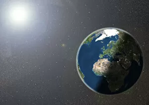
Background imageVintage Maps Collection: Globe Showing Europe And Africa, True Colour Satellite Image Of The Earth

Globe Showing Europe And Africa, True Colour Satellite Image Of The Earth
Globe Showing Europe And Africa, True Colour Satellite Image. True colour satellite image of the Earth showing Europe and Africa, half in shadow, and the sun

Background imageVintage Maps Collection: Globe Asia, True Colour Satellite Image. Earth. True colour satellite image of the Earth, centred

Globe Asia, True Colour Satellite Image. Earth. True colour satellite image of the Earth, centred on Asia. The North Pole is at upper centre

Background imageVintage Maps Collection: Africa At Night With Country Borders, True Colour Satellite Image

Africa At Night With Country Borders, True Colour Satellite Image. True colour satellite image of Africa at night with country borders

Background imageVintage Maps Collection: Globe Europe, True Colour Satellite Image. True colour satellite image of the whole earth, showing E

Globe Europe, True Colour Satellite Image. True colour satellite image of the whole earth, showing Europe at centre. The picture is a composite created from thousands of separate images recorded by

Background imageVintage Maps Collection: Globe Centred On Europe And Africa, True Colour Satellite Image Of The Earth

Globe Centred On Europe And Africa, True Colour Satellite Image Of The Earth
Globe Centred On Europe And Africa, True Colour Satellite Image. True colour satellite image of the Earth centred on Europe and Africa with cloud coverage, during summer solstice at 12 a.m GMT

Background imageVintage Maps Collection: Europe At Night With Cloud Coverage, True Colour Satellite Image

Europe At Night With Cloud Coverage, True Colour Satellite Image. True colour satellite image of Europe at night with cloud coverage

Background imageVintage Maps Collection: Globe Oceania, True Colour Satellite Image. Earth. True colour satellite image of the Earth, centred

Globe Oceania, True Colour Satellite Image. Earth. True colour satellite image of the Earth, centred on the region of Oceania. North is at top

Background imageVintage Maps Collection: Europe At Night, True Colour Satellite Image. True colour satellite image of Europe at night

Europe At Night, True Colour Satellite Image. True colour satellite image of Europe at night. This image in Lambert Conformal Conic projection was compiled from data acquired by LANDSAT 5 & 7

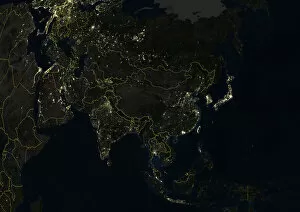
Background imageVintage Maps Collection: Asia At Night With Country Borders, True Colour Satellite Image

Asia At Night With Country Borders, True Colour Satellite Image. True colour satellite image of Asia at night with country borders

Background imageVintage Maps Collection: Desert Erg Iguidi, Algeria, True Colour Satellite Image. True colour satellite image of Erg Iguidi

Desert Erg Iguidi, Algeria, True Colour Satellite Image. True colour satellite image of Erg Iguidi, a sand desert between Algeria and Mauritania

Background imageVintage Maps Collection: City Of Harbin, Mandchouria, China, True Colour Satellite Image

City Of Harbin, Mandchouria, China, True Colour Satellite Image. The city of Harbin and surroundings covered by snow. The river Songhua that crosses the picture is frozen

Background imageVintage Maps Collection: Globe South America, True Colour Satellite Image. Earth. True colour satellite image of the Earth, c

Globe South America, True Colour Satellite Image. Earth. True colour satellite image of the Earth, centred on South America. North is at top

Background imageVintage Maps Collection: Lake Yamma, Queensland, Australia, True Colour Satellite Image

Lake Yamma, Queensland, Australia, True Colour Satellite Image. The Lake Yamma is a salted lake located in a semi-arid area. The lake evaporates totally during the dry season

Background imageVintage Maps Collection: Betsiboka River, Madagascar, True Colour Satellite Image. Betsiboka river

Betsiboka River, Madagascar, True Colour Satellite Image. Betsiboka river, the major river of Madagascar, goes into the Mozambique canal, close to the city of Mahajanga


All Professionally Made to Order for Quick Shipping


-

Why Choose Us?

We are a leading provider of Art Prints and Photo Gifts since 2003, working in partnership with a range of Sporting Clubs, Charities, Museums and Picture Libraries. A large share of profits from any of their images will go directly towards supporting that charity or club. Our archive of images is carefully curated to bring you a wide range of subjects, including landscapes, wildlife, architecture, and more. We ship from our partner labs in the UK, USA, EU (Netherlands) and Australia.
+

How do I place an order?

Ordering is quick & easy - Just follow 5 Simple Steps:
  1. Find your image: Use our search box or browse our online photo Collections to find the image you want.

  2. Choose your print format: Select your desired product and add it to your cart.

  3. Enter your details: If you're a returning customer, simply enter your email address and password, and we'll fill in your billing and shipping address details. All personal details are held securely and are fully GDPR compliant. As standard, we remove all Personally Identifiable Information after 12 months.

  4. Pay for your purchase: We use state-of-the-art security for online shopping and do not have access to your card details.

  5. Sit back and relax: We'll email you confirmation of your order and when it's dispatched. Registered customers can also track orders in the 'My Account' area.

+

How do I pay for an order?

You can pay for your order with most of the major credit and debit cards, or PayPal. For added security, major financial institutions process payment details separately and securely on our behalf. We do not have access to your online payment card details. Online payments are preferred however we do take phone orders. For UK customers only we accept cheques issued against a UK bank.
+

Is my data safe?

We take data security very seriously. We do not have access to your full card details and all payments are requested over a fully secure connection. Additionally, we fully comply with current European and GDPR legislation, and automatically remove all personal data after at most 12 months (unless you have an account with us and have signed in recently). We also have a strict opt-in policy and would never sell your personal details. Your data is only used to fulfill your order promptly and efficiently.
+

Is wall art ready to hang?

For quick and easy installation all wall art, including framed prints, canvas prints and metal prints are supplied with a ready to hang solution on the back. Generally, saw tooth hangers are applied as they allow wall art to hang flush against the wall. The serrated edge of the hanger prevents the frame from shifting or tilting when hung.
+

Are the photo prints fade resistant?

Yes, we use archival quality photo paper photographic paper for vivid reproduction Prints are an accurate representations of the original artwork, which is preserved for artistic character and authenticity. We guarantee they match previews shown on our web site