Fraud Blocker Skip to main content

Home > Design Pics > Vintage Maps

Vintage Maps Collection (#3)

507 Items

We are proud to offer this selection in partnership with Design Pics

Background imageVintage Maps Collection: Map of ancient Egypt. From Cassells Universal History, published 1888; Illustration

Map of ancient Egypt. From Cassells Universal History, published 1888; Illustration

Background imageVintage Maps Collection: Layout of the ancient Gallo-Roman town Massilia, (Marseilles) showing the old Phocaean harbour

Layout of the ancient Gallo-Roman town Massilia, (Marseilles) showing the old Phocaean harbour, the Lacydon. After an illustration by Edgar Holloway

Background imageVintage Maps Collection: Map of Epirus and western Greece, 295 BC. From Cassells Universal History, published 1888

Map of Epirus and western Greece, 295 BC. From Cassells Universal History, published 1888

Background imageVintage Maps Collection: Map of Asia Minor, showing the expedition of Cyrus the Younger and retreat of the Ten Thousand

Map of Asia Minor, showing the expedition of Cyrus the Younger and retreat of the Ten Thousand. From Cassells Universal History, published 1888

Background imageVintage Maps Collection: Map of the world according to Homer. From Cassells Universal History, published 1888

Map of the world according to Homer. From Cassells Universal History, published 1888

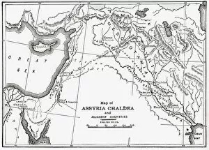
Background imageVintage Maps Collection: Map of Assyria Chaldea and adjacent countries. From Cassells Universal History

Map of Assyria Chaldea and adjacent countries. From Cassells Universal History, published 1888; Illustration

Background imageVintage Maps Collection: Ireland divided into its four province of Ulster, Munster, Connacht and Leinster

Ireland divided into its four province of Ulster, Munster, Connacht and Leinster. After a map published in 1700

Background imageVintage Maps Collection: Map of the British Colonies south of Canada up to 1783. From British History in Periods

Map of the British Colonies south of Canada up to 1783. From British History in Periods, published 1904

Background imageVintage Maps Collection: Map showing the routes of the four voyages of Christopher Columbus between 1492 and 1504

Map showing the routes of the four voyages of Christopher Columbus between 1492 and 1504. After an early 19th century work by Jean-Baptiste-Paul Touquet

Background imageVintage Maps Collection: Map showing the Panama Canal, a man-made waterway which connects the Atlantic Ocean with

Map showing the Panama Canal, a man-made waterway which connects the Atlantic Ocean with the Pacific Ocean. The canal cuts across the Isthmus of Panama

Background imageVintage Maps Collection: Map of south-Central Africa showing British and German possessions in the 1890 s

Map of south-Central Africa showing British and German possessions in the 1890 s. After a map published in the June 25th, 1890 edition of The Graphic

Background imageVintage Maps Collection: Map showing the Suez Canal, a man-made sea-level waterway in Egypt

Map showing the Suez Canal, a man-made sea-level waterway in Egypt, which connects the Mediterranean Sea to the Red Sea through the Isthmus of Suez

Background imageVintage Maps Collection: Map of European possessions in Africa in the 1880 s. After a map which appeared in the December 20th

Map of European possessions in Africa in the 1880 s. After a map which appeared in the December 20th, 1884 edition of The Graphic

Background imageVintage Maps Collection: Map of Europe according to the Peace Treaties 1918 - 1924. From The Evolution of Modern Europe

Map of Europe according to the Peace Treaties 1918 - 1924. From The Evolution of Modern Europe, 1453 - 1932, published 1933

Background imageVintage Maps Collection: A new map of the British Isles, showing their ancient people, cities, and towns of note

A new map of the British Isles, showing their ancient people, cities, and towns of note, in the time of the Romans. After a map by cartographer Edward Wells published in 1800 in an atlas titled A New

Background imageVintage Maps Collection: England and Wales in the late 18th century. After a map by cartographer and publisher William Faden

England and Wales in the late 18th century. After a map by cartographer and publisher William Faden, engraved by William Palmer

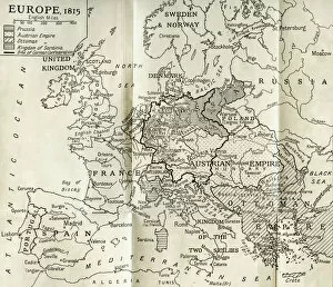
Background imageVintage Maps Collection: Map of Europe in 1815. From The Evolution of Modern Europe, 1453 - 1932, published 1933

Map of Europe in 1815. From The Evolution of Modern Europe, 1453 - 1932, published 1933

Background imageVintage Maps Collection: An early 18th century map of the British Empire in North America also showing French

An early 18th century map of the British Empire in North America also showing French, Spanish and Dutch settlements. After a work by British cartographer Henry Popple, ? - died 1743

Background imageVintage Maps Collection: A mid-18th century map of the British Empire in North America also showing French

A mid-18th century map of the British Empire in North America also showing French, Spanish and Dutch settlements. After a work by British cartographer Henry Popple, ? - died 1743

Background imageVintage Maps Collection: Map of the world showing the extent of the British Empire in 1886

Map of the world showing the extent of the British Empire in 1886. The Empires territories are marked in red. The map was included as a supplement in the July 24

Background imageVintage Maps Collection: Map of Europe under the empire of Charlemagne. From The National Encyclopaedia

Map of Europe under the empire of Charlemagne. From The National Encyclopaedia: A Dictionary of Universal Knowledge, published c.1890

Background imageVintage Maps Collection: Map of Europe at the dismemberment of the Carolingian Empire. From The National Encyclopaedia

Map of Europe at the dismemberment of the Carolingian Empire. From The National Encyclopaedia: A Dictionary of Universal Knowledge, published c.1890

Background imageVintage Maps Collection: Map showing the Nicaraguan Canal, a proposed shipping route through Nicaragua via Lake Nicaragua

Map showing the Nicaraguan Canal, a proposed shipping route through Nicaragua via Lake Nicaragua in the first decade of the 20th century

Background imageVintage Maps Collection: Map of England as divided between the king and the parliament at the end of 1643

Map of England as divided between the king and the parliament at the end of 1643. The shaded areas are districts held by the parliament and the Scots

Background imageVintage Maps Collection: Drawing map of Durham Cathedral

Drawing map of Durham Cathedral

Background imageVintage Maps Collection: Map of Abyssinia and the Adjacent Districts. From observations taken by British traveller

Map of Abyssinia and the Adjacent Districts. From observations taken by British traveller and artist Henry Salt in 1809 and 1810. Drawn by J. Outhett and engraved by A. Macpherson. Published 1814

Background imageVintage Maps Collection: La Floride. Map of south-east North America, including Florida

La Floride. Map of south-east North America, including Florida, showing Native American villages and French, Spanish and English settlements. Published by Pieter van der Aa, Leiden, circa 1713

Background imageVintage Maps Collection: Map of Spain showing the Caliphate of Cordoba, 929 - 1031. From Las Glorias Nacionales

Map of Spain showing the Caliphate of Cordoba, 929 - 1031. From Las Glorias Nacionales, published in Madrid and Barcelona, 1852. The map is in the Spanish language

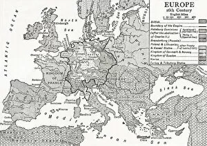
Background imageVintage Maps Collection: Map of Europe in the 16th century. From Britain and Her Neighbours, 1485 - 1688, published 1923

Map of Europe in the 16th century. From Britain and Her Neighbours, 1485 - 1688, published 1923

Background imageVintage Maps Collection: Map of central Europe at the time of the Thirty Years War. From Britain and Her Neighbours

Map of central Europe at the time of the Thirty Years War. From Britain and Her Neighbours, 1485 - 1688, published 1923

Background imageVintage Maps Collection: Map of the Siege of Barcelona in April 1706 during the War of the Spanish Succession

Map of the Siege of Barcelona in April 1706 during the War of the Spanish Succession. It shows fortifications of the city and of Montjuic

Background imageVintage Maps Collection: Cholera epidemic, New York City, 1832. Map highlighting hubs of infection and its spread

Cholera epidemic, New York City, 1832. Map highlighting hubs of infection and its spread. From the book by David Meredeth Reese

Background imageVintage Maps Collection: Map of the world by Gerard Mercator, first published circa 1595. Orbis terrae compendiosa descriptio

Map of the world by Gerard Mercator, first published circa 1595. Orbis terrae compendiosa descriptio

Background imageVintage Maps Collection: Map by an unknown cartographer published by G. W. Bacon, London

Map by an unknown cartographer published by G. W. Bacon, London, showing the theatre of the Crimean War, 1853 - 1856
Map by an unknown cartographer published by G.W. Bacon, London, showing the theatre of the Crimean War, 1853 - 1856

Background imageVintage Maps Collection: Canaan, or Palestine, as it was divided between the twelve tribes of Israel

Canaan, or Palestine, as it was divided between the twelve tribes of Israel. After a map published in 1750; Israel-Palestine

Background imageVintage Maps Collection: Map of Ireland circa 1650-1675 by Dutch engraver, cartographer and publisher Nicolaes Visscher 1

Map of Ireland circa 1650-1675 by Dutch engraver, cartographer and publisher Nicolaes Visscher 1

Background imageVintage Maps Collection: Nathaniel Nye, 1624 - after 1647. English mathematician, astronomer, cartographer

Nathaniel Nye, 1624 - after 1647. English mathematician, astronomer, cartographer

Background imageVintage Maps Collection: Sebastian Cabot, c. 1474 - c. 1557. Italian explorer, describes his journeys to King Henry VII of

Sebastian Cabot, c. 1474 - c. 1557. Italian explorer, describes his journeys to King Henry VII of England; Artwork

Background imageVintage Maps Collection: Map of North and South America by Andre Thevet, 1516 - 1590. Thevet was a French Franciscan priest

Map of North and South America by Andre Thevet, 1516 - 1590. Thevet was a French Franciscan priest, author and traveller

Background imageVintage Maps Collection: Map of Southern India and Ceylon, after a work made circa 1720 by Dutch cartographer Adriaan Reland

Map of Southern India and Ceylon, after a work made circa 1720 by Dutch cartographer Adriaan Reland. Adams Bridge between the two nations is clearly marked

Background imageVintage Maps Collection: World map dating from the late 17th or early 18th century and published in Amsterdam showing

World map dating from the late 17th or early 18th century and published in Amsterdam showing the western and eastern hemispheres. Amongst many inaccuracies, the California area is shown as an island

Background imageVintage Maps Collection: 18th century map of Central America and the Gulf of Mexico engraved by Balthasar Ruyter

18th century map of Central America and the Gulf of Mexico engraved by Balthasar Ruyter

Background imageVintage Maps Collection: Map of Scotland dating from the early 18th century decorated with 14 small drawings or plans of

Map of Scotland dating from the early 18th century decorated with 14 small drawings or plans of important cities. Anonymous engraver

Background imageVintage Maps Collection: Map of India and Southern Asia dating from 1792

Map of India and Southern Asia dating from 1792

Background imageVintage Maps Collection: Map of America by cartographer John Speed published circa 1627. The cartouche, lower left

Map of America by cartographer John Speed published circa 1627. The cartouche, lower left, reads: America with those known parts in that unknowne worlde both people and manner of buildings

Background imageVintage Maps Collection: French map from 1720 of Palestine. Titled Carte de la Terre Promise or Map of the Promised Land

French map from 1720 of Palestine. Titled Carte de la Terre Promise or Map of the Promised Land

Background imageVintage Maps Collection: Plan of Madrid, Spain, dated 1934

Plan of Madrid, Spain, dated 1934

Background imageVintage Maps Collection: Map of Limerick, Ireland, dating from 1690 and showing the forces of William III besieging

Map of Limerick, Ireland, dating from 1690 and showing the forces of William III besieging the city during the Williamite War of 1689 - 1691


All Professionally Made to Order for Quick Shipping


-

Why Choose Us?

We are a leading provider of Art Prints and Photo Gifts since 2003, working in partnership with a range of Sporting Clubs, Charities, Museums and Picture Libraries. A large share of profits from any of their images will go directly towards supporting that charity or club. Our archive of images is carefully curated to bring you a wide range of subjects, including landscapes, wildlife, architecture, and more. We ship from our partner labs in the UK, USA, EU (Netherlands) and Australia.
+

How do I place an order?

Ordering is quick & easy - Just follow 5 Simple Steps:
  1. Find your image: Use our search box or browse our online photo Collections to find the image you want.

  2. Choose your print format: Select your desired product and add it to your cart.

  3. Enter your details: If you're a returning customer, simply enter your email address and password, and we'll fill in your billing and shipping address details. All personal details are held securely and are fully GDPR compliant. As standard, we remove all Personally Identifiable Information after 12 months.

  4. Pay for your purchase: We use state-of-the-art security for online shopping and do not have access to your card details.

  5. Sit back and relax: We'll email you confirmation of your order and when it's dispatched. Registered customers can also track orders in the 'My Account' area.

+

How do I pay for an order?

You can pay for your order with most of the major credit and debit cards, or PayPal. For added security, major financial institutions process payment details separately and securely on our behalf. We do not have access to your online payment card details. Online payments are preferred however we do take phone orders. For UK customers only we accept cheques issued against a UK bank.
+

Is my data safe?

We take data security very seriously. We do not have access to your full card details and all payments are requested over a fully secure connection. Additionally, we fully comply with current European and GDPR legislation, and automatically remove all personal data after at most 12 months (unless you have an account with us and have signed in recently). We also have a strict opt-in policy and would never sell your personal details. Your data is only used to fulfill your order promptly and efficiently.
+

Is wall art ready to hang?

For quick and easy installation all wall art, including framed prints, canvas prints and metal prints are supplied with a ready to hang solution on the back. Generally, saw tooth hangers are applied as they allow wall art to hang flush against the wall. The serrated edge of the hanger prevents the frame from shifting or tilting when hung.
+

Are the photo prints fade resistant?

Yes, we use archival quality photo paper photographic paper for vivid reproduction Prints are an accurate representations of the original artwork, which is preserved for artistic character and authenticity. We guarantee they match previews shown on our web site