Fine Art Print > Europe > France > Maps
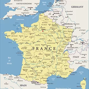
Fine Art Print : na. Map of Corsica, France dated 1735. By an unidentified cartographer


![]()
Fine Art Prints from Design Pics
na. Map of Corsica, France dated 1735. By an unidentified cartographer
Design Pics offers Distinctively Different Imagery representing over 1,500 contributors
Media ID 31615411
© Ken Welsh
18th Century Cartography Corsica Drawing France Geographical Geography 1735
20"x20" (+3" Border) Fine Art Print
Discover the timeless beauty of our Fine Art Prints from Media Storehouse. This exquisite piece showcases a captivating map of Corsica, France, dated 1735. The intricate details of this unidentified cartographer's work come alive in this high-quality print, transporting you back in time. With vibrant colors and sharp lines, this Fine Art Print by Ken Welsh from Design Pics is a stunning addition to any home or office space. Elevate your decor and ignite your imagination with this beautiful piece of history.
20x20 image printed on 26x26 Fine Art Rag Paper with 3" (76mm) white border. Our Fine Art Prints are printed on 300gsm 100% acid free, PH neutral paper with archival properties. This printing method is used by museums and art collections to exhibit photographs and art reproductions.
Our fine art prints are high-quality prints made using a paper called Photo Rag. This 100% cotton rag fibre paper is known for its exceptional image sharpness, rich colors, and high level of detail, making it a popular choice for professional photographers and artists. Photo rag paper is our clear recommendation for a fine art paper print. If you can afford to spend more on a higher quality paper, then Photo Rag is our clear recommendation for a fine art paper print.
Estimated Image Size (if not cropped) is 50.8cm x 50.8cm (20" x 20")
Estimated Product Size is 66cm x 66cm (26" x 26")
These are individually made so all sizes are approximate
Artwork printed orientated as per the preview above, with landscape (horizontal) or portrait (vertical) orientation to match the source image.
FEATURES IN THESE COLLECTIONS
> Maps and Charts
> Early Maps
> Maps and Charts
> Related Images
EDITORS COMMENTS
This vintage print takes us back to the 18th century, offering a fascinating glimpse into the history and geography of Corsica, France. Created in 1735 by an unidentified cartographer, this meticulously detailed map showcases the island's intricate landscape and topography. The enchanting illustration captures the essence of a bygone era when cartography was both an art form and a scientific endeavor. The map is adorned with vibrant colors that bring life to every contour, river, and coastline. It invites us to explore Corsica's rich historical heritage through its numerous towns, villages, and landmarks. As we trace our fingers along its delicate engravings, we can almost feel the spirit of adventure that must have accompanied those who navigated these lands centuries ago. Preserved within this archival piece lies not only geographical information but also a testament to human curiosity and exploration. It serves as a reminder of how maps were once cherished possessions for travelers seeking new horizons or scholars unraveling the mysteries of distant lands. Ken Welsh has skillfully captured this significant artifact from history in all its glory. This print allows us to appreciate the craftsmanship involved in creating such intricate illustrations while immersing ourselves in Corsica's past. Whether you are an enthusiast of cartography or simply intrigued by historical artifacts, this image will transport you back in time to uncover Corsica's secrets one stroke at a time.
MADE IN AUSTRALIA
Safe Shipping with 30 Day Money Back Guarantee
FREE PERSONALISATION*
We are proud to offer a range of customisation features including Personalised Captions, Color Filters and Picture Zoom Tools
SECURE PAYMENTS
We happily accept a wide range of payment options so you can pay for the things you need in the way that is most convenient for you
* Options may vary by product and licensing agreement. Zoomed Pictures can be adjusted in the Cart.