Jigsaw Puzzle > Aerial Photography > Africa
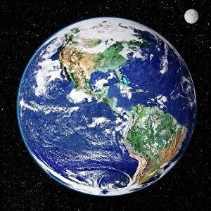
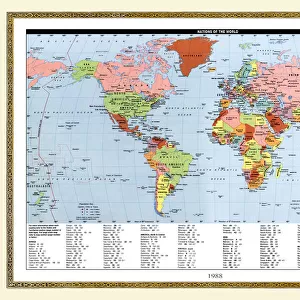
Jigsaw Puzzle : Earth, topographic and bathymetric map


![]()
Jigsaw Puzzles from Science Photo Library
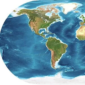
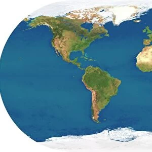
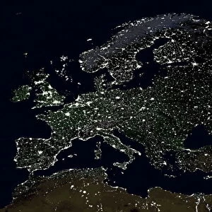
Earth, topographic and bathymetric map
Earth. Blue Marble: Next Generation cloud-free topographic and bathymetric map of the Earth in July 2004. Highlands and lowlands of the continents are shown as ridges and flat areas, with Arctic and Antarctic ice in white. The seabed depth varies from shallow (light blue) on the continental shelves, to deep ocean basins (dark blue). Topographic and bathymetric data is usually gathered by using aerial and satellite imagery combined with radar and sonar mapping. Landcover data is from NASAs Moderate Resolution Imaging Spectroradiometer (MODIS) sensor aboard the Terra satellite
Science Photo Library features Science and Medical images including photos and illustrations
Media ID 6328989
© NASA/SCIENCE PHOTO LIBRARY
Africa Altimetric Altimetry Bathymetric Bathymetry Blue Marble Composite Continent Continental Shelf Continents Depth Earth Observation Flat Projection From Space Global Height Highlands Land Lowlands Mapped Modis Mountains Nasa Next Generation Oceanic Oceanographic Oceanography Pacific Ocean Physical Geography Plains Radar Ridge Satellite Satellite Image Sea Bed Sea Floor Shelves Sonar Mapping Terra Topographic Topography Whole Earth World
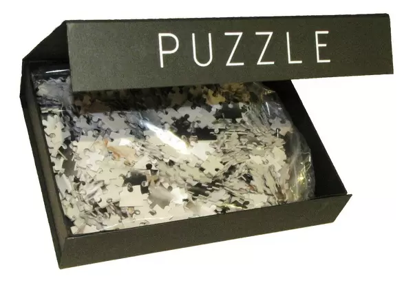
Jigsaw Puzzle (1000 Pieces)
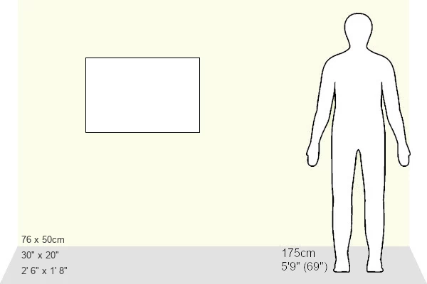
1000 piece puzzles are custom made in Australia and hand-finished on 100% recycled 1.6mm thick laminated puzzle boards. There is a level of repetition in jigsaw shapes with each matching piece away from its pair. The completed puzzle measures 76x50cm and is delivered packaged in an attractive presentation box specially designed to fit most mail slots with a unique magnetic lid
Jigsaw Puzzles are an ideal gift for any occasion
Estimated Product Size is 76cm x 50.2cm (29.9" x 19.8")
These are individually made so all sizes are approximate
Artwork printed orientated as per the preview above, with landscape (horizontal) or portrait (vertical) orientation to match the source image.
FEATURES IN THESE COLLECTIONS
> Aerial Photography
> Related Images
> Animals
> Mammals
> Muridae
> Plains Mouse
> Arts
> Artists
> O
> Oceanic Oceanic
> Europe
> France
> Canton
> Landes
> Europe
> United Kingdom
> Scotland
> Highlands
> Related Images
> Maps and Charts
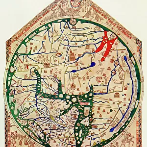
> Flat Earth
> Maps and Charts
> Related Images
> Maps and Charts
> World
> Science Photo Library
> Aerial and Satellite
MADE IN AUSTRALIA
Safe Shipping with 30 Day Money Back Guarantee
FREE PERSONALISATION*
We are proud to offer a range of customisation features including Personalised Captions, Color Filters and Picture Zoom Tools
SECURE PAYMENTS
We happily accept a wide range of payment options so you can pay for the things you need in the way that is most convenient for you
* Options may vary by product and licensing agreement. Zoomed Pictures can be adjusted in the Cart.